
Stage 23 – Russia & Mongolia: Baikal And Beyond [1/2]
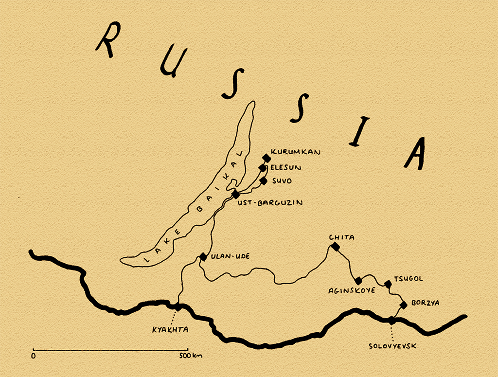
The north of Mongolia fades gradually into the huge expanse of Siberia, an immense wilderness which occupies three-quarters of Russia and much of the Eurasian landmass. Lake Baikal, by far the largest, deepest and most likely oldest freshwater lake in the world, the ‘Pearl of Siberia’, marks the centre of perhaps the most beautiful part of the region where the endless taiga meets the northern steppes and hardy Russian settlers (and exiles and prisoners) have for generations lived among the native Siberian tribes. East of here, beyond Baikal and many thousands of kilometres from the Russian capital, this very sparsely-populated transition zone fades into the great grasslands of China and the region Russians simply call the ‘Farthest East’. In the more than two months which I would spend looping through this region on my way back west to Europe, I would encounter both the stunning beauty and fierce harshness of this environment as the brutal winter abruptly began. Most of all however, I would enjoy the camaraderie of the friends who accompanied me, wilderness camping in what were at times quite harsh conditions.
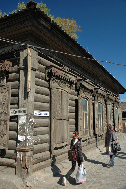
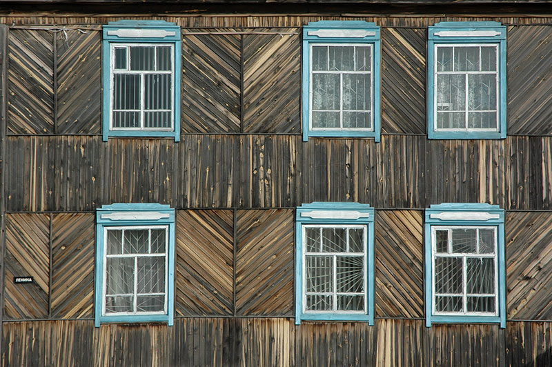
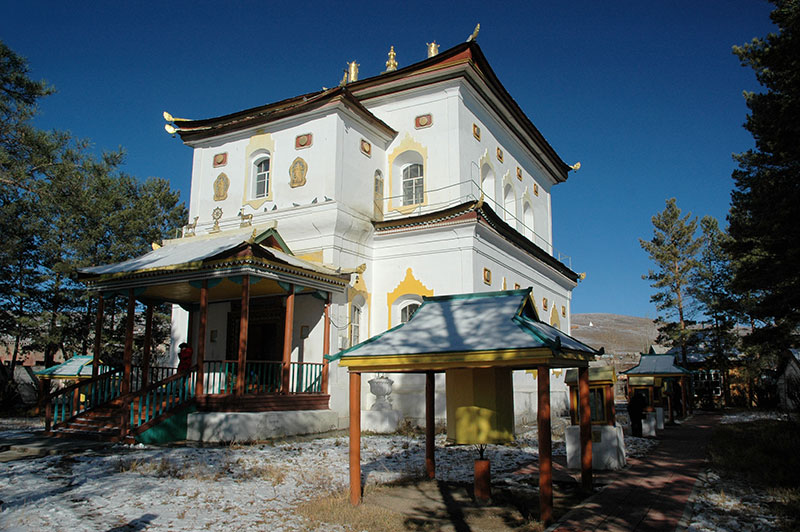
Wooden House, Ulan-Ude, Buryatia Republic, Russia
On the evening of the 16th September 2010 I am the last to leave the Russian customs post at Kyakhta. I’m unable to buy car insurance, so being very cautious I decide to park the truck in a grassy clearing a few hundred metres from the post and sleep the night there. In the morning I walk to a nearby shop where a friendly lady directs me to the town centre, which I reach by minibus. After weeks in the wilderness of Mongolia, the Russian town of Kyakhta is a stark change in environment. Pastel-coloured Tsarist- and Soviet-era buildings form an orderly, if distinctly faded centre, including a ruined cathedral with two roofless octagonal towers and the rather charming trading arches, which have disappeared from many larger Russian cities. It’s a cool autumn morning and light rain falls from a grey sky. Puddles form on the old asphalt of the main street and I am struck by the familiarity of a grey, mundane European scene, despite the fact that I am in deepest Asia, almost six thousand kilometres by road from Moscow.
Though looking quite forlorn today, Kyakhta is in fact quite a historic place; following the signing of the Treaty of Kyakhta in 1727, the border between Russia and Qing-Dynasty (Manchu) China was formalised and the town set up as a trading post on the ‘Siberian Route’, also known as the Tea Road. For almost two centuries goods passed through this trading post; with tea, silk and cotton heading west and furs, hides and textiles heading south towards China, until the completion of the Trans-Siberian Railway which bypassed the town. I buy a month’s car insurance in the post office, and then drive north out of town, soon finding myself back in the familiar wilderness of rolling hills dotted with stands of pine trees; but there is a difference from Mongolia. Here is a country with modern infrastructure; a road network, signposts and towns with strong hints of European culture and architecture. I no longer need to continually read the landscape in order to decide which way to proceed, or search for locals to quiz for directions, nor do I need to keep an eye on the weather and hope for kindly conditions for camping. It would take a few days to switch-off from the rigours of travel in Mongolia, and re-familiarise myself with the comforts of civilisation.
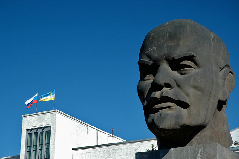
Head of V.I. Lenin, Ulan-Ude, Buryatia Republic, Russia
I arrive in the afternoon in the city of Ulan-Ude where I am hosted by Vladimir, who lives in a quaint and typically Siberian wooden house of dark-stained wood with light-blue window frames and roof gables, and a kitchen-garden with a simple outhouse and banya (Russian sauna). Ulan-Ude came to prominence as a major stop on the Trans-Siberian mainline which reached it in 1900 when it was still known as Verkhneudinsk, but like many Siberian cities is of little obvious historic interest. The city centre is nevertheless quite charming; a neat grid of late-nineteenth and early-twentieth century wooden buildings, only occasionally marred by modern glass-fronted structures. Ulan-Ude is also the capital of the Republic of Buryatia, and the republic’s flag flies along the Russian tricolour on the roof of the Republican Council building. Immediately in front of this, in Soviet Square sits a forty-two tonne head of Lenin, the largest in the world (who here has slightly narrow, Asiatic eyes), built in 1971 to commemorate the centennial of the man’s birth.
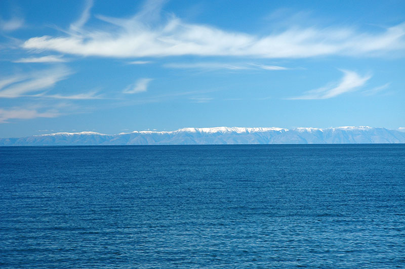
Lake Baikal, Buryatia Republic, Russia
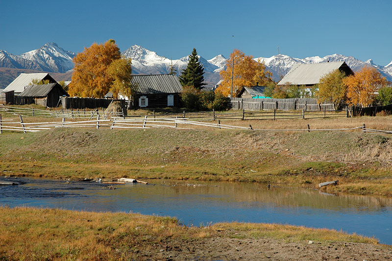
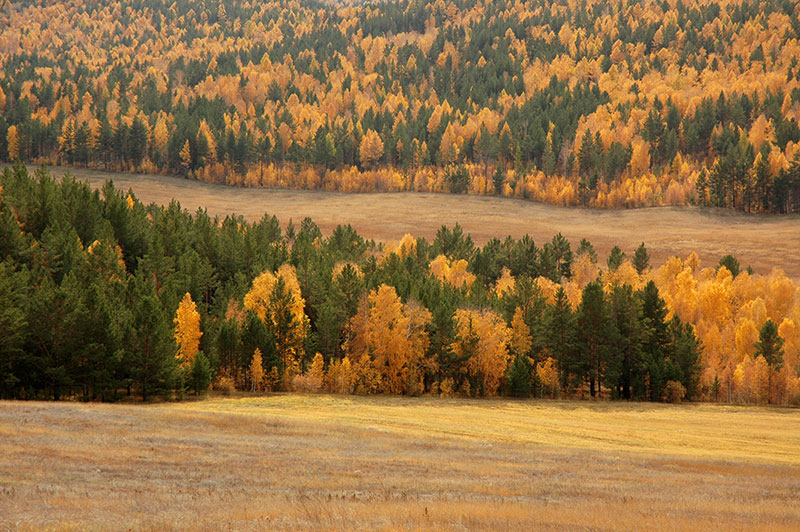
Ulan-Ude is a pleasant place to unwind for a few days and between wandering around the back streets, watching the fishermen wading into the Selenga River from the overgrown naberezhnaya (embankment), and drinking beers in small cafés, I get a new Mongolian visa (on which my middle name is spelt incorrectly) and meet a few other travellers who are passing through town on the Trans-Siberian. After ten days however, seeing a break in the recently rainy weather, I head north on a crisp autumn morning to the real jewel of the region; Lake Baikal. The road heads north from the city’s suburbs, plunging straight into dark spruce forest as it winds over successive ridges before dropping into a rolling, wide valley and passing isolated settlements such as Baturino where the gleaming whitewashed Holy Candlemas Nunnery sits amongst tumble-down wooden village-houses. In Gremyachinsk the road reaches the lake shore and suddenly reveals a truly stunning vista of inky-blue water beyond a clean and pebbly shore dotted with larch trees whose needles are now striking shades of yellow and vivid orange. On the lake’s far shore, under crystal-clear skies of deep blue filled only by the occasional wisp of cirrus clouds is a long range of distant mountains whose upper peaks are dusted with fresh snow.

Barguzin River, Ust-Barguzin, Buryatia Republic, Russia
The road runs along the lake shore for one hundred beautiful kilometres, through dense forests, along sandy coves and past small, wild peninsulas before climbing briefly into the hills once more on a rough unsurfaced pass, emerging in the small town of Ust-Barguzin on the mouth of the Barguzin River. It is on this short stretch that I pass a green Lada Niva travelling very slowly, with foreign licence plates that are too dirty to identify. I have supper in a simple stolovaya (canteen) in Ust-Barguzin, with traditionally frosty service and as I am driving out of town to find a campsite I spot the same Niva parked at the side of the road and stop to offer assistance to the two rather lost-looking occupants. They are Toni and Marjo, two Finns who were total strangers before jointly buying an old Russian 4×4 and driving east from Finland with the aim to reach Mongolia. After a few minutes’ talking we decide to camp together and so begins almost six weeks of travelling and wild-camping together.
Suvo, Buryatia Republic, Russia
We find a clearing in the forest from which locals are emerging pushing bicycles with hoes and other implements attached. We make a small fire and enjoy a night of fireside drinking; a pleasant contrast to camping in the barren and often windswept Mongolian landscape, though the nights here are already becoming cold with the temperature dipping below freezing. In the morning we continue east, away from Baikal, crossing birch-lined streams of dark, tannin-rich water towards the wide and glorious Barguzin Valley, an idyllic slice of rural Siberia, far from the main rail and road axis to the south. We stop in the village of Chitkan first, with its rustic Tsarist-era church, patchily whitewashed and sprouting grass from the cupola on its bell-tower. Later in the afternoon, a little further north we reach the very bucolic village of Suvo, a picture-perfect scene of tidy wooden cottages among dazzling golden birch trees on a green riverbank lined with leaning wooden fences, overlooked by the jagged, snow-dusted peaks of the Barguzin Mountains which separate the valley from Baikal.
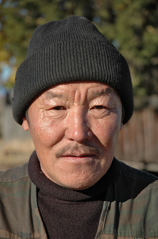
Buryat Man, Suvo, Buryatia Republic, Russia
These small villages have the feeling of a timeless Russia; outposts in the Siberian frontier almost untouched by the trauma of Bolshevism or the unchecked capitalism and consumerism which has followed. In spite the formidable isolation and harsh climate (or perhaps because of it) the locals are especially friendly, such as the old gentleman in Chitkan who animatedly tells us about the village and shows us his coin collection, or another in Suvo who greets us with genuine interest, asks for his photo to be taken, then presses two roubles into my hand. This, together with the sublime autumn scenery makes the Barguzin Valley immediately one of the most beautiful and enchanting destinations I have come across in Russia, and by far the most friendly and charming of Siberia’s mountainous republics.
We camp near Suvo in the evening, establishing a routine which we would follow across the forested wilderness of Siberia all the way to the Mongolian border. We are somewhat out of season, having escaped the insects and tourists of the summer, but the nights are becoming long, with temperatures dipping below freezing. After arriving at our chosen site, we collect perhaps ten to twelve fallen trees and drag them towards the cars, which we park at right-angles for some form of shelter. We dig a pit and then burn several of the tree-trunks at a time over the pit, building up a large, hot fire which warms us all night. The night is divided into three shifts to keep the fire going; 11:00-02:00, 02:00-05:00, and 05:00-08:00 when we get up and prepare to leave. Temperatures dip to -10ºC but with the continuous fire we can sleep on the ground in summer sleeping bags, and burn several hundred kilos of wood each night.
Ina River Bridge, Buryatia Republic, Russia
In the morning as we leave Suvo, we pass one of the few clear traces of Buryat culture which I have seen; a roadside animist shrine consisting of a sacred rock surrounded by a small wooden fence which is tied with sky-blue votive prayer rags identical to those seen at holy sites across Mongolia. Buryats are a northern tribe of the Mongols, linguistically and culturally very close though having both Turkic and Siberian roots and traditionally living in the forested valleys around Lake Baikal. Highly integrated into Russian society, as seen by the mixed populations across the republic from the capital to small villages such as Suvo, the Buryat language is classed as severely endangered with Russian very much the lingua franca. Next to the shrine is a stack of discarded vodka bottles and near that, a friendly village drunk sits slightly dazed-looking waiting for a lift, and when I drop him at his house a couple of kilometres along the road, he thanks me as if I’d rescued him from certain death.
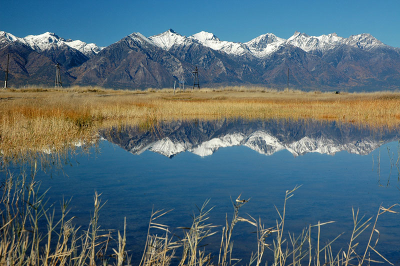
Barguzin Valley, Buryatia Republic, Russia
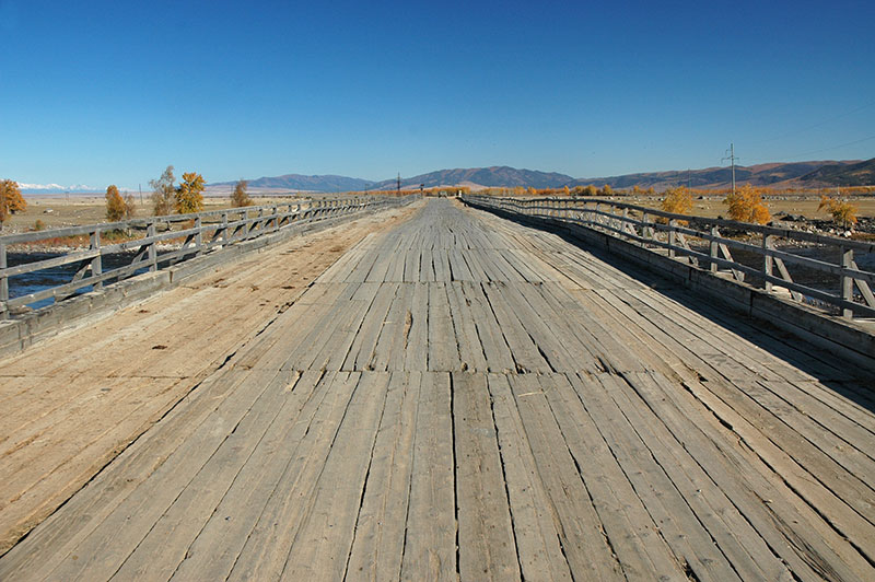
To the north-east of Suvo the road, now an unsurfaced track, crosses the Ina River on a beautiful wooden bridge, then enters a large plain of golden grass dotted with rivers and small lakes, an area of truly exquisite beauty. All around, wooded hills are textured by the contrasting yellows of larch trees with the green of pine, spruce and fir, overshadowed in the north by a range of gleaming snow-peaks which lie beyond the northern tip of Baikal, on the edge of the trackless taiga. Our northward progress is eventually stopped by the Argada River which we chose not to cross, instead turning west back towards the Barguzin River and the string of villages which lie on the far side of it. However, by mid-afternoon we end up on a long wooden bridge which has recently collapsed just short of the river’s western bank, and so camp for the night in a patch of pine forest near the village of Elesun, enjoying a relatively warm evening after a very pleasant day.
Town Hall, Barguzin, Buryat Republic, Russia
In the morning, we find a bridge slightly further south and cross the Barguzin River, then head north on the asphalted road through large villages of neat Siberian houses largely untouched by modernity, to the small town of Kurumkan. Here we spend the afternoon employing three Russian mechanics to replace the front wheel bearings on the Niva, then camp in thick forest a few kilometres north of town. We drive back down the valley the following day, stopping in the quaint town of Barguzin with its beautiful two-storey wooden town hall, then crossing the Barguzin River once again on an old ferry and driving through some unexpected sand dunes to camp on the eastern shore of Lake Baikal. Clouds begin to form in the sky to the west, but the afternoon and evening are glorious; we are alone on a long, sandy beach dotted with pine trees and logs of washed-up driftwood. It’s a beautiful setting and a nice ending to our time in the area, though by morning clouds have rolled in and the spell of perfect autumn weather comes to an end, making us yet more grateful for the enchanting few days we have spent in the Barguzin Valley.
Taiga, near Petrovsk-Zabaikalsky, Zabaikal Territory, Russia
After returning to Ulan-Ude for a night, we set-off east on the Trans-Siberian Highway, on the M55 which runs to Chita. The road winds south and then east, crossing low passes and driving through patches of multicoloured taiga, soon leaving the Republic of Buryatia and entering Zabaikal (literally ‘beyond Baikal’) Territory. As we leave the surroundings of the lake, the country starts to feel wilder, the traffic thins and the villages go from being very attractive, with ornately decorated and colourful wooden houses, to being run-down, depopulated and forgotten, causing one to wonder just how, and why European Russians came to live in such a harsh and fantastically isolated area. Although the Trans-Siberian Highway (and Railway) are the modern conduits of Siberia, along which nearly all the population now live, Russian settlers have been in the region since the sixteenth century when Cossacks (a militaristic Eastern Slavic people from southern Russia and Ukraine, formerly loyal to the Tsarist authorities) rapidly subjugated various native Siberian tribes and established Russian control all the way to the Pacific by the mid-sixteenth century, using a series of small west-to-east river routes connected by short portages.
Decembrist Church, Chita, Zabaikal Territory, Russia
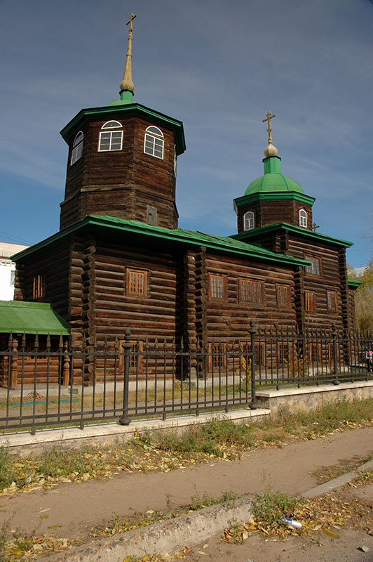
We spend a night camping in a forest clearing, following a long valley north-east the next day to the capital of Zabaikal Territory, the city of Chita. Historically overshadowed by nearby Nerchinsk, a centre for trade with China, the opening of the Trans-Siberian Railway marked a decline in the latter’s fortunes, and importance shifted to Chita, a large garrison strategically close to China and starting point of the Trans-Manchurian Railway. The three of us are hosted here by Anatoly, a generous local businessman who shows us around his native Chita; to the beautiful cream-coloured wooden post-office, the bustling market full of Chinese traders where one hears Mandarin as much as Russian, to the colourful and elegant Neoclassical building of the intelligence services, and the striking all-wood eighteenth century Decembrists’ Church which now functions as a museum.
Chita, like all of Siberia, has a modern history synonymous with exile, imprisonment and hard labour in brutal prison camps, culminating under Stalin in the infamous Gulags of the USSR to which millions were sent, and where many hundreds of thousands perished under unimaginable hardship. This dark tradition in fact goes back much further in time, to the mid-eighteenth century when the Tsarist government disposed of petty criminals and political opponents in this harsh and far-flung end of the empire. Later, this exile was used alongside forced migration as a method to settle and develop this territory which lay thousands of kilometres from the capital, far closer to Peking than to Moscow. Perhaps the most famous group of Tsarist-era exiles were those convicted of supporting the Decembrist Revolt of December 1825, when a group of Army officers and soldiers failed to pledge allegiance to Tsar Nicholas I following the abdication of his brother Constantine. Consisting of many formerly high-standing members of society (often followed by their wives), the largest group of Decembrists were settled initially in Chita, and had a gentrifying influence in Siberia, in some cases becoming landowners, embarking upon philanthropic vetures and later pressing for reforms in the Russia such as the abolition of serfdom. This new Siberian intelligentsia came to be widely respected by natives, and even glorified in the anti-Tsarist rhetoric of the USSR.
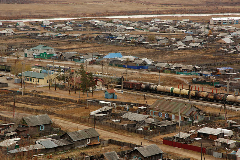
Novokruchinsky, Zabaikal Territory, Russia
After three nights in the very pleasant company of Anatoly, his wife and daughter, we pull ourselves from the comforts of the family apartment and resume our journey. To the east of Chita is the M58, leading to the Pacific at Vladivostok, via Khabarovsk, and at Magadan via Skovrodino and Yakutsk; all destinations I would love to visit, but which I sadly have to postpone to a future journey (currently planned for 2017-18). Instead, the three of us head south, leaving the Trans-Siberian Highway and following the road towards the Chinese border. We cross more forested ridges, leaving the edge of the taiga and entering a more bleak and windswept landscape of grassy valleys dotted with occasional trees, where we see our first real accumulations of snow. We pass through sleepy small towns, reaching the district capital of Aginskoye in the afternoon where we camp in a patch of birch trees on the edge of town and drink Toni’s expensive and coveted bottle of Russki Standart Platinum vodka.
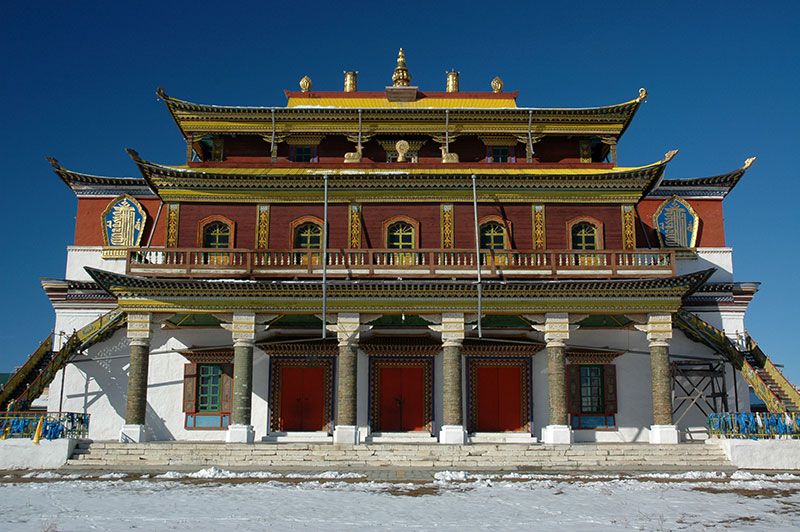
Dechen Lhudubling Datsan, Amitkhasha, Zabaikal Territory, Russia
In the village of Amitkhasha, a few kilometres west of Aginskoye is the Dechen Lhudubling Datsan, a Buryat Buddhist monastery of the Tibetan tradition, functioning as a centre of education similar to those in Tibet or Mongolia. We visit the datsan in the morning; a surprisingly well-maintained and vibrant complex of temples, stupas and service buildings dating from 1811 which, though closed during much of the Soviet Period, managed to survive Stalin’s religious purges and is now the oldest datsan in Russia, older and more impressive than the completely rebuilt Ivolgin Datsan near Ulan-Ude which is considered to be the more important. The new main temple is a large and imposing structure of brick with a wooden balcony and pale green roof; a very rare example of a graceful modern construction. Other, older buildings in the complex show a more charming architectural syncretism; a two-storey whitewashed temple with strong Tsarist echoes below a yellow pagoda-roof, and a quaint yellow classroom building similar to a typical Siberian cottage, but with a simple tip-tilted roof. Pilgrims and monks mill around the buildings making for an unexpectedly vibrant atmosphere in this otherwise quite austere and neglected region.
Tsogchen Dugan, Dashi Choypelling Datsan, Tsugol, Zabaikal Territory, Russia
Just over one hundred kilometres from Aginskoye, in the village of Tsugol lies the Dashi Choypelling Datsan whose main temple, the Tsogchen Dugan comes unexpectedly into view as we drive up on a muddy track from the highway. The sight is rather compelling; more picturesque by far than anything at Amitkhasha, the authentic nineteenth century shrine has panels of Mongolian script, preserved glazed-green brick columns and a beautifully intricate external staircase leading to the upper levels of the temple. There is fresh snow on the ground and the yellow, three-tiered pagoda-roof contrasts sharply with the deep-blue of the late-afternoon sky, making me think that after the gompas of Spiti and Ladakh in India, this is the most beautiful Buddhist structure I have ever seen.
Just south of Tsugol, we cross the Onon River, a distant tributary of the Amur River which delineates much of the Russia – China border on its course to the Pacific more than 3500 kilometres from here. The landscape becomes increasingly snowy, but we are glad to find a small patch of forest on the final ridge of mountains before the road descends onto steppe. The snow is about fifteen centimetres deep, but the Finns are in their element here collecting birch trees while I dig a fire-pit, and we have a comfortable final night in Russia around a raging birch fire.
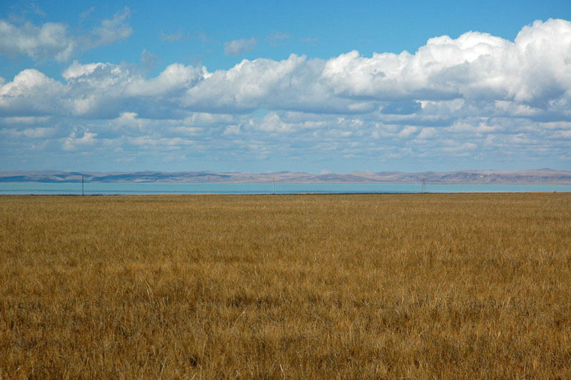
Zun-Torey Lake, Zabaikal Territory, Russia
South of our campsite we roll down onto the edge of the steppe. The snow soon disappears and we drive across a undulating landscape of dry grass. During Soviet times, this region was heavily militarised, particularly after the Sino-Soviet split of the early 1960s. We drive past the crumbling remains of military-industrial complexes aside the Trans-Manchurian Railway, even passing a small ghost town. These decaying concrete skeletons of buildings seem to add to the barren terrain to give a feeling of remoteness and desolation, though trade and traffic is these days thriving with China at the nearby border crossing. Our goal however is a remote and very seldom-used border crossing into the far east of Mongolia, into a region I had been unable to access last month due to a quarantine following an outbreak of foot-and-mouth disease, which I suspect to still be in force. We nevertheless choose to attempt to cross the border here.
In the small junction town of Borzya, at 116.5º east of Greenwich, I reach the easternmost point of my journey, nearly one third of the way around the world from the UK, on roughly the same line of longitude as Beijing. We have lunch in Borzya and stock up on supplies, then drive the final eighty-five kilometres on an arrow-straight gravel track to the isolated border post at Solovyevsk. Here we enter the true steppe; a flat expanse of waving yellow grass, the northern fringes of one of Asia’s most ecologically important grassland areas. Puffy cumulus clouds rack up in the huge sky, and turquoise Zun-Torey Lake appears on the horizon. At the tiny barracks of Solovyevsk, we surprise the Russian border guards, though they are friendly and by mid afternoon we have left Russia, ready to begin the crossing of northern Mongolia.

Hello!
I’m a book illustrator from Russia. In the moment I’m drawing illustrations to the book about Transsiberian railway. I really need a photo of Darasun to draw this city – but it’s really difficult to find one. I like your photo of Darasun very much (this one https://eurasiaoverland.files.wordpress.com/2014/12/23-25-darasun.jpg ) but it’s too small for me, I can’t see all the details. May be you can send me this photo in a good quality? I will not publish or print your photo, I’m just going to look at it and to draw my own illustrations based on your photo. As a thank I can mention you in a book and send you one copy, when it is ready.
Thank you!
Hi Anna!
How nice to hear from you. I am intrigued to know why you are illustrating Darasun, it seems like a small and insignificant junction town!
I have to say however that I do like Zabaikalsky Krai; I was there again last year and visited Nerchinsk which is quite close to Darasun. And in January this year I was sitting in a banya with a friend in Magadan, and one of his friends who joined us was born in nearby Tsugol. Small world!
I would be very happy for you to have the original photo; I have sent it to you in an email 🙂 It is the only picture I took of Darasun though, as I just got this nice view from the road when driving to Tsugol.
Best of luck with the illustrations, I would be flattered to be credited and delighted to receive a copy 🙂
EO