
Stage 45 – Russia, Ukraine & Turkey: Farewell Former USSR

Since the very beginning of my Odyssey almost eleven years earlier, my route had taken me to parts of the Former Soviet Union in most of the intervening years and I had visited very nearly every region of each of the fifteen republics which once made up the Soviet Union. The journey I had just completed, driving through the Siberian wilderness in winter from distant Magadan, had been my most ambitious trip to date, a long dreamed-of journey which, I now felt, had well rounded-off my travels in the region. I now wished to focus on future journeys and thus it was time to close the chapter of the Odyssey in the Former Soviet Union.
With the winter journey having gone according to plan quite flawlessly, I now had just over two weeks of planned redundancy in which to make an extended journey from Moscow back to western Europe. Instead of taking a simple, direct route westwards, I had in the last few weeks mentally planned a longer trip which would take me south through the steppe of western European Russia, across into the very east of Ukraine, then down to the very edge of the Former Soviet Union at one of its most celebrated cities; the Black Sea port of Odessa. From here I would leave by ferry, making use of a mode of travel which harks back to a romantic age, but which these days has all too often died out in the face of the ever more joyless convenience of air travel. Journey’s end would then come effectively in Istanbul, undoubtedly one the world’s finest cities and a gateway to Asia for a future continuation of the Odyssey.
I would be joined on this journey by my friend Katya, a Muscovite whom I had first stayed with in 2010 and in whose brand new Moscow apartment I was now staying, an intelligent good-humoured travel partner who would add her local perspective to my impressions and make more memorable this lingering farewell to the Former USSR.

Novokuznetskaya Metro Station, Moscow, Russia
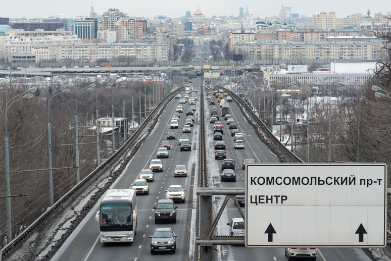
It’s the 21st March 2018 and I set out with Katya to take a look at the Russian capital, hoping to get more of an impression of a city which I have only very briefly visited in the past. I stopped for one night in the city in 2007 on my first trip to Russia and remember a centre of dazzling, extravagant beauty, surrounded by sprawling suburbs of ugliness and a road network inundated with some of the worst traffic I have ever seen. Later visits had been brief embassy trips or flight transfers, none of which had endeared the city to me. Given that Russia is the world’s largest country, it is staggering just how centralised it is; virtually everything of political, economic or cultural importance happens in Moscow (or to a far lesser extent, Saint Petersburg) and it seems to me that this modern, mostly rather charmless and ever-growing metropolis of around twelve million people, a rat race which draws people from across the Former Soviet Union, has little in common with the laid-back provinces and huge wilderness which is the Russia that I know.
Katya lives in the far south of the city, in a green-belt area only recently ceded to Moscow’s metropolitan area, and so we must take a minibus to reach the outermost station of the huge Moscow Metro before making our way towards the centre. We stop in and transfer through three ornately beautiful stations; Novokuznetskaya, Avtozavodskaya and Taganskaya, each like working museums of Soviet architecture, art and sculpture. All three were completed during the reign of Stalin, great expressions of artistic talent executed in very high quality materials, which are hard to reconcile with the crimes against humanity which were going on in the background at the time. We emerge back into the damp, grey Moscow afternoon in Basmanny District, one of Moscow’s central districts between Kitay-Gorod (the very centre of the city, containing the Kremlin and Red Square) and the inner-most Garden Ring. Basmanny contains many preserved buildings from the Tsarist period; mostly colourful churches of seventeenth century Peterine Baroque or slightly later Neoclassicism. Nowhere however, does it really feel like a preserved, historic centre as amongst all the oldest buildings are incongruously bland, or even ugly Soviet constructions, and equally incongruous glass-fronted, neon-lit chain shops and boutiques. Katya detects that I’m failing to appreciate the discordant layers of seemingly randomly scattered epochs of development, commenting “The disorder is what I love about it. This is Moscow and it’s absolutely Russian”.

Church of Cosmas and Damian on Maroseyka, Moscow, Russia
We walk along Solyanka and onto Maroseyka, passing numerous fine churches, then past the Ivanovsky Convent, whose smart Baroque is immediately adjoined to a peeling Soviet office building, still in use by the Police. We wander into disorderly backstreets, passing many more churches, to a university building which overlooks a small park which appears to be popular with young, intellectual types, overlooked by the yellow Choral Synagogue, with glimpsed views down to the Kotelnicheskaya Embankment Building, a Stalinist landmark on the Moscow River. Whilst quite charming and with a definite character of its own, I still can’t quite warm to the disorder. What does strike me about the city is how much cleaner it is now than a decade ago; the streets are in far better condition, better lit, well signed and the rather seedy street markets run by Caucasians and the ugly kiosks where one could buy alcohol and snacks from an unseen babushka via a sliding metal tray, both legacies of the economic collapse of the 1990s, have thankfully gone. As Katya puts it: “It has become civilised”. We finish the evening meeting a few colleagues of mine who are either expatriates in the city or visiting on business; a glimpse into the hedonistic night life of the city which is an attraction in itself.
Vernadskogo Prospect, Moscow, Russia
The next day I set out alone to see a few more points of interest, starting by taking the metro out to the south-eastern suburbs at Kolomenskoye. Once a wholly separate village on the Moscow river, Kolomenskoye became a royal estate for the princes of the Grand Duchy of Moscow. It is dominated by the early sixteenth century Ascension Cathedral, built to celebrate the birth of Ivan IV (The Terrible), who would go on to turn the Grand Duchy into the Tsardom of Russia, cementing Moscow’s role at the heart of the Russian state. Architecturally, the Cathedral, built in the ‘tent’ style of a slender central column, marked a move away from the Byzantine style; an assertion of the confidence of the growing Russian state. Kolomenskoye remains a pleasant urban park, detached from the city’s endless traffic and offering peaceful respite along the banks of the lazy Moscow River, from which the winter ice has receded almost entirely. I take a bus west towards Moscow State University, another towering, almost intimidatingly austere, but undeniably beautiful piece of Stalinist architecture, then walk down to Sparrow Hills, high above the right bank of the Moscow river. Here, in a spot popular with bus-loads of raucous Chinese tourists, one gets a fine view of the south of the city enclosed by a loop in the river, beyond which are the modest collection of blue-glass skyscrapers of Moscow’s International Business Centre. Standing on a nearby overpass above Vernadskogo Prospect, one can look down one of Moscow’s arterial highways, thick with traffic, which crosses the Garden Ring and pierces the very heart of the city, marked by the gilt domes of the Cathedral of Christ the Saviour and Kremlin walls.

Elektrozavodskaya Metro Station, Moscow, Russia
Walking down a pleasant, wooded embankment park, I cross the river and walk to the Novodevichy Convent, an urban island of harmonious seventeenth century churches, Moscow’s best-preserved cloister. Sadly, I arrive at the famous Novodevichy Cemetery just in time for it to unexpectedly close, much to my annoyance. Walking up to the striking Soviet architecture of the Moscow Youth Palace, only partly ruined by foul modern advertising boards, I join the metro at Frunzenskaya and admire a few more stations before meeting Katya in a bar for the evening. Of these, the most striking and my favourite of all of Moscow’s elegant Stalinist-era stations is Elektrozavodskaya, completed in 1944 and named for a nearby light-bulb factory, with the ceiling of the main hall lit by 318 incandescent bulbs each in a recessed lamp, a beautiful piece of artistic flair.
I’ve certainly seen a little more of the Russian capital on this present visit and can see that, with its own very distinctly Russian character, it is more than just a brash European city, but I still can’t say I particularly like it. I feel it would be an interesting place to live, for its main attraction is surely the array of people from across the Soviet world which one may find here with an unparalleled range of cultural events. The road, however beckons, and so I leave Moscow with my strongest impressions still coming from that beautiful June morning spent in the city’s exotically beautiful centre.

Vostok K Rocket, Tsiolkovsky State Museum of the History of Cosmonautics, Kaluga, Kaluga Region, Russia
Katya lives very conveniently alongside the Kaluga Highway which leads quickly out of Moscow into the provinces, thankfully precluding the use of Moscow’s MKAD ring road. The weather is dull and grey as we begin our southward journey, well matching the endless grey outer suburbs which stretch for more than fifty kilometres from Katya’s apartment, and around eighty from the city centre. Crossing finally out of Moscow, we enter Kaluga Region which for me is the eighty-second of Russia’s eighty-five administrative divisions which I have visited over the years. We are aiming for the city of Kaluga but take a small detour first to a Soviet-era roadside monument marking the supposed site of the Great Stand on the Ugra. According to Soviet-era historians, this was the site of a stand-off in 1480 between the forces of Ivan III, Grand Duke of Moscow, and those of Ahmed Khan, leader of the Golden Horde, which marked the end of almost two hundred and fifty years of the ‘Tatar Yoke’.
In the city of Kaluga itself, we head for the Tsiolkovsky State History Museum of Cosmonautics, a Soviet-era museum of space exploration dedicated to Konstantin Tsiolkovsky, one of the pioneers of rocketry and astronautics, who spent much of his life in the city. Housed in a 1960s Futurist building and surrounded by impressive pieces of Soviet rocketry, the museum is an attraction in itself, though is filled with a vintage display chronicling firstly Tsiolkovsky’s work, then numerous items from the Soviet space program such as the original return module of Vostok 5 which orbited the Earth for just under five days in 1963 before landing in the steppe of northern Kazakhstan. Outside is a genuine Vostok K rocket, the backup for Gagarin’s 1961 Vostok 1 mission.
Yepifan, Tula Region, Russia
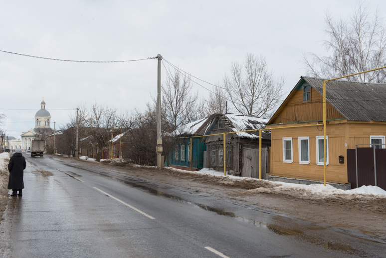
Away from the museum, Kaluga feels rather provincial and quiet. Just as Moscow lures the young, ambitious and capable from across the country, here, just two hours away, the pull is especially strong and seems to have left Kaluga as something of a backwater with nothing of importance going on. We leave in the afternoon heading east into a snowstorm, bypassing the city of Tula and stopping briefly in the fading evening light in Novomoskovsk, where a boulder in a snow-filled park surrounded by cigarette ends and empty plastic beer cups rather unceremoniously marks the source of the River Don. We spend the night a few kilometres away in a small hotel in Bogoroditsk, which in the morning I find to be a likeable small town with an elegant, preserved country estate of Catherine II and a friendly, compact centre. From Bogoroditsk we drive east and then south on small roads, crossing a very young Don which is little more than a stream and the charmingly faded small town of Yepifan, before reaching the Tsarist-era monument at Kulikovo Field.

Memorial to the Battle of Kulikovo, Kulikovo Field, Tula Region, Russia
The Battle of Kulikovo took place in the vicinity of these plains on the upper Don in 1380 and was one of many battles between the Grand Duchy of Moscow and the Golden Horde. However, according at least to mainstream Russian historians, the battle marked the beginning of Russia’s liberation from the Tatar Yoke and a decisive victory of the Christian principalities of Rus’. Perhaps equally importantly, the battle saw the divided principalities united under leader Dmitry of Moscow (who gained the epithet ‘Donskoy’ after the battle) and thus cemented Moscow’s position as the leader amongst the early Russian principalities. We are the only visitors at the site, a gold-domed black obelisk set in a small park amidst the rolling countryside. The memorial is quite unusual in being a rare example of a Tsarist-era monument to have survived the Soviet period, and is therefore refreshingly free from Soviet concrete or Marxist-Leninist class-struggle nonsense. Just up the road is a museum which surprises us both; rather than a dusty old Soviet local museum, it’s a modern, well laid-out exhibition with clear displays and a pleasingly objective display of artefacts from the battle and from both cultures, which paints the Golden Horde as a sophisticated eastern culture and a formidable enemy, rather than a horde of bloodthirsty barbarians as they are usually portrayed.

Saburov Fortress, Saburovo, Oryol Region, Russia
In the afternoon we head west again, crossing the M4 highway through rolling farmland into Oryol Region, where we stop briefly to sneak into the closed house-estate of Ivan Turgenev, arriving after dark in the city of Oryol. Here I stop in to re-visit the first city I had visited in Russia back in 2007, looking wistfully at the Hotel Rus’ on Lenin Square and remembering how thoroughly awful my first impressions of Russia were. I laugh to myself now, thinking about the months and tens of thousands of kilometres of wonderful experiences I have since had in this country which I have long since fallen in love with. After spending a night in a pleasant wooden hotel in the village of Znamenka, just outside of Oryol, we set out on a beautifully clear and sunny morning to the nearby village of Saburovo which contains a quite remarkable piece of architecture. Built at the end of the eighteenth century, Saburovo’s large and partly ruined red-brick fortress is quite unlike anything I have seen before in Russia. Built by Count Mikhail Kamensky, a tyrannical Field Marshal of the Russian Army, the slowly decaying walls and derelict, three-storey defensive towers hark back to the age of feudalism, when this northern edge of Russia’s Black Earth Region would have been cultivated by serfs kept by wealthy landowners. Ironically Kamensky, after an inglorious military career, would meet his demise at the hands of one of his mistreated serfs.
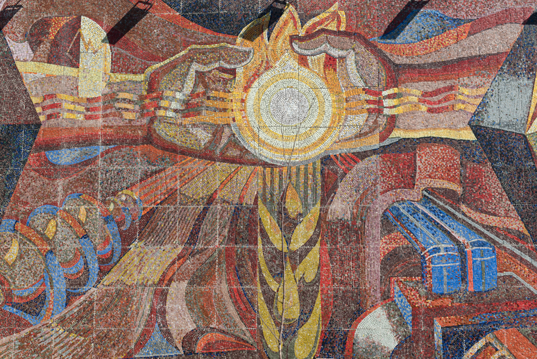
Soviet Mosaic, Kursk, Kursk Region, Russia
We continue southwards on the main highway, passing what used to be the turning on the M2 highway to Kiev, from where I had entered Russia for the first time, then stop around midday in the city of Kursk. Though a city of some age, Kursk was heavily damaged in the Second World War and is a visually very Soviet, set either side of the long, wide Karl Marx and then Lenin Street with blocks of often grandiose Stalinist architecture, some beautiful mosaics and a large Victory Park. It’s a likeable place with an air of mild prosperity, not completely drained by the lure of Moscow. Just south of Kursk we stop to look at an ancient carved-stone balbal (menhir) sitting undisturbed in the snow-covered steppe of a small nature reserve; similar in style to balbals found across Central Asia for holding a ceremonial cup in both hands at waist-level, though lacking any facial features. This balbal is the work of the Cumans; a Turkic nomadic nation who arrived in these steppes from the east in the eleventh century CE, from where they attacked Rus’, Byzantium, the Balkans and Central Europe. It’s a reminder that these plains of European Russia were once more closely linked to the steppes of Asia than to settled Europe, and with the snow around the balbal seemingly undisturbed for months, seems to be all but forgotten. It’s really a joy to find such obscure relics of distant history out in the open.

Cuman Menhir, near Kursk, Kursk Region, Russia
Continuing in the softening light of the afternoon, we enter Belgorod Region at dusk where Katya has to laugh at a sign reading ‘Belgorod’s roads are a territory of the law’ but the change is immediate; we are suddenly on a very high quality four lane dual carriageway with continuous street lighting, as if we had suddenly crossed the border into central Europe. Belgorod Region is the centre of Russia’s agricultural belt and, like Tyumen Region, is an example of what good governance can make of Russia’s great wealth. We spend the night in a modern and very pleasant roadside motel in the town of Stroitel, a few kilometres north of the city of Belgorod. The following morning is again brilliantly clear, illuminating a crisp, snowy landscape of gently rolling farmland which we cross on local roads heading east. We head towards the town of Prokhorovka, epicentre of the infamous 1943 Kursk Tank Battle, quite possible the largest in history, a land offensive which saw the Red Army quickly repel a German offensive for the first time, marking the end of major German advances on the Eastern Front. I come hoping to find some monumental Soviet memorial in the same vein as Stalingrad or Brest, but rather surprisingly, there is very little to be seen beyond some old tanks and a rather cheap looking modern orthodox chapel (to which the tanks’ guns appear to be aimed). We spend much of the day driving east through a beautiful winter landscape of rolling farmland, passing through Ostrogozhsk and, after some difficulty locating a road, reach a prominent limestone ridge overlooking the Don, where we park the car and walk over a hill towards the Divnogorsk Holy Assumption Monastery.

Church of the Nativity, Divnogorsk Holy Assumption Monastery, Voronezh Region, Russia
In a landscape dominated by open steppe and gently incised valleys, the limestone outcrops of Divnogorsk overlooking the Don are a dramatic sight and as we descend a snowy hillside and then a walkway leading through a patch of bare forest, I am genuinely surprised to see a hillside studded with dramatic karst outcrops, amongst which lies the ancient cave monastery. Established in the mid-seventeenth century at a time when this was the southern frontier of the Tsardom of Russia, subject to raids by Crimean Tatars and Nogays, the monastery was built into the soft native limestone, the first such cave monastery in the Don Region. Although now disused and locked, the monastery is preserved with the white stone facade of the troglodyte Nativity Church surrounded by numerous hermit cells and two modern gilt domes perched oddly atop two of the karst towers. The location is also magnificent, overlooking the more modern, active monastery built next to the riverside, beyond which spreads a beautiful Russian winter landscape of a meandering Don and gently rolling hills stretching to a distant horizon. As we drive south away from Divnogorsk, we are treated to a magnificent pink sunset, colouring the snow-covered valleys with soft, warm colour. We arrive after dark in the provincial town of Rossosh, which I had passed through one sunny June morning in 2014, heading for the Volga and Kazakhstan. In the overcast morning it reveals itself as a slightly shabby but lively place, with market traders on the streets and old Soviet cars filling the air with exhaust fumes. ‘It reminds me of the nineties’ Katya remarks.

Sunset, near Divnogorye, Voronezh Region, Russia
We drive south out of Rossosh on a near-empty road into the Donbass; once the unpopulated ‘Wild Fields’ ruled by various nomadic groups, then settled by Cossacks, the Donbass became synonymous with coal mining and heavy industry in Soviet times, though today is associated with the war which has unfolded since 2014 just to the south. After treating the Hilux Surf to its first wash since Magadan on the edge of Kantemirovka, we approach the border at Bugayevka in cold, heavy rain. Ironically, after dozens of relaxed and trouble-free border crossing experiences, here one of the customs officers decides to subject us to a thorough questioning which reminds me strongly of encounters with the FSB (Russian security services) in the North Caucasus. Whether it is from pure boredom in this backwater border crossing, or from that old Soviet equation with foreigners as spies (admittedly this border crossing must see almost no ‘foreigners’ and is located close to the Donbass war zone to the south in Ukraine), we are looked upon with suspicion; Katya is taken alone for questioning, after which the officer comes out and demands to know who we are planning to stay with in Kiev. Ironically, the fact that our paperwork is not in order (I, as usual, have not bothered to register myself in the country and Katya has lost her internal passport) is not made into a problem, and we are soon free to go.
Thus ends my sixteenth visit to Russia, one which I feel will be the last on this Odyssey. I can look back on very nearly a year spent in total in Russia, a vast, enchanting country, a juxtaposition of beauty and brutality which can be seen through its landscape, people, history and art. I can say that I really love Russia and her people who are individually deeply talented, sensitive, down-to-earth, kind and hospitable, yet as a collective still seem to live under the shadow of their fearful history, trying to move on from the total collapse of the Soviet Union and the fear and fallacy of Marxist-Leninist Socialism. Though lacking any plans to revisit, it feels rather odd for Russia not to figure in my near future.

Holy Trinity Church, Novorozsosh, Luhansk Region, Ukraine
The Ukrainian side of the border is more relaxed and we pass through without any problems, purchasing vehicle insurance from a vastly overweight man squeezed into a Lada with the engine running to keep warm, who warns us that the roads ahead are terrible. We enter Luhansk Region, the only region of Ukraine I have not yet visited (plans in 2014 had to be changed due to the outbreak of war) and one which is partly occupied by Russian-backed separatists who have proclaimed the independent ‘Lugansk People’s Republic’, based in the regional capital Lugansk. We however, have entered a northern strip of the region which remains under control of the Kiev government. The condition of the road is indeed terrible and becomes worse as we approach the first town, Markivka. Here the road becomes almost completely destroyed and the town looks little better. Although we are seeing it in the worst light, in the mess of melting snow and mud which signifies the end of winter here, it’s clear that the region is poor, neglected and depopulated. Damp buildings line the road, many seemingly abandoned and few people seem to be out in the streets braving the rain and the muddy water squirting from the deep, unavoidable holes in the road with each passing vehicle. As we pass through further towns of Lisnaya Polyana, Novorozsosh and Starobilsk, the situation is little better. It would be tempting to imagine that this was the direct consequence of war, but there was never fighting here; what we are looking at is the consequence of neglect by the central government and a total lack of opportunity. It’s little surprise then that across the Donbass rust-belt of eastern Ukraine, many people feel little allegiance towards Kiev and have welcomed occupying Russian backed forces.

Derelict Department Store, Novopskov, Luhansk Region, Ukraine
As darkness falls the road becomes even worse; at one stage it seems we are driving through fields where the road surface has completely vanished, leaving a filthy mess of mud. These are some of the very worst roads I have ever driven on. We pass an army checkpoint in the dark without problems, after which the road improves slightly as we enter Kharkiv Region, stopping in the town of Kupiansk where we finally find an ATM and a supermarket. After a night spent sleeping in the car in a muddy field, we finally find an acceptable road the following morning when we reach the Kharkiv ring road. We pass north of the city and then across the black earth countryside of eastern Ukraine, through Poltava and a rather bleak late winter landscape dotted with many poor, half-abandoned villages. We reach Kiev late in the afternoon where we are hosted by my friend Peter, a former colleague with whom I stayed in 2014 when I last passed through. After initial confusion finding Peter’s street address, which has changed due to yet another round of name-changing as part of Ukraine’s vigorous decommunisation efforts, we settle in for the evening in his spacious penthouse apartment in the very centre for good food and conversation.
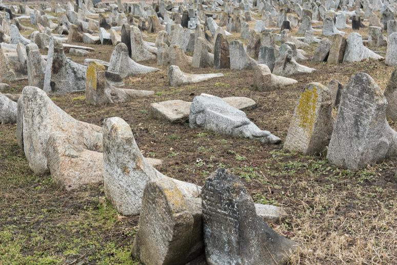
Jewish Cemetery, Berdychiv, Zhytomyr Region, Ukraine
Before leaving in the morning, Katya and I take a quick look around central Kiev, a city I have always and the very first which I visited in the Former Soviet Union in the wonderful summer of 2007. Whilst still elegant and attractive, Kyiv is noticeably less prosperous, with fewer expensive cars on the streets and, I detect, a slightly more seedy air. This might be in part due to the time of year, but it’s clear that the country has slipped since 2011 when I spent almost two months here; thanks to the Crimean Crisis, war and subsequent economic fallout, Ukraine is now Europe’s poorest country. We head out west from the capital in a final flurry of snow, on the first really good road we have found in the country, then turn south around Zhytomyr, stopping in the town of Berdychiv. Once an important trading centre in the Polish-Lithuanian Commonwealth, Berdychiv became a centre of Jewish culture with the population in the eighteenth century around eighty percent Jewish. This population has almost entirely vanished, after repression in Tsarist times, terrible Nazi massacres and finally emigration of the remaining population following the economic collapse of the Soviet Union. What is left, as a rather sombre but intriguing monument, is a large Jewish cemetery with unusual, tapering Jewish gravestones which I have not seen anywhere else. Continuing south, we stop at the site of Werwolf, Hitler’s easternmost command bunker. It was here, after contracting influenza in a humid underground bunker, that a fevered Hitler gave his fateful orders for the division of Army Group South into groups advancing simultaneously to Stalingrad and the Caucasus; a disastrous strategic miscalculation. The Nazis destroyed the bunker on their retreat in 1944, leaving just shattered blocks of concrete and an oddly intact swimming pool.

Sobornaya Street, Vinnytsia, Vinnytsia Region, Ukraine
Just down the road, we stop in the early afternoon in Vinnytsia, the largest city of the historic region of Podolia and one which traces its roots to the fourteenth century. Like much of the western half of Ukraine, Vinnytsia was long under the control of Moscow’s western rivals; firstly the Grand Duchy of Lithuania, then the Polish-Lithuanian Commonwealth, only coming under Russian domination in 1793. We find a hotel then walk out to the city centre which is modestly attractive with some elegant nineteenth century city blocks, but what strikes me most is the subtle change that makes me realise we have left the traditional sphere of Russian influence; the city is built on a smaller, more human scale, more intimate with narrow streets and small business mixed in with houses and apartment blocks. The people also look different, with softer, more mixed features and seem more at ease in their surroundings. This more urbane and less authoritarian atmosphere makes me realise that we have entered the transition zone into central Europe. We walk through pleasant urban parks, stopping at a monument to the roughly ten thousand people (mostly ethnic Ukrainians) murdered by the NKVD in the Vinnytsia Massacre, part of Stalin’s Great Purge of the 1937-38, whose bodies were ironically exhumed by occupying Nazis in 1943, in the midst of their yet greater crimes against humanity here, where perhaps thirty thousand Jews and prisoners-of-war were murdered. This grisly history of intolerance seems to be yet another sign of nearing the centre of Europe.
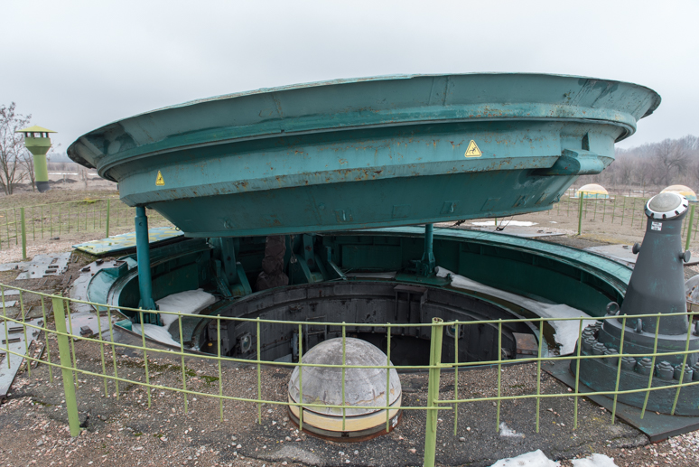
RT-23 ‘Molodets’ Missile Silo, Museum of Strategic Rocket Forces, near Pervomaisk, Mykolaiv Region, Ukraine
The morning is rather dismal and we head out of town eastwards on a road which soon becomes an atrocious mess of broken asphalt, choked by crawling, heavy lorries but lined by tall, bare, poplars and willows heavy with mistletoe which must be very attractive when spring arrives. We bypass the city of Uman and join the main Kiev – Odessa highway which is in reasonable condition, soon turning off towards the city of Pervomaisk. We leave behind the very last traces of snow which has been a constant companion of mine since Magadan and enter a landscape of large fields of black earth. Amongst these lies the Museum of Strategic Rocket Forces, which turns out to be a fascinating diversion.
Ukraine, which was heavily militarised during the Cold War, inherited dozens of missile silos (and other military hardware) from the Soviet Union, all of which were destroyed with assistance from the US, apart from this example which has been preserved as a museum with a former officer as a guide. We enter a rather worn looking Cold War installation and after being led around a conventional museum, walk through a long underground tunnel to reach the Unified Command Post. As with the nine satellite missile silos, each capable of launching an RT-23 ‘Molodets’ intercontinental ballistic missile with ten warheads, the command post is a thirty-three metre deep, 3.3 metre wide tube sunk into the ground, capable of sustaining a direct nuclear strike. We are led into the command post and descend in a small lift, then two sets of ladders to the lower-most command quarters where a crew of two could survive autonomously for up to forty-five days. The launch control systems are still operational and, once activated by Katya and I simultaneously pressing red buttons, illuminate a series of ancient light displays and a buzzing siren which, though almost comically dated, are at the same time deeply terrifying (though I do for a moment imagine vaporising Las Vegas). Ascending the eleven storeys once more, we walk through another short passage then emerge rather surreally back into the damp, misty Ukrainian countryside. Here we can see a preserved launch silo which has been filled with concrete and whose blast door is left permanently ajar (with ludicrous Western health and safety labels). Surrounding us are huge Soviet MA-2 missile transporters, a static R-36 ICBM (which is still in use in Russia) and other frightening pieces of hardware dedicated to mass destruction. It’s probably the most fascinating museum experience I have had.
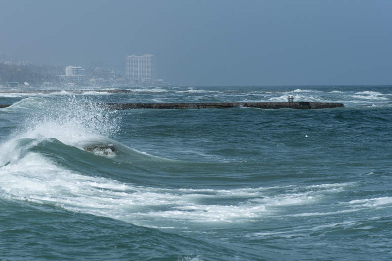
Black Sea, Odessa, Odessa Region, Ukraine
We drive through Pervomaisk and then west on yet another rough and neglected road, re-joining the highway and heading south to Odessa, which we reach after dark, stopping at a hotel close to the beach in the city’s rambling southern suburbs. In the morning, we set out on foot, heading straight for the coast where strong waves whipped up by a warm, southerly wind crash onto sandy beaches. After many weeks of snow and ice and sub-zero temperatures, it’s a joy to walk along the promenade together. We take a shabby tram which trundles noisily along rails which in places lift from the broken asphalt of the city streets, alighting near the centre and walking through parks with freshly budding trees. On my first visit to the city in October 2011, perhaps slightly jaded after four and a half years on the road yet with no appetite to return to western Europe, I had found Odessa rather overhyped and left disappointed by the vulgarity of its more wealthy inhabitants set against the pretensions of its European-influence architecture. Perhaps this time I come in a more positive frame of mind, or perhaps it is merely the good company and hint of spring in the air, but I really warm to Odessa. I enjoy its faded elegance, an architectural melange of Gothic, Art Nouveau, Renaissance, Tsarist and Soviet styles set along wide, tree-lined streets; its juxtaposition of beauty and squalor and its thoroughly seedy though unthreatening air of iniquity. It’s a fine end-point to my travels in the Former Soviet Union.
Brodsky Synagogue, Odessa, Odessa Region, Ukraine
My real reasons for coming to Odessa are however, romantic. As a child I had avidly watched the travels of Michael Palin and in his series Pole to Pole I have distinct memories of his leaving the Soviet Union by ferry from Odessa in summer 1991, a day before the August Coup which led to the state’s rapid dissolution. I believe it was in no small part that Mr Palin put into my young mind the idea that travel should be a journey, rather than a destination. Add to this the rare chance these days to travel by long-distance ferry in a world where such routes are disappearing in favour the tasteless efficiency of air travel, and the thought of leaving Odessa by car ferry for Turkey was to me unmissable. The ferry is delayed by a storm coming in off the Black Sea which prevents it from docking, but shortly after midnight during a second unplanned night in Odessa, we drive to the nearby port town of Chornomorsk (which was still name Illychivsk last time I passed through in 2011 en route to Moldova) where we are stamped out of Ukraine and can board the ship. I’m directed to park the car on the dock and we board the MV Vilnius Seaways on foot, reaching our cabin shortly before 03:00. After a brief sleep, I am called at around 08:00 to load the car which, together with one other private vehicle, has its wheels chocked aft of scores of articulated lorries on a lower vehicle deck.
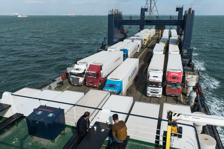
MV Vilnius Seaways, Black Sea
Soon the ship gently slips out from Chornomorsk and the low-rise skyline of the docks and the city of Odessa shrink into the horizon. It’s a moment which for me is both poignant and exciting; after accumulating almost two and a half years of travel in the Former Soviet Union this once truly vast country, a place which feels like a world in itself, still fascinates and thrills me with its exotic blend of Siberian wilderness, Central Asian landscapes, evocative ancient cities and myriad nations with everything underlined to some degree by Slavic, European culture. I’m closing a chapter in the story of my own life and I feel deeply privileged to belong to a generation which is free to explore the vast region, so long isolated from the outside world. To be doing so in much the same way that I saw Mr Palin leave more than twenty five years earlier adds a personal touch; a final experience lived in this wonderful part of the world. We soon settle into the rhythm of the voyage; our cabin is very comfortable with a good en suite bathroom and a starboard porthole which I am very pleased to find we can open, allowing in a fresh breeze. We are called three times a day over the ship’s radio system for breakfast, lunch and dinner and otherwise are free to relax or wander out on deck. With a great sense of satisfaction at having wrapped up my winter trip across Russia in style, the company of a beautiful woman and the comfort and allure of a sea voyage, life really is rather good. After several joyless years in the doldrums of north-western Europe, working and saving for some unknown future, it’s a joy to be alive, to live for the moment, just as I had during all those years I spent on the road before beginning my current interlude of mundanity.

Fatih Skyline, Istanbul, Turkey
After a soothingly calm night at sea, we wake to a pink dawn as the ship glides past the fort and small harbour of Rumelifeneri, entering the northern mouth of the Bosphorus. We pass the outer suburbs of a great city which is coming to life for the day, pass under all three Bosphorus bridges and are presented with the skyline of Fatih on the Istanbul’s European shore, in my mind without doubt the finest I have seen in the world, with the inimitable domes and spires of the Hagia Sophia, Sultan Ahmet Mosque and Topkapı Palace atop Seraglio Point, where the first Greek settlers established Byzantium in the seventh century BCE. We dock at Haydarpaşa, close to the elegant Ottoman-era railway station station from where my first Asian adventure began in 2003. It’s a magnificent arrival in this most romantic of cities; far more pleasant than fighting through traffic and infinitely more civilised than flying. We are the second vehicle off the ship and although customs procedures are slow compared to a land border, they are relaxed and friendly. The contrast with the Former Soviet Union is marked; here it’s not unusual to find people speaking English or German; as travellers and outsiders we are not regarded as anything unusual; altogether different from the insular world we have just left. Just after midday we leave Haydarpaşa Port and drive a few hundred metres to the small ferry terminal at Harem where we board a ferry which departs after three minutes, crossing to the dock at Sirkeci in the busy port of Eminönü, right in the heart of Istanbul. It’s a short drive across the Golden Horn to the busy neighbourhood of Beyoğlu where we check into a very pleasant hotel room overlooking the British Consulate General.

Mahmutpaşa Hill, Istanbul, Turkey
We have reached Istanbul in the balmy warmth and colour of spring, a world away from the dreary grey of Moscow and a perfect place to end the journey. Although this is Katya’s first time in the city, I suggest we avoid the crowds waiting to file into the most obvious tourist attractions and so we spend our time walking through the backstreets of the centre. From nearby Taksim Square, we walk through the affluent streets of Beşiktaş, down to the waterfront around the ornate Dolmabahçe Palace, then up into the steep streets of Beyoğlu filled with small businesses and artisans in workshops just off the cobbled streets. Across the Golden Horn we visit the city’s ancient heart in Sultanahmet, passing of course through the Hippodrome, then down to the Byzantine city walls and waterfront on the Sea of Marmara, perhaps my favourite spot in the city. We adopt a slow pace, stopping in teahouses to soak up the atmosphere when the fancy takes us and following no planned route. Heading back uphill into the backstreets of Sultanahmet, we are surrounded by city life with men sitting at small street-side tables drinking tea and others pushing carts loaded with goods through the narrow, ancient thoroughfares. Crossing north into Fatih’s bazaar district, we avoid the horribly touristy covered bazaar, instead walking through narrow, congested streets to Mahmutpaşa Hill where locals flood the street shopping for clothes and shoes.

Galata Bridge, Istanbul, Turkey
Walking up through streets of fragrant soap and spice shops, we reach the Süleymaniye Mosque, admiring views across the Golden Horn to Beyoğlu, then work our way back via Eminönü to watch the sunset from the Galata Bridge, from where locals pull small fish from the murky water. Drawn back to the Bosphorus the next day, we cross over to Üsküdar and walk down the Asian shoreline, watching the busy ferry traffic and admiring the magnificent skyline of the European shore, entering the affluent shopping streets of Fenerbahçe and returning from the ferry dock at Kadıköy. Everywhere are people, shops full of goods, restaurants serving excellent Turkish food, teahouses and a plethora of cats, for which the city authorities even build small street-side wooden houses. Istanbul really is a magnificent city to stroll in and I can’t ever imagine myself tiring of visiting it.

Beyoğlu, Istanbul, Turkey
All good things must come to an end however, and so after three nights together, Katya flies back to Moscow early in the morning and I get back into the car for the final drive west. Leaving the sprawling western suburbs of the city, I make the now familiar drive along the D100 through the rolling fields of rural Thrace, stopping briefly in Edrine before approaching the border at Kapikule. Here, long queues are made worse by Bulgarian peasants attempting to jump the line, causing yet more jostling and a fight to break out, but before long I’m out of Turkey and into the nether regions of the European Union. I can look back on a once-in-a-lifetime winter expedition followed by a very pleasant transition though Russia and Ukraine, picking out points of historic interest and witnessing first hand the effects of the latest upheavals of the post-Soviet world. An indulgent final visit to Istanbul leaves me poised for a future trip into Asia, something on which to focus my mind as I head back to my job.
It takes two and a half days of driving to reach base in western Europe on the afternoon of the 8th April 2018, 20,087 kilometres from Magadan and 43,332 kilometres since leaving the same spot in October last year. With my long-planned dream journey through the Russian winter completed, it is time for me to focus on my next direction in life; further travels are only vaguely conceived; revisiting the Middle East and making my first, long-awaited steps into Arabia, perhaps including a detour into the Greek Islands or Balkans, or less clearly defined journeys to China, South-east Asia or the long-planned second Odyssey to Africa. Perhaps more importantly it is time for me to work on my career and make the long dreamed-of emigration out of Europe.
Stage 44 – Russia: The Siberian Winter [3/3]

The final part of my winter journey across Russia would take me on more winter roads; up across the vast, frozen lowland of West Siberia to the Arctic Circle and back down using a final, long ice road on the Ob River. Here, the experience would differ slightly from that of the rugged east of Siberia, with superior infrastructure and better-maintained winter roads as a result of the region’s oil and gas industry. The grip of the winter would also start to ease; days were now getting longer and the warmth of the sun would make crisp, clear winter days very pleasant, despite night-time temperatures regularly still reaching -30º C. But whilst the driving would be less daunting and uncertain, the stops I made along the way, and the experiences I had there would be among the most moving, thought-provoking, life affirming and unforgettable of the entire journey through the Siberian winter.

Vasyugan River, Novoyugino, Tomsk Region, Russia
I leave the tiny village of Prokop on the bright, sunny morning of the 27th February 2018. The temperature is a perfect -25º C as I drive to the end of the asphalt road in the town of Kargasok from where, after a brief stop for supplies, I take an unpaved road along the Vasyugan River to the village of Novoyugino. Here I am glad to find the beginning of the next zimnik (winter road), which crosses the Vasyugan Swamp, the largest in Eurasia, and marks the end of a long section of highway driving which started on the eastern shore of Lake Baikal nine days ago. As always, I am unsure of the route which this temporary road will take, but here at least there is a schematic map and a toll office where I confirm that the road leads to Strezhevoy, on the opposite bank of the Ob in the far north-west of Tomsk Region, several hundred kilometres away. After paying the toll, I drive down the river-bank past a scuppered tug-boat and cross the Vasyugan River into a frozen wilderness.

Novoyugino to Strezhevoy Winter Road, near Vertikos, Tomsk Region, Russia
The zimnik is initially wide and well-graded, passing through alternating forests of tall, old-growth pines, stands of birch trees and more open, waterlogged ground, all deep frozen and still. The road becomes progressively narrower and lumpier as it crosses the frozen swamp, heading northwards, well inland from the Ob River. Most other suers of the zimnik are lorries servicing distant oil and gas infrastructure, but I am passed by two passenger vehicles whom I later come across stopped at the road-side, with one old Volga estate car crashed off the road sticking out of a snow-covered swamp. The car is soon pulled out by a passing truck and I lend the driver some tools to get the engine re-started by taking the battery out of his friend’s car, which has already crashed further up the ice road. I take some comfort in knowing that even the locals come to grief on these slippery winter roads and keep my progress slow and steady over the slippery, frozen surface of what must be an impenetrable peat bog in summer. Late in the afternoon I pass the riverside settlement of Vertikos, from where the road roughly follows a large oil pipeline. I’m delayed waiting for a stranded articulated lorry with no chains on its rear wheels to be recovered by a civilian tank on a treacherously slippery descent into the forest, then push on in the gathering dusk northwards through the forest. Well after dark I pass the oil pumping station at Raskino and push on to another oil processing facility with a glowing orange flare stack where I stop and heat up some Russian Army rations inside the car.

Pontoon Bridge across the Ob River, Koltogorsk, Tomsk Region, Russia
Just beyond this facility I meet a fork in the road, signed left to Strezhevoy. There is of course nobody around from whom to ask directions, so I reluctantly take the left fork, away from the river where I had entertained some hope of spotting Nazino Island, infamous in Gulag history for the abandonment of six thousand deportees on a river island in the Ob in May 1933 without any supplies, some of whom resorted to cannibalism to survive. The zimnik soon turns due west, away from the river and pipeline and enters the dark forest on a narrow track. On a wide, frozen lake or mire I decide to stop for the night, but with the temperature at -30º C and the road far from any sign of human settlement, I decide to keep the engine running through the night for the first time since the Lena River. In the morning, after around eighty more kilometres of beautiful forest and swamp, I come upon a straight asphalt road which I take north to the bank of the Ob. This is an important transport artery for the oil fields to the south (from where I presume the asphalt road originated), so rather than a simple ice road crossing, the Ob is traversed here by a temporary pontoon bridge, with the steel pontoons shored-up by large tug-boats, all now frozen solidly into the ice of the Ob. Beyond the port of Koltogorsk on the river’s right bank I find the city of Strezhevoy. Though a slightly grim and charmless-looking place (albeit with the cheapest petrol I would find in the country), Strezhevoy is far from a backwater and currently marks the end of the ‘Northern Latitudinal Corridor’; a modern road, rail and oil conduit which links the oil and gas producing regions of West Siberia with European Russia and will one day make the zimnik I have just taken redundant when it bridges the gap to the city of Tomsk.
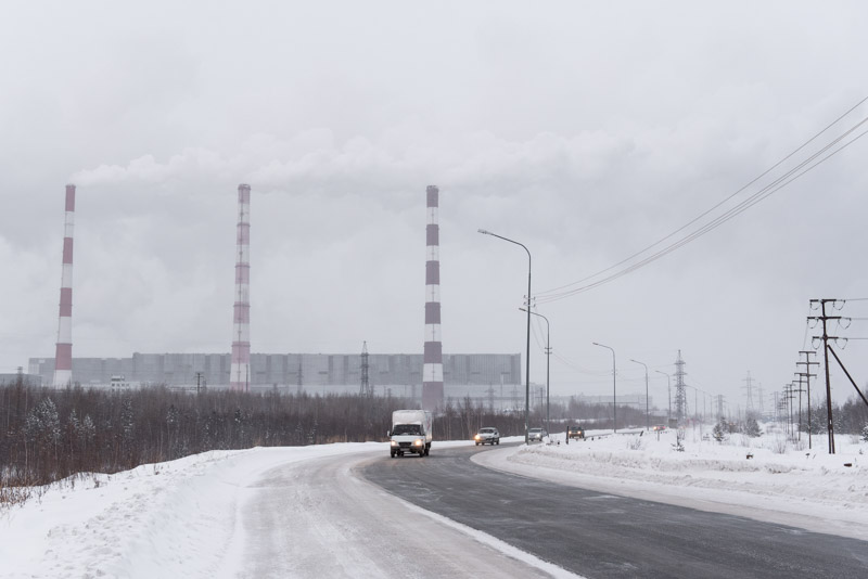
Surgut-II Power Plant, Surgut, Khanty-Mansi Autonomous Area, Russia
Just outside of Strezhevoy I cross into the Khanty-Mansi Autonomous Area, Russia’s main oil-producing region and am taken aback by some of the best infrastructure I have seen in the country; a very high quality road and parallel railway built on berms above the swamp and conducted above countless mires and meandering streams by many new bridges. I pass the city of Nizhnevartovsk on a road busy with ever more traffic as I near Surgut, the largest city in the region. The first sign of reaching Surgut is a broiling mass of steam to the right of the highway; the source of which are two power stations, Surgut-I and -II, the latter being the largest gas-fired power station in the world, whose dense billows of condensed water vapour fume wildly in the frigid afternoon air. I’m welcomed to Surgut by aggressive traffic but soon find the apartment of my host Anna, where I will spend a rest-day. Surgut was founded in 1594 as a staging post and ostrog (wooden fortress) on the old pioneer route along the Ob, though there is no hint of this when looking at the city’s relentlessly modern architecture. Anna takes me to the rather contrived ‘Old Surgut’ open museum where in newly-built wooden houses one gets the impression that Surgut was nothing more than a large muddy village until well into the twentieth century. All this changed in the 1960s with the discovery of huge oil reserves below the vast West Siberian swamps, which triggered an oil boom and the largest free population movement in the history of the USSR, transforming Surgut into a modern city with a population now over three hundred thousand. With people having moved from across the entire Soviet Union, today’s population is a cross section of the Former USSR, almost none of whom belong to the area’s supposedly titular Khanty or Mansi tribes.
Surgut is a boom town, a dull place to work and sleep (I find myself drawing parallels to my own posting up in a dreary corner of north-western Europe) and after one day I am ready to leave. I make use of the city’s amenities, have the engine oil changed in the car, do some shopping and refuel, then head out in the early afternoon on another excellent road, this time heading north through a flat, featureless landscape of swamps with thinning stands of forest. As darkness nears I cross into the Yamalo-Nenets Autonomous Area and spend the following day driving ever north, watching the trees thin out and become small and stunted as the landscape changes from forest and swamp to wide, featureless tundra as I near the Arctic Circle.
Tundra, near Novy Urengoy, Yamalo-Nenets Autonomous Area, Russia
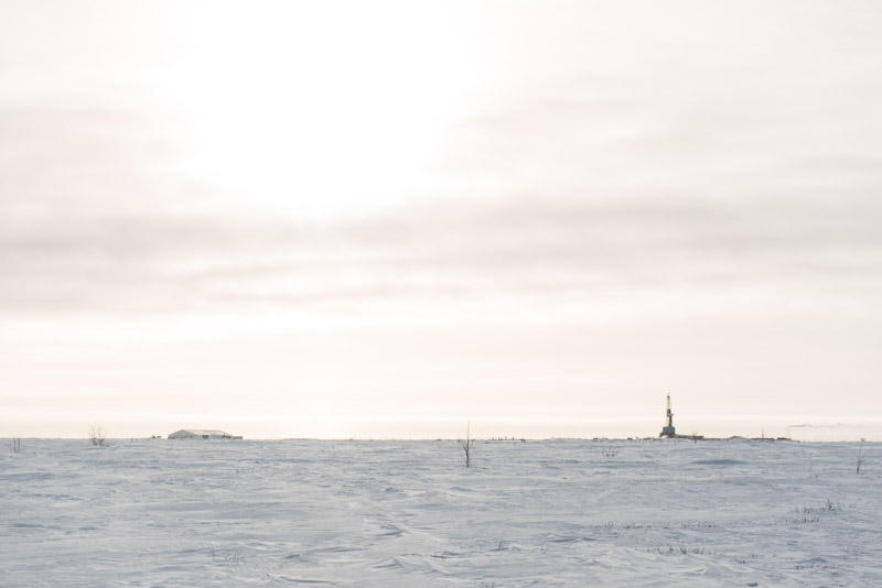
I stop for a day in the modern city of Novy Urengoy where I am hosted by Evgeniya and her mother Lyuba in a spacious, comfortable apartment. Evgeniya calls a contact the following day, a Russian-German who speaks perfect English and turns out to be a fellow Imperial University alumnus. With a driver, we enter the network of private Gazprom roads north of the city and visit first an active drilling rig, then stop at a roadside marker precisely on the Arctic Circle. The landscape around is pure tundra, but everywhere are the rigs, pipelines, well-heads and production facilities which produce the gas and condensate from the Urengoy Gas Field, the second largest in the world. Back in Novy Urengoy we meet Evgeniya’s boyfriend and make a quick tour of the city; established only in the 1970s and with a relatively affluent and well-educated population, it feels somewhat more amiable than Surgut if even farther from the rest of the world. At home, Lyuba, who has been feeding me delicious home-cooked food at every opportunity, makes a point I so far had not considered: “It’s a nice place to live. Salaries are high and the living standard is higher than in other places in Russia. We have the time and the means to travel abroad. But what future does this place have? In one hundred years, when the gas has long run out, there will be nobody left here”. Lyuba and Evgeniya have certainly had enough of the isolation and nine-month long winters, and are planning to move to Saint Petersburg later in the year.
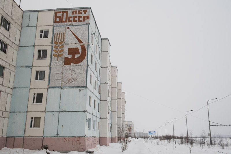
Apartment Building, Nadym, Yamalo-Nenets Autonomous Area, Russia
I continue eastwards from Novy Urengoy on the last section of the highway, driving through more tundra under a sky of windswept, fibrous cirrus clouds and patchy stands of dwarfed pines and larches; the most beautiful scenery I have seen since crossing the Ob. At some point on this road I complete the ten thousandth kilometre since leaving Magadan, a quite astounding distance given that I am still in the thick of the winter trip. After a few hours of easy driving I cross the Nadym River on an impressive modern road bridge (with an adjacent railway bridge stalled in mid-construction) and reach the end of the road in the city of Nadym. Here I am hosted by Sveta and her husband Yury, both of whom have moved here from southern Russia in pursuit of higher salaries. The day after I arrive, the weather deteriorates with a warm front bringing strong winds, snow and temperatures up to a horrible -1º C; an early warning of the spring melt and a reminder that it is the fickleness of nature which dictates when the winter driving season ends. I appreciate the down-time however, enjoying Nadym’s relaxed, small-town atmosphere, practising English with Sveta, drinking beer with Yury, researching the next few steps of my trip and recovering from a cold I have picked up somewhere.
Trans-Polar Mainline, Yamalo-Nenets Autonomous Area, Russia
After two much-appreciated rest days waiting for the bad weather to pass, I awake to a beautifully clear morning with the temperature back down to a pleasant -19º C. I bid farewell to my hosts at around 11:00, top up with fuel, then drive to the checkpoint on the edge of town. Here, after registering myself, I pass the barrier and begin the penultimate zimnik of the trip; this one connecting Nadym and the oil and gas towns of the north with Salekhard on the Ob River. Though still a temporary winter road, the initial section is built on a well-made berm above the swamp and is even asphalted; in a few years’ time, this too will be an all-weather road. What makes this route special however is that there is more than beautiful, frozen wilderness to look at whilst making my way to the Ob, for the zimnik takes the path of what remains of the Trans-Polar Mainline, better known as the ‘Dead Road’; one of the most grandiose of Stalin’s many Gulag construction projects.

Tundra, Yamalo-Nenets Autonomous Area, Russia
The isolated appearance of Nazi naval vessels in the Kara Sea during the Second World War, together with the potential exploitation of mineral riches of the Russia Arctic, convinced Stalin of the need for a new, deep-sea port to be built at Cape Kamenny on the Yamal Peninsula. In 1947 work was started to reach the site of the new port by rail, connecting the Pechora Basin across the Polar Urals to the Ob River. Meanwhile, surveying of the Cape Kamenny site showed it to be unsuited as a deep-water port, which led to the focus of a new port shifting to Igarka on the lower reaches of the Yenisei River, far further to the east beyond more than a thousand kilometres of virtually unexplored wilderness. The railway was to be built by forced labour and it is thought that between eighty and one hundred thousand prisoners, most of them ‘politicals’, were sentenced to this terrific wilderness to build a railway of a projected 1,482 kilometres between the Ob and the Yenisei. The project was divided into two units; Project 501 worked eastwards from Salekhard on the Ob, whilst Project 503 worked westwards from Yermakovo, upstream from Igarka on the Yenisei. The two great rivers would be crossed by railway ferries in summer and by laying tracks on the ice during winter. The use of slave labour was nothing unusual for the time, indeed railways had customarily been built by prisoners even in Tsarist times, but the conditions here would have made life here horrific; an untrammelled wilderness of endless bogs, streams and forest, bitterly cold in winter and alive with pestilent biting insects in the short summers. The sheer absurdity of the project must surely also have weighed on the minds of the conscripts. Shortly after Stalin’s death in May 1953, the project was abandoned with around eight hundred of the 1,482 kilometres of track completed. Billions of roubles were written off on the failed project. The thousands of prisoners who died from exposure, malnutrition and exhaustion are today unrecorded, most likely of little concern to the NKVD’s accountants. The remains of Project 501; the railway line and the camps which housed the prisoners who built them, lie slowly decaying in the vast tundra, poignant relics to the ignorant ambition of a monster. Perhaps nothing better embodies Gogol’s oft-repeated adage that ‘Russia has two problems: Fools and bad roads’.

Isolation Cells, Karas Camp, Yamalo-Nenets Autonomous Area, Russia
Soon after leaving Nadym, the railway comes into view just to the north of the zimnik. Seeing the first of what would be dozens of ruined bridges crossing a small stream, I pull over, driving foolishly far from the road surface, something I should by now know not to do, and get my front right wheel stuck in deep snow. I’m furious with myself for making such a beginner’s mistake but resign to waiting for a lorry to pass and pull me out. Some Nenets reindeer herders on a snowmobile stop to check I am not in trouble, though I decide to keep waiting for a truck rather than try to dig and recover the vehicle by hand. Perhaps half an hour after getting stuck, a huge 6×6 lorry stops and tows me out, the Bashkir driver refusing the two bottles of vodka I offer him on the grounds of alcohol being forbidden for workers in the area. Resuming progress along the road, I spot many more bridges; some intact but buckled by repeated frost-heaves, others collapsed with rails drooping off leaning piers where wooden supports have long rotted back into the swamp. At one stop I am able to carefully make my way across the knee-deep snow and reach the railway line itself. Here, where the wind has scoured away the winter snow cover I can clearly see the rails and rotted wooden sleepers. Often the bowed, rust-pitted rails have broken free from the sleepers leaving baseplates and spikes scattered on the ground. It’s a poignant sight, the line stretching out into the snow, seemingly untouched for decades.
Ruined Bridge, Trans-Polar Mainline, Yamalo-Nenets Autonomous Area, Russia
Along the course of the railway there were lagpunkti (camps) approximately every twenty kilometres, many of which have survived until today, though with the thick winter snow I will only be able to visit those that are immediately adjacent to the zimnik. I come across the first of these, Shchuchy Camp, in the afternoon and am able for the first time in my years of travel in Russia to see a Gulag camp, as described in the harrowing literature of authors such as Solzhenitsyn or Shalamov, preserved in its original state. Close to the roadside are remains of an old barbed wire fence and the support piles of a guard-tower, beyond which is a barracks with the remains of prisoners’ bunks and a kitchen area with large cast-iron cauldrons. Rather movingly, passing drivers and hunters have made something of a small altar, with offerings of coins, cigarettes, vodka bottles, sweets and even food, evidence that, contrary to the wishes of the Russian government, the Russian population are not ignorant of, or unmoved by, the crimes of the Soviet regime. I’m deeply impressed by the camp; fascinated by its state of preservation, having presumably been untouched since the early 1950s; shocked by the conditions the prisoners must have endured, but also enchanted by the perfect silence and great natural beauty, as the late afternoon sun pierces the stunted pines and birch trees which have grown inside the abandoned lagpunkt. A little further along the road I’m treated to a spectacular sunset behind sparse stands of larch, and choose to stop as darkness falls, not wishing to miss any part of this fascinating ‘Dead Road’.

Watchtower, Idyakha Camp, Yamalo-Nenets Autonomous Area, Russia
I awake to a cold but perfectly clear morning and, not far from my rest point for the night, come across Karas Camp where I find three of the infamous ‘punishment isolators’; cells where prisoners were locked up alone as punishment and given rations insufficient to keep them alive. Nearby, I decide to brave the snow to examine a large collapsed bridge whose rails fly through the air above a stream totally stripped of their sleepers. It takes around half an hour to reach the bridge which is little more than one hundred metres from the road. I’m well-dressed, well-fed and the weather is a benign, sunny -25º C. What the undernourished, poorly-clothed prisoners must have suffered in the dark depths of winter, or the boggy, pestilent summer is still hard to imagine. I pass more camps; Idyakha, where I wade out to the shell of a guard tower and barbed wire fence, and Limbyayakha where an intact guard tower directly overlooks the road. The zimnik then leaves the new road-bed and reverts to a lumpy, temporary track, soon bringing me to the wooden entrance gate of Glukhariny Camp, which seems to be actively preserved and is the most intact camp I come across. Here one can get a feel of the entire layout of a lagpunkt; specifically of the square ‘Zone’ in which prisoners could move between buildings, surrounded by a triple barbed-wire fence with a sentry guard tower in each corner. I feel I have a had a privileged glimpse of one of history’s darkest episodes, one the current government is keen for people to forget. It’s pleasing to see the camps either preserved or left alone, but I wonder at this point what their fate will be once the highway is completed. Beyond Glukhariny the zimnik takes me through more forest in which I see a number of overgrown camps, running to the north of the railway line and more dilapidated bridges, though I reluctantly pass these places as I wish to complete the zimnik today. Well after dark the zimnik descends into a wide bog in which the snow is thick, stranding a two-wheel drive van which I unsuccessfully attempt to recover, then meets a new asphalted road. From here it is a smooth drive of ninety kilometres to the city of Salekhard, capital of the Yamalo-Nenets Autonomous Area and my base for the next few days.

Ob River and Polar Urals, Salekhard, Yamalo-Nenets Autonomous Area, Russia
I am met on the edge of Salekhard by Slava, a friend of a friend of mine, who escorts me back to his lavish dacha or holiday house on the northern edge of the city, a few kilometres north of the Arctic Circle. Slava returns to his family home for the night, but meets me in the morning to show me around. We start at a small hill on the bank of the Ob on the inside of the wide turn which the river makes towards eastwards where it soon meets the Kara Sea. The unbridged expanse of ice is crossed only by a seasonal two-laned ice road with the cranes of the port of Labytnangi lying dormant on the far shore. Well beyond this are the magnificent Polar Urals, sculpted, ethereally white mountains which hover in the far distance and mark the easternmost boundary of Europe. During the planning stages of this trip I had hoped to find a zimnik running through them, alongside the railway to the Pechora Basin, but Slava assures me that there has not been a zimnik since Soviet times. Heading into town, we stop to see a reconstructed ostrog marking the position where the village of Obdorsk was founded at the end of the sixteenth century, which would become the town of Salekhard in the 1930s. On the highway nearby is a large black locomotive on a plinth, a monument to Project 501, though the monument’s brass inscription states only that the locomotive was brought here in 1947; no mention is made of the forced labour which underpinned the project. I am glad to have seen for myself the reality of the project out in the wilderness to the east. In the afternoon Slava invites a couple of friend over, who bring their families, and we round the day off in good Russian style grilling shashlyk (skewered meat) outside Slava’s dacha, enjoying the bracing Arctic Siberian air at a temperature of -25º C.

Khanty Woman, near Aksarka, Yamalo-Nenets Autonomous Area, Russia
What I wish most to do in Salekhard however, is head back out into the tundra in order to catch a glimpse of the life of the native reindeer herders who still live a traditional life beyond any modern infrastructure. Yury, a close friend of Slava, knows a family of herders who live not far from the town of Aksarka, around sixty kilometres downstream on the right bank of the Ob. Yury and Slava very kindly agree to facilitate a trip out to meet them, so on my second day in Salekhard we load Slava’s snowmobile onto a trailer behind Yury’s Nissan 4×4 and head out on the only road out of Salekhard, east to the small town of Aksarka. Here we join an ice road on the Ob and drive just over twenty kilometres downriver, stopping at the mouth of a small stream and getting out the snowmobile. Slava and I get into a sled while Yury carefully drives up the bank onto the tundra, passing through stunted, metre-high pines for a few minutes until we reach a stirring sight. In a small patch of open tundra well above the Ob, four chums, large, reindeer-skin conical tents, sit amongst the paraphernalia of nomadic herders; sleds, storage chests, animal skins and much else. A few reindeer plod around the camp, interested and not in any way fearful of our arrival. We have reached the winter home of the Kondygin family, who belong to the Khanty nation.
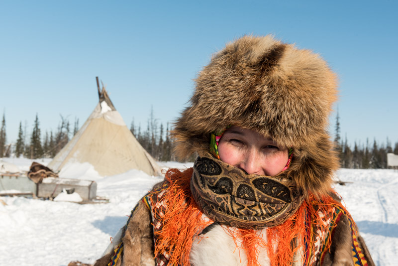
Khanty Woman, near Aksarka, Yamalo-Nenets Autonomous Area, Russia
The Khanty are a Ugrian people indigenous to the northern Ural Region (once known as Yugra) who speak a Ugric language thought to be related to Hungarian. Traditionally living nomadic lives based on reindeer husbandry, fishing, trapping and hunting, the Khanty are one of very few indigenous Siberian tribes to have received their own autonomous okrug (area) during Soviet times. Despite having endured collectivisation, which saw the murder of tribal chiefs and traditional shamans and the abduction of children into state care, many of Russia’s estimated 12,500 Khanty still live traditional lives, though the ever present lure of globalisation, plus incursion of the nearby oil and gas industry threaten this. We are warmly welcomed by the extended family when we arrive in the chum of Tikhon and Anna, whose children and grandchildren are visiting. In the warmth of the chum I meet people with kind, round faces with almond eyes, not dissimilar looking to Tuvans or Mongolians but with paler features and often coloured hair and eyes. With one another they speak Khanty, which sounds nothing like Hungarian to me. We are invited to have tea at a table spread with bread, jam, sweets, frozen fish and reindeer tongue which is very tasty, not unlike well-cooked duck. Soon the children wrap the grandchildren up against the cold in brightly coloured clothes, then leave towards the river. Slava and Yury also wish to return to Salekhard, but very kindly offer to collect me the following day, thus giving me the chance to spend a night sleeping in an authentic Khanty chum.

Khanty Chum Camp, near Aksarka, Yamalo-Nenets Autonomous Area, Russia
Once the sound of Slava’s snowmobile recedes into the distance, I’m struck by the silence and marvellous isolation out in this wilderness a few kilometres south of the Arctic Circle. I have a walk around the surroundings of the camp, then watch life slowly unfolding around the chums; Tikhon chopping wood for the stove and Anna fetching fresh snow to melt into water and feeding the three friendly and very tame reindeer who wander around the camp like pets. There’s a long, red sunset over the Ob with the prospect of a storm coming in from the west most likely precluding any aurora sightings. Inside the warmth of the chum I’m struck by the similarity of the layout with a Mongolian ger; a central stove and a south-facing entrance; a family area to the right as one enters, with guests accommodated on the left and a storage area with utensils and trinkets opposite the entrance. The chum however lacks the ever present musty, milky aroma of a ger and is also slightly less spacious, being built around forty-five thin, straight larch trunks rather than the pre-tensioned and shaped supports of a ger. Anna makes me a den of thick blankets in which to sleep, unrolling a flowery sheet from above to form a privacy curtain. In the absolute silence of the tundra, I drift off into a deep sleep.

Khanty Chum, near Aksarka, Yamalo-Nenets Autonomous Area, Russia
In the morning the weather has indeed closed in and we wait patiently in the chum for a call from Yury. I watch Anna pack away the bedding and make tea, whilst Tikhon sits ruefully at the stove smoking. I sense in them a tremendous sense of patience, perhaps not surprising from a people who watch the seasons pass and must adapt their lives to the conditions around them. Their lives seem startlingly different from my own; restless, ever chasing various ambitions and projects. “We stay here in winter to be close to the forest, for fuel. In summer we move into the open where the insects are not so bad. Right now our reindeer are being herded off to the north. You could go and visit but we don’t have any fuel for the snowmobile.” They also seem to be free from any sort of political or religious prejudice; with the pragmatic life-outlook of nomadic people living in tune with their environment and accepting their place in the world. I wished my Russian were good enough to ask them if they preserve any of the old shamanic rituals or holidays, or if any of their wooden idols have survived attempts at Christianisation and Soviet purges. Given more time I would love to stay longer with these people and witness more of their lives, perhaps trying to learn a little patience from them.

Aurora Borealis, Salekhard, Yamalo-Nenets Autonomous Area, Russia
After lunch, with the conditions outside slowly worsening, Tikhon and Anna pack up some belongings and we drive down to the river on Tikhon’s Soviet-era Buran snowmobile, where we meet Yury. Anna will join us for the drive to Aksarka, where she will visit her family who live in the town, while Tikhon returns stoically alone to the chum. The ice road is about to close as the blizzard worsens, but we make it to Aksarka where we drop off Anna then return to Salekhard. Soon after returning to Slava’s dacha, it’s clear that I have eaten something which my body violently disagrees with, and I spend the next two days lying on the sofa, consuming nothing but boiled water with a little sugar and salt to replace the fluids I lose with each purgatory visit to the lavatory. On the evening of the second day of rest I am feeling back to normal and preparing dinner when I look out of the window and am filled with an uncontainable, child-like excitement at what I see out of the window; a strong, green glow moving gently in the sky; my first real view of the Aurora Borealis.

Aurora Borealis, Salekhard, Yamalo-Nenets Autonomous Area, Russia
After grabbing my camera and tripod and donning my warmest clothes, I rush out into the bracing cold; temperatures have dropped to almost -30º C once again, leaving a crystal-clear sky. A steady green band of aurora is streaming in the sky above; charged particles from the Sun’s solar wind meeting the Earth’s magnetic field and being deflected into the upper atmosphere, exciting sparse atoms, with atomic oxygen giving the common emerald-green colour. As I stand watching, mesmerised, the intensity of the stream of energy approaching me from the north-west increases, with the band bifurcating into two separate streams, folding in on themselves to form more chaotic, whirlpool-like formations and vertical rays which shimmer in red and yellow, shooting across the sky with surprising speed to form a shimmering curtain of aurora; one of the most breathtakingly beautiful things I have ever seen, all taking place perhaps one hundred kilometres above my head. After reaching this crescendo, the aurora diminishes, and I take refuge in the warmth indoors. At around 02:00, as I’m about to sleep, I see another band of light in the sky; this time coming from the north and bending round to the east. Heading out once more I watch the sky again as the band passes directly overhead and abruptly folds in on itself so that I am looking directly up a vertical arc to witness a staggering auroral corona, with lines taking the eye to a convergence point far overhead, giving the impression of peering out into space; something I will never forget. I count my food-poisoning as a blessing; had it not happened I would be far to the south by now and would have certainly missed this natural wonder.

Ob River Ice Road, near Labytnangi, Yamalo-Nenets Autonomous Area, Russia
I leave Salekhard the morning after my aurora experience wondering how I could ever repay Slava and Yury for their efforts and kind hospitality, facilitating something of a climax to my winter trip. It’s another beautifully clear Arctic day with bright sunshine and an invigorating air temperature of -29º C, though a brisk wind makes outdoor conditions bitterly cold. Crossing the Ob, I reach the left-bank town of Labytnangi and, after registering at a checkpoint, begin my final ice road; a long one which will take me up the Ob to the roadhead in Priobye, around five hundred kilometres to the south. From the sunny warmth of the car, it’s a pleasure to drive the ice road and I’m filled with a great sense of satisfaction and accomplishment at the experiences of the last few days. Soon Salekhard feels far behind me as I re-enter the Siberian wilderness; here a huge, frozen wetland formed by the many branches of the anastomosing Ob. The ice road hugs the left-most bank of this channel system, alternating between the river, small side-channels and fluvial islands, passing small towns and tiny villages with Ugric sounding names such as Shuryshkary, Unselgort and Vorzemgort. As the day wears on, cirrus clouds appear, signalling an incoming weather front which by sunset brings an overcast sky. After stopping for fuel in the town of Muzhi, I continue on into the night, eventually stopping at a road-side clearing to sleep, exactly on the border between the Yamalo-Nenets and Khanty-Mansi Autonomous Areas.

Nativity Church, Beryozovo, Khanty-Mansi Autonomous Area, Russia
I awake to snowy conditions, with the overcast skies making the ice road far less enjoyable to drive, though the weather eases by mid-morning as I reach the small town of Beryozovo. Built on three hills at the riverside, Beryozovo is one of the region’s oldest settlements and has long been a place of exile. It was here that Trotsky escaped en-route to exile in Obdorsk in 1905, but the town’s most famous resident was Prince Alexander Danilovich Menshikov. Born a commoner, Menshikov became a favourite of Peter the Great, leading to tremendous wealth and power. Despite being repeatedly found guilty of corruption and fraud, Menshikov retained his position and at the time of Peter’s death was influential in bringing Peter’s second wife, Catherine I, to the Russian throne. During Catherine’s reign, Menshikov was the de facto ruler of Russia, promoting himself to the rank of Generalissimo. His downfall finally came upon her death when, attempting to marry his daughter into the royal line, he was overthrown by old nobility and exiled to Beryozovo in 1728, where he would die two years later. I find the tall, gilded spires of Beryozovo’s Nativity Church at a beautiful riverside setting next to a small park of old-growth pines surrounding Menshikov’s lonely grave. Here suddenly I have an odd feeling of translocation; I could be in a European Russian estate, perhaps somewhere in the countryside around Moscow. The knowledge that I am thousands of kilometres away, even today beyond the reach of any highway or railway, merely emphasises how absolute exile must have been here in the eighteenth century.
Beyond Beryozovo the ice road continues, reaching the town of Igrim and, after a short stretch of asphalt returning to the frozen swamps of the Ob. I manage to pick up a phone signal here and am able to track my progress on a satellite map; below the frozen white expanse across which I am driving lie myriad streams, swamps, ponds and oxbow lakes, all unseen from the ice road. After an unpleasantly corrugated final section in the gathering dusk, I reach a ramp where the ice road ends on the edge of the town of Priobye. This is the end of the final ice road, and in many ways the end of the winter journey. From here on, I have no option but to drive on the highway to journey’s end in Moscow.

North Urals, near Severouralsk, Sverdlovsk Region, Russia
After an overnight stop in the town of Nyagan, I set off on a dull morning for the long drive to Moscow. The temperature has risen to -3º C meaning the winter snow is starting to sweat and melt; the road is a mess of slippery brown slush, filled with typically impatient Russian drivers as it plunges straight through the endless taiga. It’s as if I have awoken from a nice dream; all the magic of the frozen, open north has vanished to be replaced with dirt and blandness. I spend four days driving back to Moscow; firstly down through the North Urals, crossing on the same highway Maciej and I had taken last August, then across the backwaters of European Russia; Kirov, Kostroma and Ivanovo Regions which are filled with broken roads, dying villages and stagnant small logging towns. On the morning of the fourth day I cross the Volga north of Kineshma, making my way to the capital on muddy backroads through the Golden Ring region. As I approach Moscow on a quiet road through the forests to the east of the capital, the temperature creeps above freezing for the first time on the trip and, driving with the windows open I am suddenly aware of the smell of the dripping pine forest, one thing I now realise I have missed during the deep Siberian winter. I brave the afternoon traffic of the MKAD, the Moscow orbital, and reach the apartment of my friend Katya by mid afternoon: journey’s end, 13,875 kilometres since leaving Magadan forty-nine days ago. Katya has just moved in to her newly-built apartment and thus I find myself shopping with her in Ikea for tableware shortly after; a more unlikely ending to a winter expedition I cannot imagine.
Despite ending in the overcast sprawl of Moscow, I am thrilled to have completed the winter journey, a dream-like journey through the vivid imagery of my own imagination; through what seems to be almost a parallel world of stunning landscapes and harsh conditions far removed from mundanity; a real adventure involving ever-present risk and uncertainty, rewarded by sights few others have seen, far removed from the tawdriness of modern-day mass tourism. With no major delays due to weather, and none due to problems with the impeccable Hilux Surf, I have two weeks of redundancy which I had built into the schedule to now enjoy, and so I plan to take a long way back to Western Europe together with Katya.
Stage 44 – Russia: The Siberian Winter [2/3]

With the deep cold of the Kolyma Highway and the remoteness of the Lena River Ice Road behind me, I felt I had completed what were likely to be the toughest and most dangerous parts of my winter journey. Buoyed by the success of driving as far up the Lena as possible and with no hint of any issue with the Hilux Surf, I was confident of making the next section of the journey. This would take me onto the Tas-Yuryakh to Verkhnemarkovo zimnik (seasonal winter road), then across the ice of Lake Baikal, onto the regular road network to the city of Tomsk, and on to the end of the road on the Ob River. However, I still had to find a way through a private road to reach the zimnik and had no idea of the ice conditions or feasibility of driving on Lake Baikal. Once again, I was heading out into the unknown.

Lena River Dock, Vitim, Sakha Republic, Russia
On the morning of the 13th February 2018 I wish Lyuba and Gleb, my hosts in Peleduy, farewell, thanking them for their warm hospitality in this friendly town in the heart of the Siberian wilderness, and drive to the neighbouring town of Vitim to fill up with fuel. Vitim is as far up the Lena River as one may travel by road from Yakutsk; from here it will be around eight hundred kilometres through the vast taiga of eastern Siberia before I reconnect with the river near the city of Ust-Kut. I pass the dormant, ice-bound river docks on my way out of town, then a large blue highway sign with the memorable information ‘Moscow 5796 km’; by far the largest distance I have ever seen recorded on a such a sign. Beyond the turn for Peleduy I am on a private road owned by Surgutneftegaz, a Russian oil company which operates the nearby Talakan Fields, to which the road leads. I am using the road in some trepidation as I should have secured a permit, though on the advice of Lyuba I am trying my luck without one. To be sent back to Peleduy to apply for a permit would be a minor inconvenience. To be refused outright and have to return to the highway in Lensk, via the most brutal section of the Lena River Ice Road, would be deeply frustrating and disappointing.

Lower Tunguska River, Nepa, Irkutsk Region, Russia
It’s almost seventy kilometres before I reach the first checkpoint on the road where I stop and hope not to have to backtrack at all. I am asked for a permit by a guard, but on inquiring how I should obtain one, am told to wait while he takes my passport and summons his boss. After an hour or so I fill in some brief paperwork, then am told to follow two gentlemen in a company pick-up truck, who escort me through the huge Talakan Oil Base, effectively a private town complete with airport, surrounded by dozens of well pads and oil-extraction infrastructure. We pass a second checkpoint, then stop at a third where my documents are checked, my escort bids me farewell and I pass through a barrier at which a long queue of lorries waits, with a sense of huge relief. This marks the end of all the uncertainty along the Lena River; from here I am certain that it is possible to reach Ust-Kut and the formal Russian road network. This last section of the private road runs northwards to the Verkhnechonsk Oil Field and soon after leaving the third checkpoint a sign announces the border between the Sakha Republic and Irkutsk Region. It has taken me two weeks to cross the republic, which is not only the largest in Russia but the world’s largest sub-national territorial entity. My mind boggles at the vast northern reaches of the republic which stretch well above the Arctic Circle. About an hour after passing the border sign, I encounter a crossroads in the utter middle of nowhere and turn left onto the infamous Tas-Yuryakh to Verkhnemarkovo Zimnik.
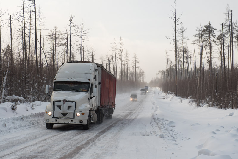
Tas-Yuryakh to Verkhnemarkovo Winter Road, Irkutsk Region, Russia
The zimnik is winter-only road consisting of solid-frozen swamp which runs for 850 kilometres through the thick taiga of eastern Siberia, passing only one village and no fuel stations on its route to the roadhead at Verkhnemarkovo. I join the zimnik 470 kilometres out from Verkhnemarkovo and see immediately that it is a very different proposition from the Lena River Ice Road. I am surprised by just how much traffic there is, much of it large, articulated lorries carrying supplies up to the oil fields and mines of the Siberian north, servicing the industries which fuel the Russian economy. With the traffic comes a reassurance that this seasonal road is in passable condition and that I will not get stranded for days on a lonely frozen river. But the heavy lorries compress deep ruts into the frozen swamp with a wheel-track far wider than mine, causing the car to tram-line dangerously and sometimes spin. Extreme caution is required when passing oncoming lorries, who take the best line and may pass me on the right rather than left according to conditions. Especially dangerous is overtaking, as any spin would most likely cause a collision. I see several accidents along the route, though the low speeds mean that none look particularly serious. It is nevertheless a good feeling to be on this busy winter road, despite it being a far from relaxing drive. As the day wears on, the sunshine smooths the very top of the road surface of compacted snow, making it extremely slippery with my stud-less winter tyres. I spin frequently and so keep my speed very low, eventually finding an area to pull in for the night overlooking the Lower Tunguska River with the village of Nepa, the only permanent settlement on the zimnik, on the far bank. I heat up more Russian Army rations on my butane stove then settle down for a night with the heater running and engine off.
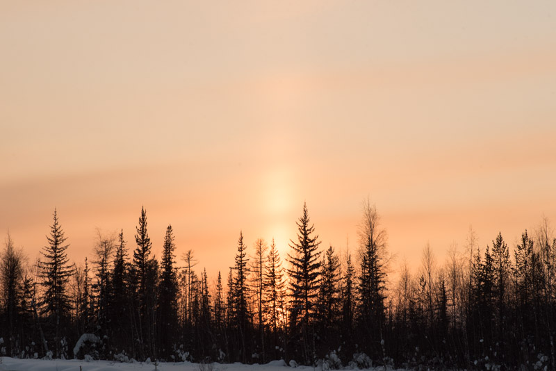
Sunset, near Verkhnemarkovo, Irkutsk Region, Russia
In the morning the temperature has dropped to -29º C from last night’s -18º C but the car’s engine fires to life from dead cold immediately and with no alarming noises, further boosting my confidence in the Hilux Surf as a remarkably dependable vehicle. I drive for the entire day on the zimnik, mostly passing through dense taiga but sometimes patches of frozen, leafless birch forest whose trees lean over into the cleared roadway. In other places the forest is bare and open, a victim of summer wild-fires in recent years, or marked by grids of narrow, cleared corridors for past geophysical surveys. As I progress further southwards, the road occasionally twists and turns for reasons which aren’t obvious to me on the ground and there are temporary wooden shacks serving food to passing lorry drivers. In a cleared area adjoining one such establishment I stop to pour forty litres of petrol into the car and get chatting to one lorry driver, who tells me I am the first tourist he has ever seen on the zimnik. I ask him how long the road is open, out of curiosity. “Only in the winter. If you bring your truck up here in March, or early April when things start to melt, you can get stuck. Then you can forget about your truck”. As the day wears on the road gradually improves and passes the flare stacks of the Yaraktinskoye Oil Field. I take in a spectacular, slow sunset which seems to be amplified by a lensing effect of winter ice clouds, pass the turning to Verkhnemarkovo and for the first time since Ulakhan-An, near Yakutsk, join the Russian public road network.

Baikal-Amur Mainline Monument, near Kunerma, Irkutsk Region, Russia
It’s -30º C the next morning and after another effortless cold-start I soon meet the Lena River which here is merely an average-looking river rather than the vast waterway I had earlier encountered. Ust-Kut is busy with morning traffic and feels very ordinary after all the wilderness I have been driving through since Yakutsk, but here I find a bridge across the Lena; the furthest downstream on the river, despite being around 3500 kilometres from its mouth on the Laptev Sea. On the far side of the bridge, I catch my last glimpse of the river; this mighty Siberian giant along which Russian explorers and traders conquered the easternmost reaches of the country, and along which unfolded a personally unforgettable road journey. A junction takes me onto the ‘Avto BAM‘, an access road for the purpose-built settlements of the BAM, or Baikal-Amur Mainline, a communist white elephant project which runs all the way to the Pacific Ocean and which has never quite sparked the local development which was originally intended as its purpose.

Ice Fisherman, Severobaikalsk, Buryatia Republic, Russia
The road winds through a series of hills and valleys, a nice change from the dense taiga, and is well graded and cleared. Traffic is light and the weather crisp and clear, making it a pleasure to drive. The BAM passes through a number of settlements built in the 1970s and 80s though today they are clearly smaller than intended, sometimes heavily depopulated. Many of the buildings are however smart, distinctive and well constructed with touches of the national designs of the BAM construction teams from different parts of the Soviet Union who built them; Zvezdny has a striking station building finished in the pink tuff characteristic of Armenia, and nearby Nebel has pastel-coloured clapboard building which look to be Baltic in style. The overall impression however is of a number of ill-conceived settlements where few people find a reason to remain. Beyond Kunerma the road narrows and dramatic, steep peaks of the Baikal Range rear up, the first real mountains I have seen since leaving the Verkhoyansk Range on the Kolyma Highway. I cross the Davan Pass surrounded by snow-covered peaks and descend on a jarringly rough road, stopping at a lookout point above the city of Severobaikalsk. Out beyond the rooftops is the huge, white expanse of Lake Baikal, frozen solid and tinted soft pink in the evening light, which also picks out the gorgeous contours of the mountains on the lake’s eastern shore.
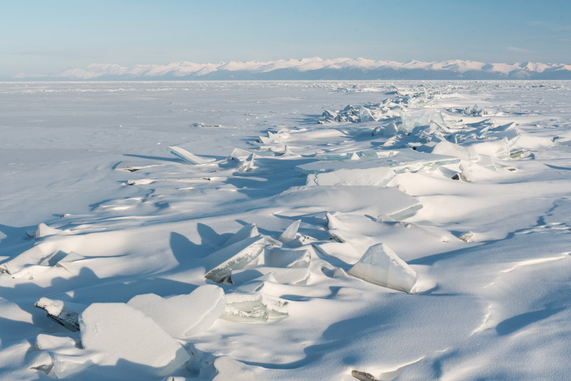
Lake Baikal, Severobaikalsk, Buryatia Republic, Russia
Lake Baikal is a magnificent sight, and I walk out onto it the next day, thrilled by the blinding white expanse of ice on which locals walk, cross-country ski and fish through small holes. My intention is to drive across the ice to the town of Ust-Barguzin on the lake’s eastern shore, and possibly on to Olkhon Island from there. Once again, the feasibility of this plan is uncertain; my host Aleksey thinks it’s still a little early in the season, with the ice optimally thick and static in mid-March, still a few weeks off. The ice fishermen I speak to, many of whom have cars parked out on the ice, tell me it is technically possible, however none of them have done it this year. The only marked track on the ice runs directly across the lake to the Khakusy Hot Springs on the eastern shore. I begin to worry that my ambitious plans may be unrealistic. Aside from this, it is also technically illegal to drive on the ice, though like the local fishermen, I intend to ignore this inconvenient regulation.
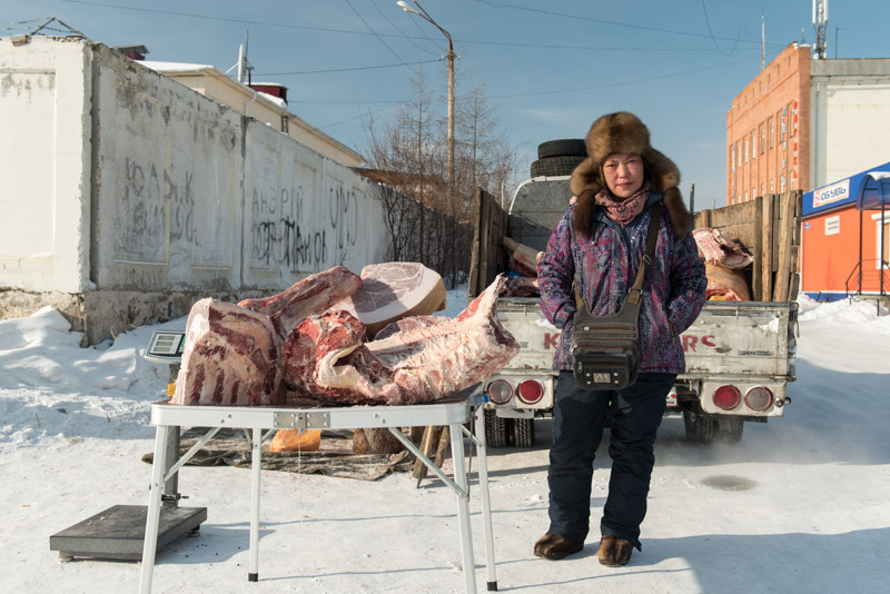
Buryat Meat Seller, Severobaikalsk, Buryatia Republic, Russia
Away from the beauty of the lake and its jagged mountainous backdrop, Severobaikalsk is a very pleasant town; much of it pre-fabricated 1980s concrete of little aesthetic appeal, but it is neither overcrowded nor underpopulated, and very friendly. All the time however, I feel myself being drawn back across the footbridge of the busy BAM station to the embankment of the lake, from where the views are stirringly invigorating. On my second morning in Severobaikalsk, I take another walk around town wondering if I should risk venturing out onto this ice alone, if necessary following a bearing on my GPS receiver, though I have no local knowledge of where the ice is likely to be drivable. I meet a Buryat lady selling large chunks of meat on a table in the open air, the Siberian winter providing a natural deep-freeze better than that in any supermarket. Customers order by weight and the meat is carved with a chainsaw. I happen to mention my plans to her and am very excited to hear that she and her husband, who is keeping warm in the cab of their pickup truck, drove up from Ust-Barguzin yesterday on tracks across the lake. They tell me that there is snow on the ice, but not too much to drive through. Relieved to hear this, I conclude my time in Severobaikalsk with a visit to the BAM Museum and lunch in a typically Soviet stolovaya (canteen). Later in the afternoon I say goodbye to Aleksey and drive in the dark down to the village of Baikalskoye, around forty kilometres to the south, where the road ends and the tracks should set off across the lake.

Baikalskoye, Buryatia Republic, Russia
I awake to a cold morning of thin cloud and a beautiful view of the snow-dusted wooden houses of the village, each streaming a small plume of smoke which sits in the heavy, still air. I drive down to a beach with a small jetty where a number of boats have been scuppered for the winter. Beyond, a huge, barren expanse of ice extends to the southern horizon. After making use of a latrine with one of the finest views I can remember, I drive out onto the ice. I’ve seen two other cars drive out onto the ice this morning but was not in a position to stop the drivers to ask directions. There are numerous vehicle tracks on the ice, but I suspect the great majority have been made by local fisherman or hunters driving to their favourite nearby spots. One track heads arrow-straight out onto the lake, so I chose this track. I once again have the slightly nervous feeling of heading into the unknown. This is an illegal, unofficial track. If something happens out on the lake, I will most likely be totally alone.

Tracks Across Lake Baikal, Buryatia Republic, Russia
Driving is initially excellent as I get used to being on the surface of a huge, deep lake, getting increasingly far from land. Several vehicles have recently used these tracks and whilst the snow is thick enough to obscure the ice at all times, it is currently thin enough not to worry about getting stuck. The ice surface feels smooth in places, though it is clear that the ice is not static, forming pressure ridges and occasional cracks a few centimetres wide, though the open water rapidly re-freezes. I am initially only concerned that the track appears to be heading towards the lake’s eastern shore, though after around thirty kilometres it turns southwards towards Ust-Barguzin. I suppose it’s human nature that the individuals who first made these tracks wished to be reasonably close to the reassuring mountains which rise up straight from the shoreline. A little further along, I start to worry when I notice the tracks diverging and thinning, and the snow getting thicker. Mounds and ridges of broken ice dot the surface causing the tracks to twist chaotically around these obstacles and I eventually find myself following a single set of tracks through increasingly deep snow. I recall travelling in remote parts of Mongolia, following little-used tracks which would suddenly thin out, usually signalling an obstacle or bad patch of road lay ahead. Sure enough, I come across a large crack perhaps sixty centimetres wide. Brashly, I drive across the re-frozen water and make it to the far side without a problem. I then make a very foolish decision to reverse back over it, in order to take a photograph of the car crossing the crack. Reversing more slowly across, I feel the wheels punch through the ice, but clamber out to the far side. I am then left in the alarming situation of having the car straddling the crack which is now partially open, with nothing but eight hundred metres of cold water below me as I open my door and look down in anguish. I consider my options, then brashly gun the accelerator with the transfer box in low-range to maximise the torque to the wheels. I make it across without an issue but am left rather shaken; along with my crash into a snow-bank on the first day out of Magadan, this is my closest brush with disaster. The crack is far too narrow to swallow the car, but an axle stuck in the crack and resting on the chassis would make for a very difficult recovery.
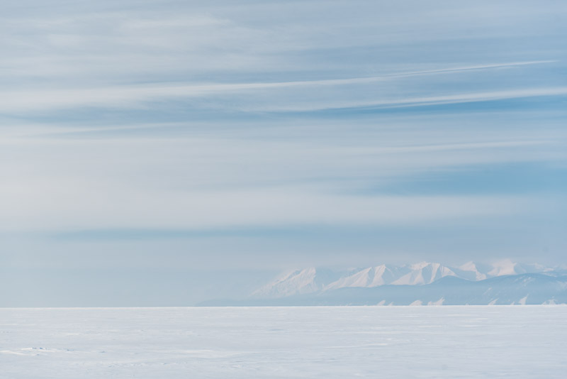
Baikal Mountains, Buryatia Republic, Russia
Amazingly, just as I am preparing to leave, a local car approaches; an overloaded Toyota Corolla estate car with the panels of a garden shed stacked on its roof. I stop the driver to warn him of the wide crack. In typical Russian style he picks a spot where the crack is somewhat narrower and nonchalantly guns the low-slung car across. Now on the far side of the crack, I am doubly relieved to see that the track is again more heavily used, and continue calmly southwards. I start to spot people with cars closer to the shore, fishing from small wooden sheds. It’s still more than one hundred kilometres to Ust-Barguzin, so I imagine that the fishing is particularly good – or illegal – here. As the day wears on, the weather worsens and visibility becomes poor, at times a white-out when I am simply driving into a white void, with lake and sky merging into one white mass. Thankfully, there are occasional markers stuck in the ice, delineating the boundary of a nature reserve into which entry is strictly forbidden. Early in the afternoon I reach the entrance to Chivyrkuysky Bay and although an ice road of sorts has been cleared recently, the ice has a nasty, wet sheen to it, and I feel more drag from the wheels, as if the ice were becoming slushy. I decide to put my foot down rather like gunning a tender against the tide into a difficult landing. Eventually, 223 kilometres after leaving Baikalskoye, I make landfall as I drive onto the ice-covered beach in the tiny village of Kurbulik, with a sense of achievement and relief, having completed another uncertain and potentially dangerous section of the trip.

Lake Baikal, Slyudyanka, Irkutsk Region, Russia
I’ve actually landed on the Svyaty Nos Peninsula and it’s a bumpy fifty kilometre drive on a washboard track – something I have come to expect in Buryatia – to the town of Ust-Barguzin, a place I have very fond memories of as it was here that I met Finns Toni and Marjo back in 2010, the start of six weeks of travelling together through stunning autumnal landscapes of Siberia and Mongolia. Afternoon clouds now hide the gorgeous scenery, but this does little to dampen my spirits after successfully crossing the lake. A bridge now spans the Barguzin River, replacing the old ferry service which I used on my previous visit, and once in town I make my way to the lake shore where we camped for one glorious, warm autumn evening, this time to see if there are any tracks heading across the ice towards Olkhon Island. On reaching the lake shore I see nothing, and a local fisherwoman shrugs her shoulders when I inquire about a track across to Olkhon. The ice looks sweaty and unsound to me so I decide to abandon the idea, having already pushed my luck enough. It’s a joy to drive into the darkness on the newly paved road to the junction town of Irkilik where I spend the night, pushing on in the morning. I decide to avoid a long highway detour through the regional capital Ulan Ude and instead drive on a small road on the right bank of the Selenga River where I soon find an ice road across the river. On the river’s left bank I reach the small town of Tataurovo and join the Trans-Siberian Highway for the first time on this trip. Here I’m suddenly reacquainted with poor driving and dirty brown road slush; two things I have not missed while driving on the icy tracks of the north. In the industrial lakeside city of Slyudyanka I climb into the very eastern edges of the Sayan Mountains, catch my last glimpse of this beautiful lake and by mid-afternoon reach my next stop; the city of Irkutsk.

Lenin Street, Irkutsk, Irkutsk Region, Russia
Irkutsk lies astride the Angara River just downstream of where it emerges from Lake Baikal. Like many Siberian cities, its origin lies in a fortress from which early Russian pioneers extracted yasak (tribute) from indigenous Siberian tribes and began to exploit local gold deposits. When the popular Decembrist Revolt against Tsar Nicholas I took place in Saint Petersburg in 1825, Irkutsk soon received a number of Decembrists; nobles and officers, often accompanied voluntarily by their wives, whom the Tsar banished to distant Siberian outposts. With the influx of such exiles, Irkutsk saw a great intellectual, educational and cultural flourishing which later with the advent of the Trans-Siberian Railway in the last years of the nineteenth century, saw the city gain an epithet as the ‘Paris of Siberia’. My pretty Buryat host Julia takes me out in Irkutsk to see a number of surviving wooden buildings from this era, often beautifully adorned with nalichniki (decorative window frames). These buildings are either run-down tenements or meticulously preserved museums, in both cases sticking out rather incongruously from the city’s often haphazard streets of Soviet concrete and modern blandness.

Angara River, Irkutsk, Irkutsk Region, Russia
The twentieth century favoured Irkutsk rather less; brutal fighting during the Russian Civil War was followed by heavy industrialisation in Soviet times, though the city has remained a centre for education with Irkutsk State University an integral part of the city’s elegant Stalinist centre. Striking out on my own for a full day’s exploration, I see a variety of sides of the city; the colourful Baroque of the Epiphany Cathedral above the steaming water of the Angara; the slightly gritty embankment where men fish from desolate banks; the wooden houses slowly being edged out by ugly, modern construction and the grimly industrial suburbs around the large dam and hydro-electric power station which I walk across in the waning afternoon light, looking across the frozen Angara Reservoir feeling a little uneasy at how close this industrial squalor is to Baikal’s drinkably pure water. Though not what I would term a beautiful city, I like Irkutsk’s raffishness and am glad to spend a couple of days here after rushing through last summer. But with the temperature a mere -12º C and the roads filthy with slush, I yearn to return to the clean, cold wilderness to the north.
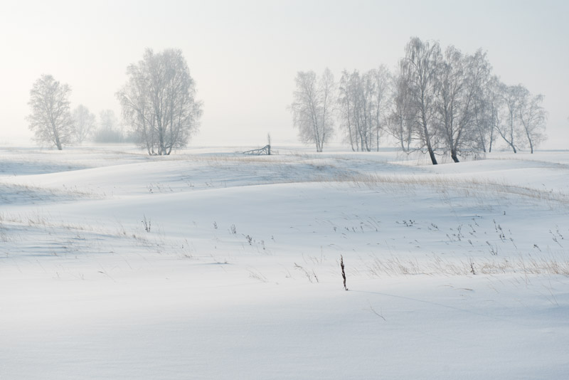
Birch Trees, near Kansk, Krasnoyarsk Territory, Russia
In order to return to the invigorating north, I judge it necessary to move west now for around seventeen hundred kilometres on a route using conventional roads, much of it on the Trans-Siberian Highway, back-tracking my outward journey last year. My route so far has generally followed major rivers, the reverse of the old pioneer trail into Siberia. Ideally, I would now follow the Angara to the Yenisei and make a portage of sorts by zimnik to the Ob, but to my knowledge there is no such road of any sort. Therefore, after leaving Irkutsk I make a solid two-day drive on the modern road, sleeping for the first night among parked lorries in a road-side village, then pushing on, crossing the steaming, strangely ice-free Yenisei on a bypass road north of Krasnoyarsk. From here I am retracing a route I last drove in 2007, on my first visit to Russia and Siberia which made such a deep and lasting impression upon me. Reaching the city of Marinsk as darkness falls, I turn off the Trans-Siberian Highway and join a rather rough road as the weather deteriorates, with heavy snowfall making the last section of the journey to Tomsk rather arduous.

Wooden Houses, Tomsk, Tomsk Region, Russia
Tomsk is one of Siberia’s oldest cities and until the nineteenth century was one of its most important. Two key points in the city’s history have however made it quite distinctive; the decision of its administration to make it a centre of education (many Russian expatriates whom I work with in Europe have studied here), and the fact that the city was bypassed by the Trans-Siberian Railway. This is my first visit to Tomsk and as I start to explore the city I notice that these two factors play off against each other nicely; its (albeit fairly minor) dislocation from the region’s main transport conduit means that modernisation has been rather less brash than in, for example, Irkutsk, yet the city’s youthful, intellectual population means the city feels modern and progressive rather than a somnolent backwater. Tomsk is built along the right bank of the Tom River, a major tributary of the Ob, and sits on the edge of the vast lowland of West Siberia which stretches up to the Urals and the Arctic Ocean. It’s a cold, clear day and the view across the snow-covered Tom towards to a ruler-flat landscape of marshes and patchy birch forest give the city a slight edge-of-the-world feel. In contrast to the riverbank views, the main Lenin Avenue, though not devoid of Soviet concrete, is still a modestly proportioned thoroughfare, much of which is lined by quaint, two-storey, pastel-coloured Tsarist-era buildings and even the occasional wooden structure. I visit the Regional Museum and then cross the road to a former police jail, which is now the Memorial Museum of the History of Political Repression, though the real highlight is simply to walk along a major thoroughfare in a Russian city which has ridden the wild transition to a market economy so beautifully unscathed.

Tatar Sloboda, Tomsk, Tomsk Region, Russia
On my second full day in the city, I start by walking through quieter streets a little east of the centre and find many beautiful wooden houses which, whilst often rather shabby or hemmed-in by modern, red-brick mansions and apartments, are still present in sufficient numbers to constitute perhaps Russia’s best-preserved, living urban landscape of wooden architecture. Some wooden structures are lavishly built with ornate turrets and spires, having once belonged to wealthy merchant families. I however find my highlight of the city close to the riverbank, behind Lenin Avenue in the slightly down-at-heel Tatar Sloboda, an ancient settlement said to date from the seventeenth century, having been founded by ‘Tatar’ traders from Kazan, Tobolsk and Central Asia. Here I stroll along the aptly the named Tatar Street where an almost unbroken line of lived-in wooden houses is overlooked by the tall, green-tipped spire of the early twentieth century Red Mosque; a particularly fine view. In the afternoon my rather excitable host Natasha, a photographer, persuades me to engage in – of all unlikely things one might do during a winter expedition – a spot of menswear modelling for her friend (also Natasha). Resuming my wandering of Tomsk’s backstreets, I amble up Oktyabrsky Vzvoz (ascent) and as the sun lowers behind yet more period architecture and watch locals skating on a large pond in a scene which could be a classical Russian painting.
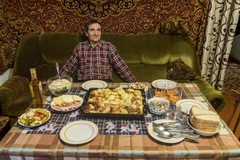
Siberian Home, Prokop, Tomsk Region, Russia
I leave Tomsk on a bright, cold morning feeling I have found Siberia’s most attractive city and one of the nicest in Russia. I cross the Tom which I last crossed with Maciej on a pontoon bridge far upstream in the foothills of the Abakan Range, then shortly after meet the Ob River for the first time on this trip; the westernmost of the three great Siberian rivers. I spend the day driving roughly along the Ob on an excellent asphalt road into what feels like an ever-widening landscape, to the tiny Siberian village of Prokop. Here I have arranged to stay with Slava, who lives with his family in a traditional Russian village house with a kitchen garden, banya and outhouse. I am the first foreigner that the family has hosted and am treated to famously generous Siberian hospitality; a table is soon laid with baked meat and potatoes, sausage, potato salad, pickled wild mushrooms, pickled vegetables, fresh bread and a bottle of rather fierce peppered vodka. The family have also invited a former neighbour, Alex, a Volga German and English teacher from the small nearby town of Parabel to relieve us from having to rely for communication on my Tarzan-Russian. What unfolds is a really lovely evening; the type of inter-cultural communication which makes travel so enjoyable. I go to bed in a warm Siberian home a full stomach and in high spirits, though with the clear, star-filled sky keeping the temperature at a brisk -25º C, the inevitable nocturnal trip through the garden to the outhouse is more than a little bracing.
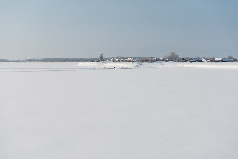
Ob River, Shpalozavod, Tomsk Region, Russia
Though the heart-warming kindness of Slava’s family and experience of Siberian village life would be reasons enough to come out to this distant village, it is the nearby village of Narym which has brought me here. Slava and I drive out on a sunny morning, passing Parabel and joining a winter road which leads for thirty kilometres across lumpy, frozen swamp to the Ob, which we cross on an ice road to reach the isolated village. Narym is the oldest settlement in Tomsk Region, having been founded in 1596 to extract yasak from the indigenous Selkup by pioneers coming several hundred kilometres down the Ob from Surgut. Once a prosperous, if tiny, trade outpost, Narym’s position on a riverbank surrounded by nothing but swamps and vulnerable to flooding meant it never really grew, and was soon permanently eclipsed by Tomsk. Perhaps unsurprisingly it became a lasting destination for exile, first in Tsarist times, when the relocated included Decembrists and Bolsheviks such as Kuybyshev, Sverdlov and most famously, Stalin. In Soviet times, under Stalin himself, thousands were sent here and either summarily executed (gruesome images in one of Tomsk’s museums show the result of the Ob eroding into a bank filled with the bones of an NKVD mass grave) or sent to labour camps. Locals say that “God created Crimea; the Devil, Narym”.

Stalin Bust, Museum of Political Exile, Narym, Tomsk Region, Russia
Driving through the empty streets of the village, the size and quality of the wooden houses suggests early exiles lived in reasonably comfortable conditions, though many of the structures are slowly disappearing into the swamp. Slava and I stop at the bright yellow Museum of Political Exile which is thankfully open and are taken around the museum by one of the lady curators. The museum was once a shrine to Stalin and there is still a plaster bust of the tyrant, fine oil paintings of a young Joseph and old photos of the huge Stalin statue which used to stand in the village. Following his denunciation, the museum was de-Stalinised into a museum of exiled Bolsheviks (ignoring the irony that the Soviet regime continued to exile dissidents here) which later became the current incarnation of the museum. Out in the museum’s grounds is Stalin’s old lair; a very comfortable cottage more holiday-home than prison, from which he chose to escape after just two months of internment. Though lovingly maintained, the place inspires a sense of increased loathing for the man, in view of the truly horrific conditions to which he deported and condemned many millions of Soviet citizens.
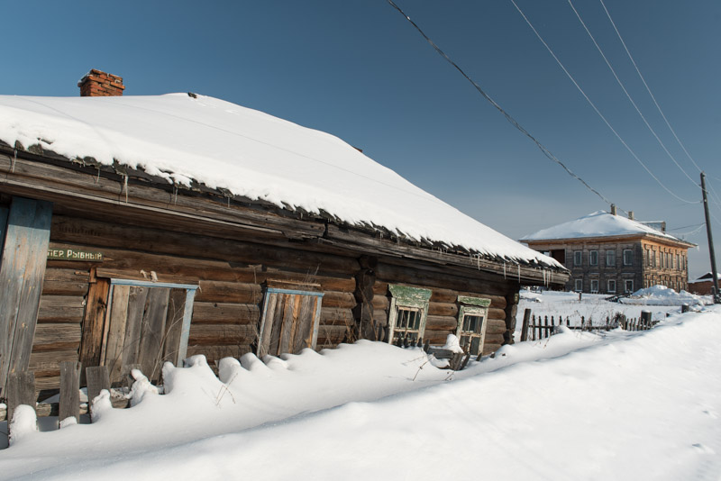
Abandoned Houses, Narym, Tomsk Region, Russia
Nonetheless, I can’t help but like Narym, which is looking its best on a crisp, sunny winter morning, though I can only imagine the hordes of pestilent summer mosquitoes rising from the endless swamps all around. I make a stupid decision to ignore a no-entry sign onto what looks to be a short ice road across a channel to the village of Shpalozavod, which turns out to be deep, soft snow in which I bog the car. Slava borrows a shovel from a local home and a passing local, drunk and driving an old snowmobile with one of its tracks missing, directs us on how to rock and power the car out, turning a worrying stranding into a bit of light-hearted fun. We stop on the way back at Chisty Yar, a natural sulphurous hot-spring where we sit in steaming hot water overlooking the deep-frozen swamps along the Ob, then drive into Parabel where we meet Alex at the local school. Here I sit as a very unusual Anglophone visitor, quizzed by the town’s pupils, many of whom have never before met a foreigner. We finish the evening in Alex’s apartment with his wife and friends who ply me with food and drink, rounding off a truly enjoyable day.
Returning with Slava to his home in Prokop, I can’t help but see the irony that in this remote and maligned swamp, I have one of the nicest experiences of the entire trip. It is with very fond memories of Tomsk Region then that I look to the next, and final stage of my journey through the Siberian Winter; back onto winter roads up along the Ob and on to the Arctic.
