
Stage 20 – Russia & South Ossetia: The North Caucasus [1/2]

Russia. My first visit to the world’s largest country, on the outward leg of this journey had been a brief encounter, but one that had sparked a latent interest in this vast and enigmatic country. Neither Europe nor Asia, Russia perhaps best defines the term ‘Eurasian’ with its diversity of people and endless, glorious landscapes. Crossing into Russia from the breakaway Republic of Abkhazia marked the beginning of a year spent in-and-out of the country in an attempt to see a meaningful proportion of its regions. This particular stage of the journey would take me through the jigsaw of ethnic republics of the North Caucasus, no less troubled, factional and feuding than their independent counterparts in the South Caucasus, and no less scenically spectacular. The highlight however would be the people; from the Russians on the western coastline, to the myriad nations in the isolated mountain valleys of Dagestan, whose outright warmth and kindness defy the often bloody and tragic history of the Caucasus.
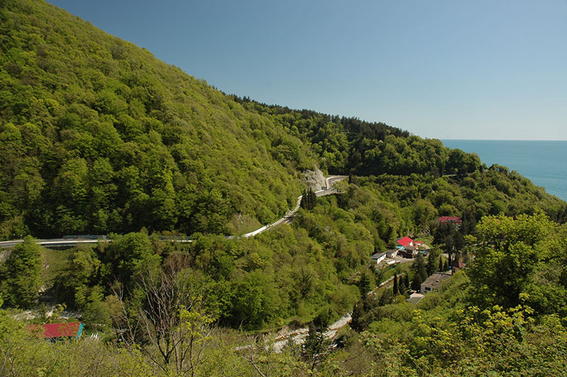
Black Sea Coast, Krasnodar Territory, Russia
It’s the 28th April 2010, and I cross the bridge over the Psou River, crossing the notional Asia – Europe border, and entering Russia for the second time. It’s a refreshingly straightforward border crossing, though due to it being technically illegal, my passport is not stamped. I drive into the small coastal town of Adler, which seems years ahead of somnolent Abkhazia just down the road, and is not nearly as attractive. After staying one night I head north-west up the coastal highway, bypassing the city of Sochi where there are signs of massive building development, with huge tailbacks caused by the upgrading of this single traffic artery linking Russia’s premier coastal resorts with the rest of the country. Beyond Sochi the road becomes highly scenic, with hairpins and steep turns winding up and down over the forested coastal hills and across rivers emerging from them, with occasional glimpses out across the glittering Black Sea.
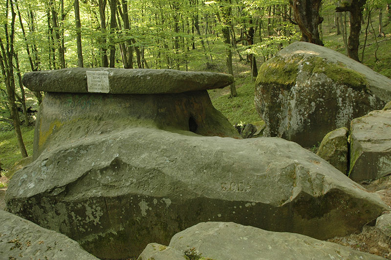
Dolmen, Tuapse, Krasnodar Territory, Russia
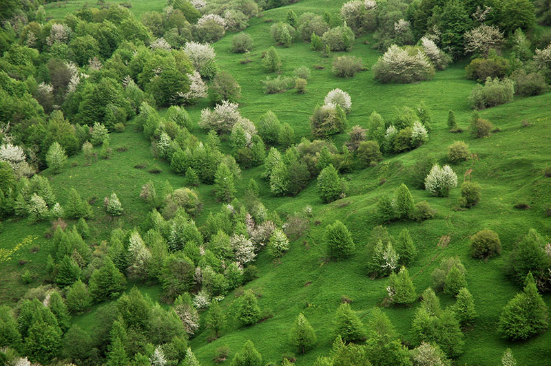
I reach the coastal town of Tuapse in the afternoon, where I am hosted by Alexandra and her boyfriend Max, who live in a ninth-floor flat overlooking the coastal hills. Tuapse, originally founded as a Greek colony is today more of a port than a resort, but a trip the following day into the hills a few kilometres inland reveals signs of a far more ancient history. We walk up into the ancient oak and beech forest which spreads up one bright green hillside, freshly erupted in the vivid, lime-green of spring. In this atmospheric woodland, amid moss-covered limestone boulders lie a number of dolmens; single-chamber neolithic tombs which are found in certain parts of Eurasia, and date from roughly the 4th to 2nd Millennia BCE, and whose origin and purpose are not fully understood. There are a particular concentration of dolmens in this western region of the Caucasus, and the example we are looking at, which is said to be roughly 4000 years old, consists of a single hollowed-out limestone chamber with a circular portal and a large slab roof. This intriguing and mysterious structure, which had clearly been a site of great importance to a long-vanished pagan culture, adds to the powerful natural ambience of the still, old-growth forest to give this spot something of a palpable atmosphere. Alexandra speaks of the site as one of great spiritual power and energy, telling me of miraculous conceptions to barren women inside the dolmen’s chamber. The low branches of nearby saplings are weighed-down with votive prayer rags attached by locals; evidence of the superstition and spirituality often present in the Russian soul, even today after decades of Marxism.
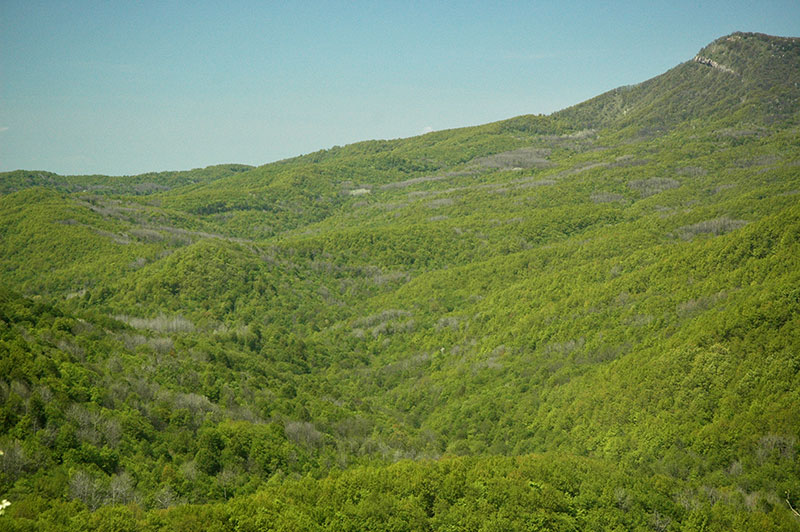
Forest, Krasnodar Territory, Russia
The road north-east out of Tuapse winds up away from the coastline, through the forested hills, past quaint villages of pastel-coloured wooden cottages with rambling gardens and picket fences; real village-Russia. Occasionally the trees part near the hilltops, revealing a sea of rippling forest which spreads to the horizon in a single shade of brilliant green, a magnificently beautiful and unspoilt natural landscape. At the top of one low pass, I enter the Adygea Republic, the first of the seven autonomous, ethnic republics which make up my route across the North Caucasus to the Caspian Sea. ‘Adyge’ is the endonym used by the Circassians to refer to themselves; an ancient Caucasian nation who may have been the architects of the region’s delmens millennia ago. Having been heavily subjugated and assimilated by the Russians in the nineteenth century, with many fleeing to Ottoman Turkey, the Adyge seem to lack the strong (and sometimes troublesome) ethnic identity of many of the region’s nations. Indeed, aside from the signpost announcing my entry into the republic, there is no obvious change from the quintessentially Russian villages as I roll down into the capital, Maykop.
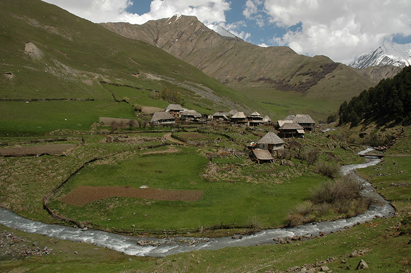
Western Caucasus, near Kamennomostsky, Adygea Republic, Russia
I meet my host Marina in Maykop, and she suggests we meet some friends of hers who are celebrating today’s Labour Day holiday in the countryside to the south of town. We drive south through more undulating hills, to the outliers of the Caucasus which are dotted by limestone bluffs and craggy outcrops, joining the Belaya River which cuts a steep, narrow course through the wooded limestone hills. We drive up close to the end of the road at Guzeripl, and join a group of Marina’s friends in the forest; a group of jolly middle-aged Russian ladies who have evidently been enjoying the day with plenty of vodka and cognac, while their husbands abstain in order to drive. They’re sitting at picnic tables laden with food and drink, and I’m soon plied with sausage, chicken, salad, bread, tea and biscuits. We’re in a wonderful setting of fresh beech forest, whose floor is carpeted with crisp dry leaves, and alive with the sound of birds and the rushing water of the river. Around us are a number of Russian family groups who have set up more permanent camps with tents and washing lines; the Russians’ affinity for and comfort in the great outdoors, combined with near-endless unspoiled nature makes camping a very popular pastime here.
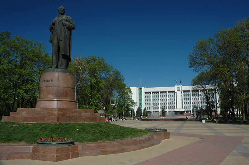
Lenin Square, Maykop, Adygea Republic, Russia
Once it’s dark, we head down towards a clearing in the forest where there is a small festival, passing a large tent playing standard Europop to amuse younger campers, to a small folk-music marquee. The songs, mostly solo acts, are all in Russian, but they’re simple, light-hearted ballads, and the participants are wonderfully unpretentious; nobody is taking themselves too seriously, and there is a genuinely friendly communal atmosphere. We all drive back together, stopping at one point for the ladies to sing from a bridge, before returning late to the deserted streets of Maykop.
In the morning, Marina and her friend Olga give me a tour of Maykop, which is a neat, typical provincial Soviet city. Lenin still stands prominently in Lenin Square on his plinth opposite the Parliament of the Republic, which is decorated with bands of geometric patterns from nominally Adyge textiles as a Soviet gesture to the republic’s titular nation. Around the square are numerous manicured parks and lovingly-tended flowerbeds, and each street seems to have some bust or etching of a local ‘hero’. The street names are also pure Soviet; Krasnooktyabrskaya (Red October), Proletarskaya (Proletarians), Krestyanskaya (Peasants) and Pionerskaya (Pioneers) to name a few, stencilled onto small metal name-plates. It’s a pleasant, calm throwback to what I imagine were the nicest aspects of the USSR, a ‘village’ city where everyone knows each other, and where nothing ever happens. This is probably what caused one of the residents to call the police and report my truck – ostensibly on the grounds of having one wheel parked in a flowerbed – as suspicious. The local bomb squad had apparently been inspecting the underside of the truck with sniffer dogs, though we only catch one policeman who is leaving as we arrive. It’s somewhat understandable perhaps, in this comatose city which lies at the tranquil end of the volatile North Caucasus region.
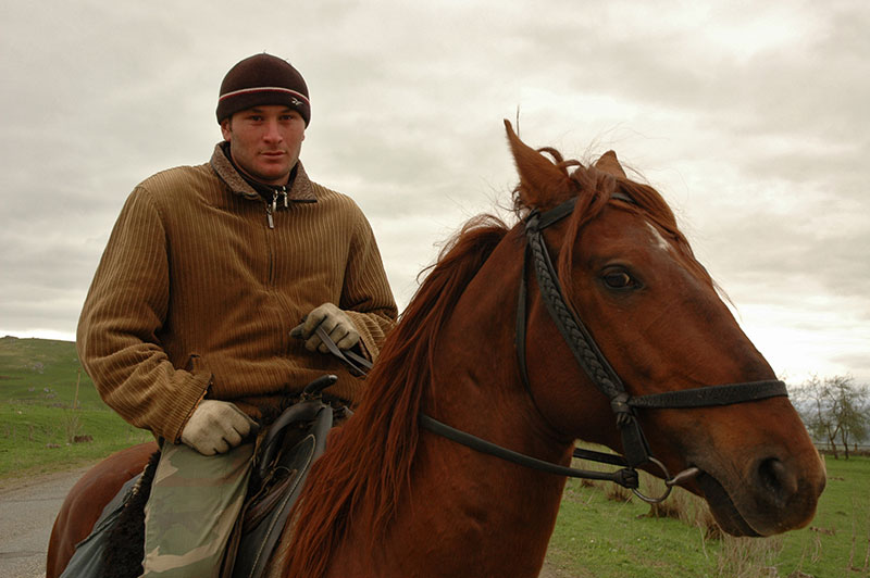
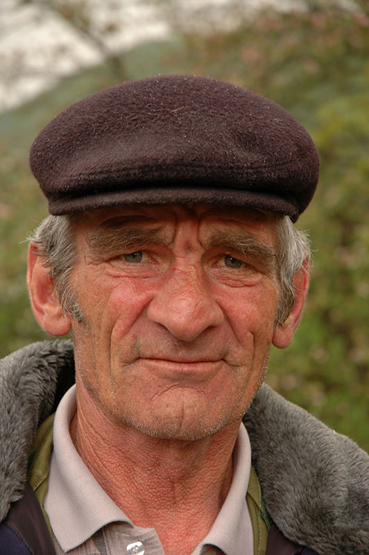
Karachay Man, near Zelenchukskaya, Karachay-Cherkess Republic, Russia
I leave Maykop and the Adygea Republic the next day, and continue east through fields of rapeseed and bright green wheat towards a distant horizon marked by mountains. In the afternoon, as I wind up into the damp foothills, I pass into the Karachay-Cherkess Republic, a dual-ethnicity republic whose titular nations are respectively Turkic and Caucasian, and which is markedly less Russified than Adygea. The change is quite abrupt; the villages are simpler, with ramshackle cottages surrounded by smallholdings, flocks of sheep grazing hillsides, men on horseback and cows wondering across roads. I stop in the town of Zelenchukskaya where I meet my host Aleksandr, and we drive together to his university dormitory in the village of Nizhny Arkhyz.
In the afternoon, Alexander takes me on a walk through the woodland to a tenth century Greek (Byzantine) church, one of Russia’s oldest and a postulated location of Maghas, the capital of the ancient kingdom of Alania which was destroyed by Mongol hordes in the thirteenth century. Also here is a balbal, an ancient, anthropomorphic menhir, the like of which may be found throughout Eurasia, and which hints at the Central Asian origins of the Sarmatian Alans, or perhaps the native Karachay, a Turkic tribe who came from the steppes of the east and settled this area in the eleventh century.
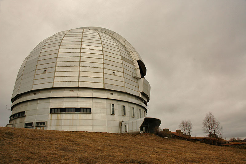
BTA-6 Telescope, Nizhny Arkhyz, Karachay-Cherkess Republic, Russia
Alexander is a cosmologist, and the following day we walk up through the forested hills, which at this elevation are still bare and only recently released from their burden of winter snow, to the Special Astrophysical Observatory of the Russian Academy of Sciences, dominated by the Soviet BTA-6, which until 1993 was the world’s largest solid-mirror reflecting telescope. I am given a brief tour, though being an optical telescope there is nothing to see during the daytime. The overcast sky also hides the mighty peaks which lie a short distance away to the south.
Leaving Nizhny Arkhyz, I return to the main highway and into the east of the republic, turning south up another valley to the small, scruffy town of Teberda where I meet my host Aslan, a Karachay who has a traditional wooden house here where he stays when he is working at the nearby ski resort of Dombay as a ski-lift engineer. We join another Karachay friend of Aslan’s for dinner, and I’m reminded of the recent history of the Caucasus, a history which Russian’s often prefer not to dwell upon. They tell me how during the Great Patriotic War (as the Second World War is known in the Former USSR), the Karachay (among many others) were seen by Stalin to welcome the Nazis, and in November 1943 were accused of collaboration and deported en masse from their Caucasian homelands to the Gulags of Siberia and Central Asia. It is thought that 35% of the Karachay race was wiped out within two years, and it was not until the 1950s that survivors started to return from exile.
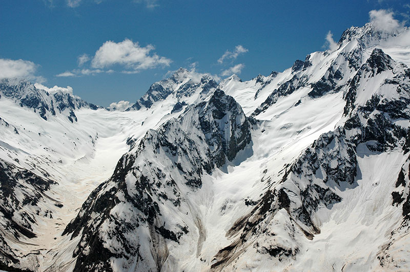
Greater Caucasus, Dombay, Karachay-Cherkess Republic, Russia
Aslan and I drive up to the end of the road in Dombay the following day, a small resort town which nestles in the steep folds of the Greater Caucasus at the foot of a huge mass of black rock, scoured by glaciers and eroded into sharp peaks, still blanketed in snow. Aslan and I are waved through the ticket queues for the ski-lifts by his friends, and are soon on a ridge at 2850 m. Here, Aslan makes a phone call to another friend, who picks us up in an Italian snow-groomer and drives us at an implausibly steep angle up to a peak at over 3000 m, where we are facing a huge wall of rock and ice, undoubtedly the most striking scenery I have ever seen in Europe, with Dombay nestled in a valley far, far below. Despite being several thousand meters lower than the Himalaya, the scenery around is nearly as impressive, and the combination of rolling green meadows fading into pristine pine forest with rivers of drinkably-clear glacial water, against the perennially snowcapped peaks make the High Caucasus just as scenic.
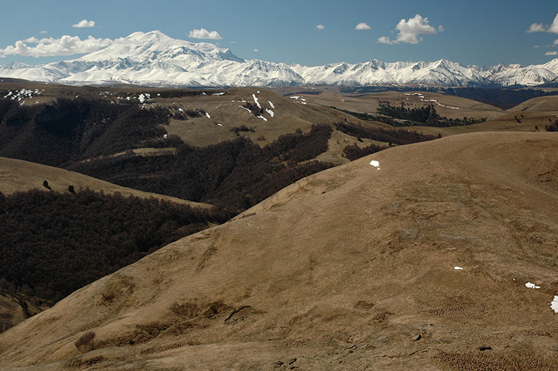
Mt Elbrus (5642 m), Karachay-Cherkess Republic, Russia
From Teberda, I head north-east, following a tip from Aslan to drive off the road at the Gumbashi Pass onto the Bichasyn Plateau. The morning is clear and the air dry but I’m unprepared for what greets me as I emerge from the pass onto a rolling expanse of parkland at 2100 m. Soft hills of grass still brown from the winter, dotted with patches of bare forest stretch back to a 150 kilometre-wide vista of the crestline of the Greater Caucasus, a sublime wall of snowcapped mountains. Almost 60 kilometres away, towards the eastern edge of this magnificent panorama, and significantly higher than anything else, are the huge twin-peaks of Mt Elbrus at 5642 m, the highest mountain in Europe. It takes over an hour to digest this view and tear myself away, but eventually I descend, passing the city of Kislovodsk, home to Aleksandr Solzhenitsyn, to the pleasant Russian town of Yessentuki.
I am hosted by Marcus, an Argentinian and Nadia, a local, who live in the city with their baby son Artur. Yessentuki is part of the Mineralnye Vody region, a popular resort renowned for its spring water which is sold throughout the country. Despite its proximity to the nations of the Caucasus, the region is almost totally Russian; from the window of the apartment, Mt Mashuk, near the city of Pyatigorsk is visible faintly to the east, at the foot of which Russian poet Mikhail Lermontov was famously killed in a duel. I spend a relaxing week with Marcus and Nadia, including the notable Soviet Victory Day holiday on the 9th May, which celebrates the surrender of Nazi Germany in 1945. Veneration of the Great Patriotic War was effectively a state religion during Soviet times, and the celebration continues today with parades of veterans and an orgy of Russian nationalism. Accordingly, we spend the day in the park drinking beers, and end up at the opulent home of one of Nadia’s friends, whose mother runs the largest brothel in town, for the ubiquitous Russian shashlik (kebabs) and vodka.
During this week I also finalise arrangements to briefly cross the Caucasus once more and enter the breakaway Republic of South Ossetia, which rather like Abkhazia last month, involves emails to the Foreign Ministry in the South Ossetian capital of Tskhinval. After initial confusion, I am granted access to visit their tiny republic, which is technically part of Georgia. I leave Marcus, Nadia and Artur early one morning, moving east once more. I’m soon held up in traffic as I pass Pyatigorsk on the M29, the old Soviet highway running from Rostov to Baku. As I leave ‘Russian’ Russia, and enter the Republic of Kabardino Balkaria, so begins a day of trouble with the notoriously corrupt Caucasian traffic police. Just outside the city of Nalchik, I run a concealed red light and am immediately chased by eagerly waiting police. At the border with the Republic of North Ossetia, I am directed to pull over at a check-point and then accused of crossing a solid white line. In the town of Alagir I’m pulled over by a policewoman and told that I “just went over the line, a little bit”, and finally, at around 15:00, as I drive up towards the South Ossetian border, after having eaten nothing all day and certainly not drunk anything alcoholic, I’m breath-tested positively at a checkpoint with an ancient Soviet device. In each instance, a straf (fine) is expected to be pocketed by the policeman, but in each instance I simply refuse and wait them out, before they get bored and send me off. These farcical pantomimes of law-enforcement are more wearisome and time-wasting than threatening, but they’re hardly enjoyable.

Roki Tunnel, North Ossetia-Alania Republic, Russia
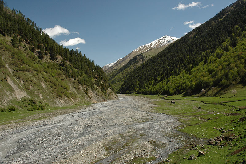
In the town of Alagir I join the Transkam, or Trans-Caucasian Highway, which enters the narrow valley of the Ardon River, climbing between the soaring valley sides of beautiful grassy meadows dotted with the ruins of stone siege-towers and churches. The Transkam is one of only two roads crossing the Greater Caucasus north-to-south, a lifeline for the South Ossetians, a highly strategic conduit for the Russians, and a thorn in the side of the Georgians, for it was via the Transkam that the Russian Army supplied their forces in Georgia during the 2008 war. I pass the Russian border post at Nizhny Zarmag with little fuss, though once again my passport is not stamped, reminding me that I am technically entering Georgia illegally. Ten kilometres beyond the border post, still in Russia, I enter the Roki Tunnel which has been bored for 3730 m through the mountains, emerging in a wide amphitheatre of mountains in the de facto independent state of South Ossetia.
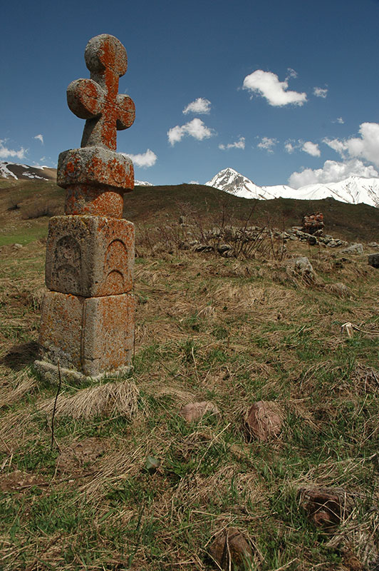
Ossetian Man, near Dzaw, South Ossetia
I’m flagged down by a few plain-clothed men, who turn out to be the South Ossetian border guards. My passport is taken and a phone call made to the capital; I mention the name of the minister with whom I had been in correspondence, and I’m soon ushered on my way. The landscape on the southern side of the mountains is broadly similar to the north, though slightly more open, and naturally further advanced in the transition from winter to summer. It’s a beautiful, sweeping descent in the afternoon to the capital Tskhinval, where I check into the shabby and decrepit Hotel Ireston.
The Ossetians are an intriguing ethnic group, descendants of the Alans, a Sarmatian tribe who in turn were the western group of the Scythians, a vast and enigmatic nation who inhabited much of Eurasia in antiquity, a time during which ‘Scythia’ represented a land beyond the frontiers of the known world. The Ossetian language is accordingly an ancient member of the Northeastern Iranian family, thought to be the only living remnant of an earlier, unknown Scythian-Sarmatian language. Today the Ossetians are squeezed in amongst the other nations of the Caucasus, though unusually are distributed both north and south of the Greater Caucasus range. With their distinct identity has come a struggle for recognition, which led to the creation of an autonomous South Ossetian region within Georgia throughout Soviet times. With the collapse of the USSR looming, the South Ossetians renewed their call for greater autonomy in 1989, leading to Georgia removing the region’s autonomous status, and the South Ossetians declaring full independence. When the USSR finally dissolved in 1991, these grievances erupted into yet another war in the Caucasus, one that resurfaced in 2008 with open Russian involvement, and has led to the existence of this tiny, largely unrecognised state.

Destroyed House, Tskhinval, South Ossetia
Tskhinval is visibly devastated, with damage from the 2008 war still clearly visible on the northern edges of town, where homes have been reduced to empty shells amid piles of rubble and the overturned, burnt-out bodies of cars. The centre of town has been largely rebuilt, but the place has more the air of a depopulated provincial town than a national capital. It’s noticeably less Russified than Abkhazia, feeling more like the rest of Georgia, though the people look more European. There is a strong army presence, with Russian Army trucks hauling muddied tanks back up the Transkam to Russia, and many men walking around in military fatigues, but the atmosphere is friendly and pleasant.
At the western edge of town lies the strangely restored railway station and beyond, the long-deserted, rusted lines which are starting to warp as grass and small fir trees push up between the old concrete sleepers. The old platforms are breaking up, covered in weeds, and the pylons are slowly tumbling down. Behind the railway lines is a long-stilled crane, and a few old warehouses with leaning chimneys and rusting old metal pipework. The area has clearly been moribund since long before the 2008 war; a poignant symbol of the isolation and decay which the region has obviously suffered since the collapse of the USSR.
Hillside, Kemulta, South Ossetia
There’s really very little to see or do in Tskhinval, so after two nights I turn back north again, slowly heading towards Russia. I have no real map of the area, and there is certainly no guide-book. The only information I have come across comes from the rather optimistic ‘tourism’ section of the website of the South Ossetian Ministry of Foreign Affairs, which has a series of surprisingly beautiful photographs of the republic which I decide to try to find.
In the village of Gufta, I take a rough side-track which leads to the western edge of the republic, winding up through beautiful, steep, green hillsides dotted with hawthorns and small, brush-like trees. Here, close to the border with Georgia ‘proper’ is Lake Ertso, a shallow lake in a grassy meadow which is apparently famous for disappearing completely, only to later return. Whilst not particularly striking, it’s a pleasant spot among rolling hillsides and mountains still streaked by the last of the winter snows, but is absolutely deserted.
Zgubir Valley, South Ossetia
Retracing back to the main road, I stop in the town of Dzaw, the second largest in the republic but in reality a village of around 1500 people. Apart from being the only place I have visited which sports bust of both Lenin and Stalin (Stalin’s home town, Gori, is only 50 km to the south), there is little going on, but the scenery becomes increasingly impressive as I continue north. In the half-abandoned village of Nizhny Rok, I turn east and into the Urstualgom Valley, the highest in South Ossetia. A churned-up dirt track drops down from the main highway, crossing a river and passing an old, ruined siege-tower, then slowly climbs to the east. At the village of Zgubir, a beautiful, wide river valley opens up between mountains clad with pristine pine forest which leads to the Russian border. The village itself – a few houses built on a hill – has an almost complete, but abandoned stone church with a rusting tin roof and birch trees growing from the steeple, which the friendly villagers tell me is Greek (Byzantine).
Edys, South Ossetia
The villagers in Zgubir also confirm that the ruined settlement of Verkhny Yerman, which the South Ossetian Foerign Ministry touts as the highest village in South Ossetia, lies at the end of the road, but tell me I must negotiate a Russian Army barracks en route. I encounter the army shortly after Zgubir, expecting to be turned away, but after simply showing my passport, I’m waved through and warned to stay on the main track, and not take any turns, indicating that I might be shot by the Gerogians. Soon after the barracks the road becomes a quagmire of muddy switchbacks which are barely driveable, but then levels out and reaches the tiny, isolated village of Edys, which is certainly the most idyllic looking place I’ve seen in South Ossetia. Situated within a wide meander of a small, fast-flowing mountain river, at the foot of snowcapped mountains, the dozen or-so homes of Edys are constructed entirely out of wood, with tall, steeply-pitched wooden-tile roofs overhanging wooden balconies. I decide to leave the truck near the village, and continue further on foot.
Gravestone, Nizhny Yerman, South Ossetia
The track climbs through pine forest, passing cascades of volcanic tephra, then emerges into a double-headed valley surrounded by the snow-covered ridges which mark the border with Georgia. One lone wooden cottage sits in a valley to the south, but all around me are the signs of ancient settlements; foundations of rock walls and long-gone structures, and a plethora of tall gravestones covered in bright orange lichen, most leaning off-vertical and some totally fallen. They each bear a cross and are clearly Christian, but their totem-like form suggests an underlying pagan influence, like a Christianised evolution of the earlier megaliths also found in the region.
Climbing further into the valley to the east, I reach the nearly-abandoned village of Nizhny Yerman where the muddy track ends. Here are perhaps ten homes still standing, surrounded by a network of rambling dry-stone walls. One wooden structure has been built against an almost-complete stone siege-tower, the last remaining link with the stone ruins I see all around. Atop a small hill next to the village is a tiny stone chapel barely large enough for a man to crawl into, with a free-hanging bronze bell suspended on a pole connected to a conical cairn of stones. I speak to one man, who along with one other are the only souls I see in the village. He tells me that he now lives in Vladikavkaz, in (Russian) North Ossetia, and only comes here occasionally. Since the Russian government began to openly issue Russian passports to citizens of South Ossetia (and Abkhazia), it’s little wonder that so many South Ossetian villages are rotting away, as people leave this isolated and war-torn little republic to live in Russia.
Leaving the village, I walk further east into a treeless grassy valley, which is strewn with more ruins; stumps of siege-towers, toppled gravestones and crumbling stone walls. At 2400 m, it’s an intriguing ruin of what must once have been quite a sizeable community, something like Ushguli in Svaneti, Georgia. A few kilometres further, crossing a pass at the head of the valley would lead to the volcanic Kelsko Plateau, but it’s still deep in snow, I am out of supplies, and I am not even sure which country it technically lies in, so I return to the truck in Edys.
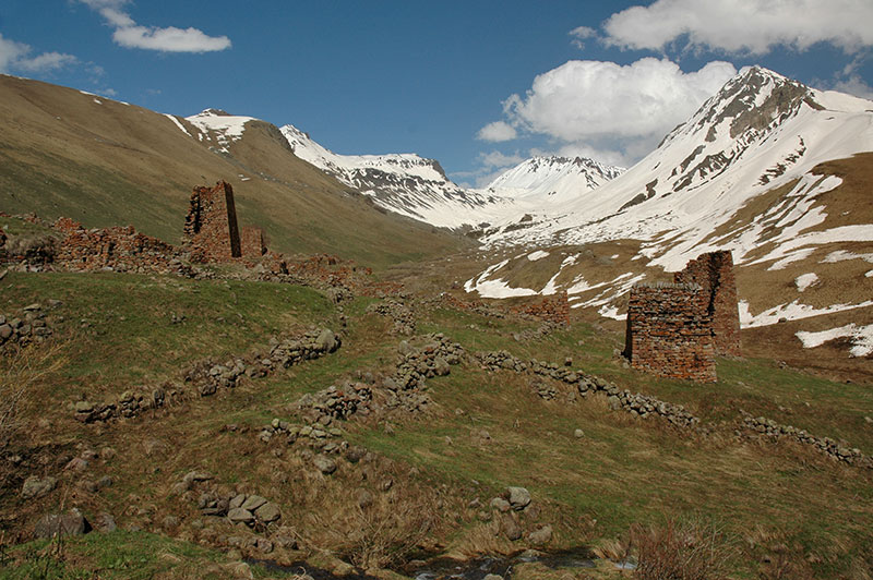
Ruins of Verkhny Yerman, South Ossetia
Next morning I return to Russia. Like all roads in South Ossetia, this one is a dead end, and so I must backtrack down the valley, past the Russian Army and back onto the Transkam, climbing the last few kilometres to the post at Vekhny Rok where the road plunges back into the Roki Tunnel, back into Russia and into Europe.
This first leg of my journey through the North Caucasus has been a warm re-introduction to Russia, to the western ethnic republics, and to the most striking scenery of the Caucasus. South Ossetia, whilst not technically part of the North Caucasus, is presently only accessible from the region, and has been a curious insight into this forgotten oddity of a country. Now however I have my sights set on the final leg of my journey through the Caucasus; across the remaining four republics to the Caspian Sea.

I really wanna go to Caucasus at some point. Such a interesting culture, friendly and lovely people…
Thank you for posting this!
I genuinely enjoyed reading this article.
South Ossetia is where my father grew up. Although I had a chance to visit it once, my knowledge about thе region is far from satisfactory.
Hi Ilona
Thanks for your message, interesting to hear from you! It would be very interesting to go there and experience the place from a local perspective. I’d be interested to hear about your experiences there too 🙂
Best wishes,
EO
Hi, Daniel! I liked your site very much. Keep on, you did it great. I work in Arkhiz area now. Everything is fine with me. I have a daughter and a wife too 🙂 Best regards from Kavkaz! Keep in touch.