
Stage 34 – Kazakhstan & Turkmenistan: The Caspian Lowlands [2/2]

After almost two weeks in Kazakhstan’s Mangystau Region, exploring necropoles and ancient Sufi pilgrimage sites and taking in the spectacularly remote sights of the Ustyurt Plateau, I am at the far-flung Kazakhstan – Turkmenistan border. Ahead of me lies my third transit of this secretive and recalcitrant dictatorship, once more on a five-day transit visa, which restricts me to a fixed route (from which I will deviate), but is the only means of independently exploring the country. In this short time I hoped to glimpse something of the culture and traditions of the seemingly timid Turkmen people, and explore some of the myriad of historically important ruins which fill this country, poised historically on the frontier between nomadic and settled civilisations.

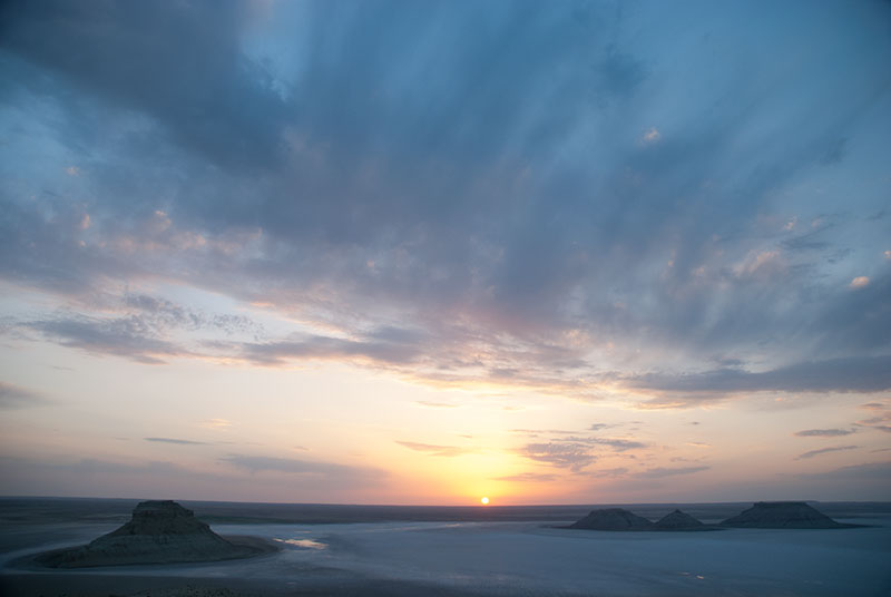
Sodium Sulphate Pool, Garabogaz, Balkan Region, Turkmenistan
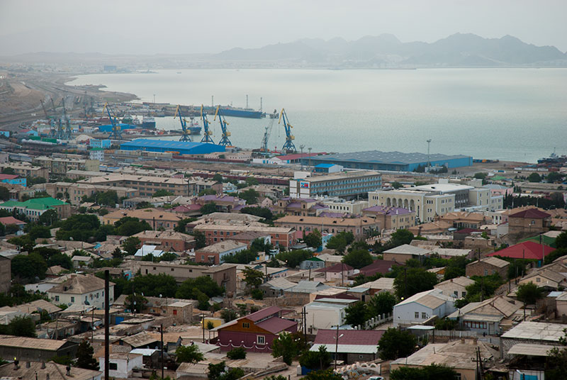
It’s the morning of the 23rd June 2014 and I’m first in front of the gates of the Garabogaz border crossing. I watch a teenage soldier open the first of the double gates, carefully inspect the raked dust for footprints, then sweep it into a pan and open the second gate. Getting into one of the word’s most closed countries is a lengthy and expensive process, as I have learned from my two previous visits, and it is not until 12:20 that I am free to leave, on more terrible, muddy tracks, passing a crashed MiG 15 jet at the roadside soon after leaving the border crossing. As I climb a gentle ridge, passing an abandoned police check-post, a sweeping curve of the turquoise Caspian comes into view once more, looking more like the Pacific Coast with its breaking waves bringing ashore a little mist and with it a beautifully cool, damp breeze, reducing the air temperature to just 28º C as if a giant air-conditioner had been switched on. The first point of civilisation is the bleak sodium sulphate mining town of Garabogaz, an almost apocalyptic scene of derelict-looking Soviet-era industry, rotting pipelines and partly occupied apartment buildings amid pink and brown evaporation pools. After Garabogaz, the road becomes paved once more as it passes through scrubbier territory, past the inlet of Garabogazkol, a large, hyper-saline lagoon intermittently connected to the Caspian sea. After hours of bleakness, the narrow, lumpy road suddenly transforms into a six-lane highway and leads into the port city of Türkmenbaşy, where I stop for the night.
Türkmenbaşy, Balkan Region, Turkmenistan
Türkmenbaşy (named after the first president of Turkmenistan), formerly Krasnovodsk, was Imperial Russia’s point of entry into the Trans-Caspian region, railhead of the Trans-Caspian railway which ran to Bukhara, Samarkand, and later Tashkent and the Fergana Valley. It was a key staging post for Russian expansion into Central Asia, and a base in campaigns against the Khanates of Khiva and Bukhara, and against the Turkmen tribes. Today, it remains a busy port, and the freight wagons of the Trans-Caspian railway are still transported by ferry across the Caspian Sea from Baku. I’m hosted in Türkmenbaşy by Dowlet, a young Turkmen who lives with his wife in a single-storey house perched in hills overlooking the city centre. From the outside his house is plain, but inside are large rooms with little furniture, and rugs, some hand-made and very fine, covering the floor, as in Persian homes. Dowlet and I sit at a tablecloth set on the floor, his wife waiting on us and bringing us large quantities of food. After eating, as it is getting dark, Dowlet takes me out in his car for a drive to the coast, where the government has spent around a billion dollars developing the glitzy seaside resort of Awaza which is practically deserted, another example of the Turkmenistani government spending vast quantities of the country’s oil revenues on projects of no real value to the populace.
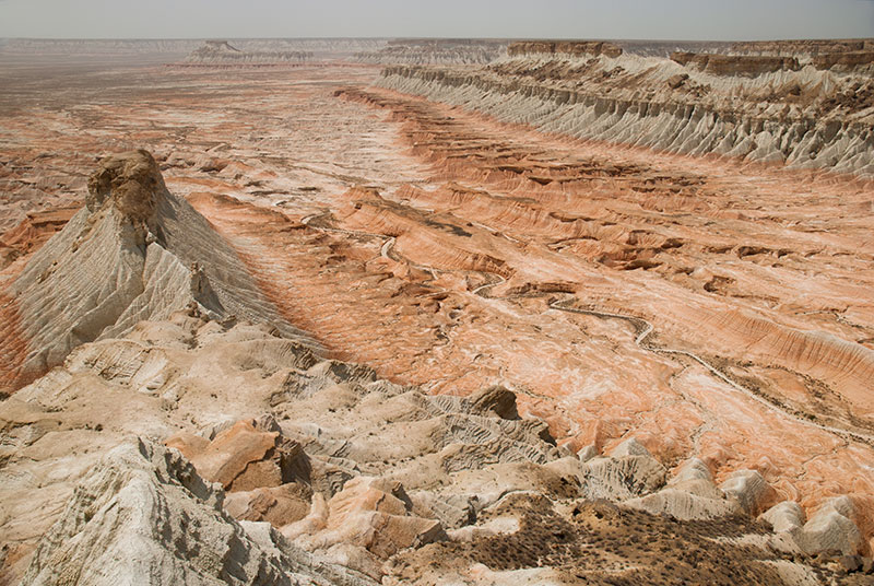
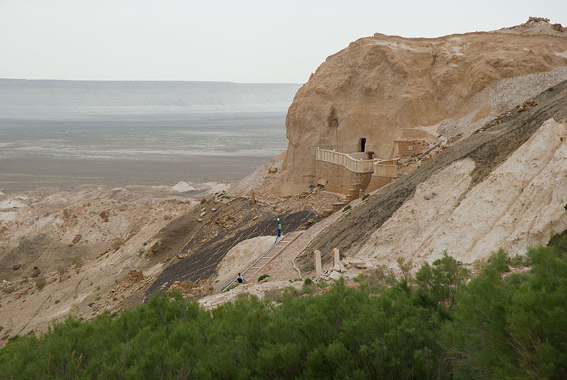
Yangykala Canyon, Balkan Region, Turkmenistan
I have a quick look around Türkmenbaşy with Dowlet in the morning; the city is attractively sited on the northern edge of a rocky bay, and with the activities of a port, does not have the eerie, comatose atmosphere of most of the country’s cities. However, aside from a few old Tasrist and Soviet-era buildings, there is little to see, and so I head east into the desert, peeling off my mandated transit route on the M37 at a lonely junction, onto an empty single-track road. After around 120 kilometres I reach the village of Goshaoba, after which the road deteriorates as it enters starkly barren desert. As I begin to climb for a final time onto the Ustyurt Plateau, I see once again the familiar banded reds and greys of the plateau’s edge, until I reach an unmarked side-track which climbs to a stunning viewpoint looking back over the terrain I have just driven through, adjacent to which is a wide badland area known as Yangykala Canyon. The view over the canyon is mesmerising, with endless erosional incisions made into two long, parallel escarpments of white and brown rock, separated by a dry, meandering riverbed in older, bright red rock, giving a quite other-worldly appearance.
Gravestones, Gozli-Ata Shrine, Balkan Region, Turkmenistan
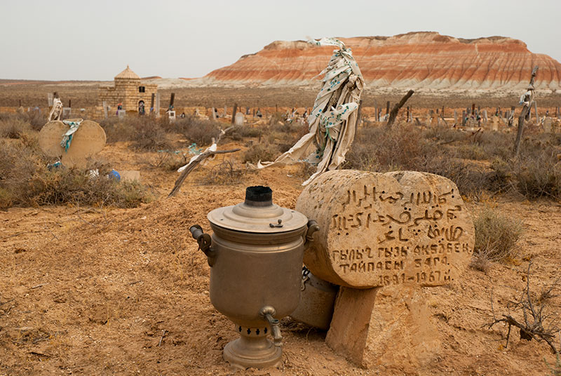
Sadly, the tight time constraints on my visa mean I have to tear my self away from the viewpoint and return to the main Türkmenbaşy – Ashgabat highway, though on my return journey I stop at the nearby shrine of Gozli-Ata, where the grave of the twelfth century Sufi mystic and student of Khoja Akhmet Yassawi sits in a beautifully remote desert location, surrounded by scraps of the multicoloured desert escarpments which I had just looked over at Yangykala. Around the twin-domed, modern mausoleum of Gozli-Ata himself are an array of gravestones, some familiar koytases, presumably of Kazakh origin, but also more distinctly Turkmen types, simple, carved headstones of different shapes according to different Turkmen tribes, with crude inscriptions in Arabic and later Cyrillic. Some have large stylised heads, looking very similar to the pre-Islamic balbal; others have large, stylised rams horns, but most common is the cross-like cloverleaf, belonging to the dominant Yomud Tribe. Amongst the graves are some highly esoteric offerings which hint at strong pagan influences: hairpins (an offering for an ailment of the head), stacked stones left by those giving prayers (which are turned if the prayer is answered), a profusion of teapots and even a samovar at selected graves, small baby cradles (for fertility), and an odd wooden trellis of long-dead tree trunks elevated on stones, heavily tied with votive prayer scarves, under which women squeeze themselves for good health or fertility. It’s a deeply intriguing spot and a thought-provoking glimpse into the fascinating and seemingly very private Turkmen faith.
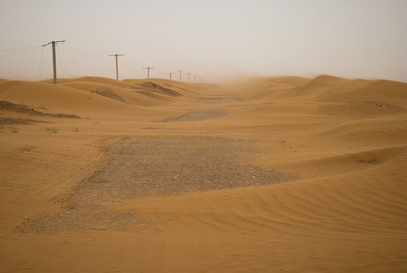
Desert Road, near Irkli, Balkan Region, Turkmenistan
The return journey takes me first to the junction near Goshaoba, then south through initially very desolate terrain, passing oddly lifeless villages amongst encroaching sand dunes. At one point, dunes inundate the road for several kilometres and I find myself engaging four-wheel-drive, passing a row of pylons whose power lines have been ripped off and lie flailing on the dunes. This is a pretty accurate picture of the acute and absolute neglect of rural communities by the Turkmen government. Later, passing the forlorn town of Oglanly, the road climbs to the western slopes of Great Balkan mountain, whose summit is wooded and whipped by clouds, an odd sight when compared to the absolute desolation I have driven through for much of the day. Descending a long, gentle gradient, I rejoin the M37 at Jebel, back on my transit route, stopping for the night in the next town of Balkanabat.
I’m hosted in Balkanabat by Ejesh, who lives with her husband in a modern apartment. Ejesh is very confident and communicable, and in contrast to my previous night’s stay with Dowlet in Türkmenbaşy, I find myself speaking almost exclusively to her, while her husband remains largely quiet. She gives me many insights into the shadowy spirituality of Turkmen culture, explaining what I have seen earlier in the day at Gozli-Ata’s shrine. Despite being outwardly very modern, Ejesh explains to me that there are still strong tribal customs, meaning for instance that her father-in-law may never see her face, something which I find very surprising in such an outwardly modern, post-Soviet society. Ejesh explains that she personally disapproves of such customs, but is bound by them as a Turkmen, a people who she describes as the most traditional in the Central Asian republic of the Former USSR.
Misrian, Balkan Region, Turkmenistan
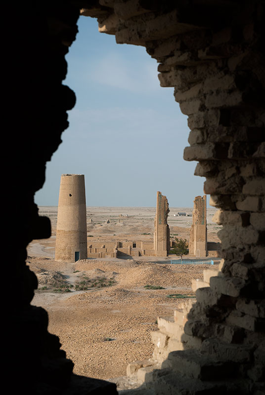
After a quick look around Balkanabat in the morning I get back on the road, turning off the M37 at Gumdag, still on my dictated transit route south to the Iranian border. The road enters desert once more with low, pale-yellow sand dunes on either side, and various infrastructure and rusting detritus from the local oil industry. I stop in the village of Bugdayly for a late lunch at a cafe run by young Uzbek women, popular with friendly Turkish lorry drivers, which I soon realise doubles as a brothel. A few kilometres beyond the village, again using waypoints built up from satellite maps, I sneak off the road and onto tracks across the takir (mudflats) which seem to head for nowhere at all. Historically, this area was the Dekhistan Oasis, inhabited since the late third millennium BCE, and at the peak of its power between the eleventh and fourteenth centuries. At this time, Dekhistan was part of Hyrcania, an outer satrapy of the Persian Empire, a caravan stop on the branch of the Silk Road connecting Persia to the Khorezm Oasis on the Amu Darya. Dekhistan was abandoned in the early fifteenth century for reasons that are not clear; perhaps a collapse of irrigation systems, or deforestation, and the area remains unpopulated to this day.
As I get further from the road, in the hazy distance I’m delighted to see the sentinel remains of Misrian, the long-abandoned capital of Dekhistan, around twenty kilometres away. I make my first stop at Mashat, a medieval graveyard of a few lone Turkmen graves and older, crumbling mausolea centred upon the Shir-Kebir Mosque which, dating from the ninth or tenth centuries, is the oldest extant mosque in Turkmenistan, and one of the oldest in Central Asia. After stopping to admire the beautiful floral stucco of the mosque’s triple-arched mihrab, I drive over to the ruins of Misrian, entering via a breach in the ruined city’s double defensive walls and carefully driving past pile after pile of scattered bricks towards the city’s only standing monuments. Around a central courtyard is the thirteenth century mosque of Khorezmshah Mohammed, with a collapsed outer portal still bearing beautiful turquoise Kufic lettering and, nearby, the truncated remains of a minaret. A little further away is the similarly truncated eleventh century Abu-Jafar Ahmed minaret with three beautiful bands of Arabic and striking geometric designs, and which may still be climbed for a fantastic view over the ruined city, which is a sea of collapsed masonry.
Beach, Ekerem, Balkan Region, Turkmenistan
Aside from a timidly-friendly Turkmen family who briefly visit, I have Dekhistan all to myself and in the late afternoon, drive the truck into the city’s inner courtyard. Whilst not as impressive as nearby contemporaries Merv or Balkh, Misrian is somehow more atmospheric for being utterly ruined and forgotten to the outside world, and I feel deeply privileged to be here alone. As I cook and eat, and later sleep under the stars in this ancient Silk Road city, imagining the camel trains and mystics who for centuries passed through, I am once again fulfilling my dreams as a traveller.
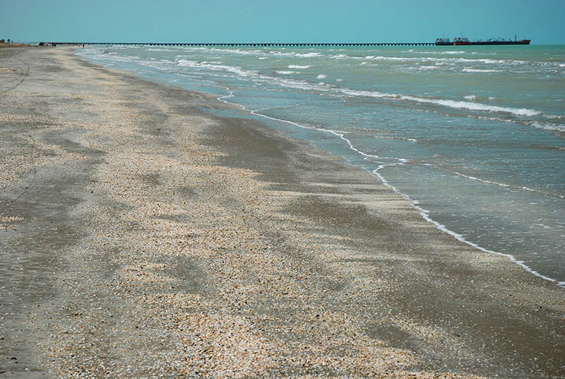
I make my way back to the road in the morning and spend the day driving through more bleak desert, past oil pipelines and wasteland often scarred by oil production. I stop for lunch in the coastal village of Ekerem, which has a beautiful sweeping beach of grey sand and shells, leading up to a tanker terminal. From Ekerem the road runs close to the coast, though wide mud flats mean the sea is rarely in sight. Near a group of oilfields, nodding donkeys and gas flares, I pull off the road and follow dusty tracks which climb up to the flanks of the Ak Patlawuk mud volcano, a curious geological phenomenon where sediments underlying the edge of the Caspian Sea are liquefied and forced to the surface in what looks like (but is not) a fumarole. Over the years, this mud has built up into a large expanse of dessicated mud flats, centred around a small cone out of which mud gently bubbles and erupts into a pool of rather foul-looking brine.

Ak Patlawuk Mud Volcano, Balkan Region, Turkmenistan
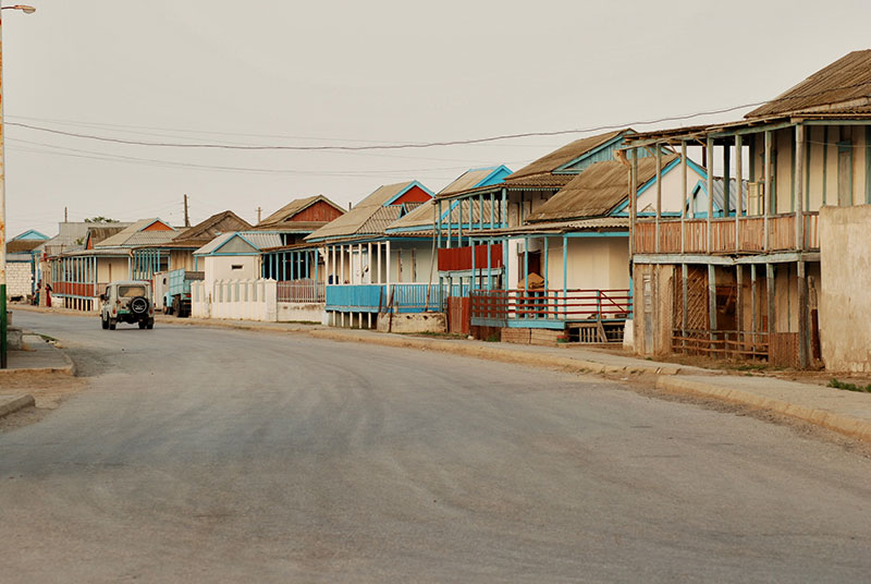
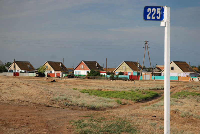
In the evening I reach the district capital of Esenguly, the southernmost settlement along Turkmenistan’s coastline, just twelve kilometres from the Iranian border. After two travelling days in the heat and dust I am keen to have a shower, and so stop in town to find a hotel; a decision I will come to regret. Esenguly, like nearby Çekişler is a coastal settlement made up of rather attractive wooden houses, surrounded on all sides by wide shaded verandas with colourfully painted beams and window frames. I find a small and very basic local hotel in which to stay, and after the owner arrives, I am told that I am his first foreign guest. I need to register with the police, who arrive at the hotel and are very friendly, casually asking to look over my photographs. I then go our for a walk around the town, escorted by the owner. Local people are friendly but seem reserved and even suspicious of me, the product, I imagine of having perhaps never seen a foreigner in town, and having grown up in a very sensitive outer border zone of the USSR, and now of Turkmenistan, a country even more closed and fearful of the outside world. I return to the hotel contented, having seen everything I have wished to see on this brief transit of the country. I drink what will be my last beer for some time (I will enter Iran tomorrow), and am invited to dinner by the other guests of the hotel, a party headed by an ebullient Turkmen businessman who talks to me at length about his life; in short he was once a powerful figure in the Soviet and later Turkmen armies, but for reasons that he does not make clear, he has fallen from grace.
The trouble starts at around 23:00 when the police return, this time with agents from Turkmenistan’s KGB who are brutish and ill-mannered. What initially seems like a casual questioning becomes an interrogation, and my laptop, cameras and mobile phone are taken and searched; something I regard as a gross invasion of my privacy. All through the experience the officers wield their absolute power over me, and make no attempt to hide the joy it brings them. My ‘crime’ is having deviated from my transit route, and I am made to write a letter of confession. What excites them further is the fact that I have stayed with Turkmen citizens, and to my horror their numbers are taken from my phone, each receiving a call from the police. For Dowlet this amounts to nothing more than some questions, but Ejesh, whom the police imagine I have had some illicit relations with (also a crime in Turkmenistan) is harassed for days after. My photographs of Turkmenistan are copied and erased from my camera, seemingly more by their bumbling incompetence than on purpose (I later recover them from my memory card), the officers lying and telling me that they will be returned at the border the next day.
Esenguly, Balkan Region, Turkmenistan
In the morning another protracted questioning begins, becoming quite ludicrous at times, though every banal and fictional answer is dutifully noted in a worn notepad. The car is searched and all my documents again examined in minute detail; at this point I realise that these small-town guys are simply wasting my time to ensure I will drive straight to the border. One dim junior is sent off to photocopy my Turkmenistan visa, but comes back having copied the Iranian visa. After tedious hours of intimidation from these incompetents, I am finally allowed to leave, and waste no time getting to the border. The road is an atrocious unsurfaced mess of hard-baked mud passing utterly bleak settlements, and I’m very happy to reach the border station in the sweltering afternoon heat. After being made to write another letter of confession (by a customs officer, whom I had run into two days earlier in the cafe-come-brothel in Bugdayly), I am finally stamped out of the country and join the line of lorries heading into Iran.
I leave Turkmenistan feeling greatly relieved not to have suffered worse from the authorities, though also must admit to myself that it is my fault for having deviated from my transit route, and not hidden the evidence of it. The police run-in has left a bitter taste after what were four wonderful days in Turkmenistan, a country I am very fond of. What is really sad however is the plight of the Turkmen people who live under the absolute power of the regime, one which squanders the country’s wealth on mindless building projects and uses it to enrich a select few, whilst the country’s infrastructure outside of the main cities simply rots away from neglect. To this day, I long to have free access to Turkmenistan’s many natural and historical attractions, but these thoughts are far in the back of my mind as I cross the small, currently dry bed of the Etrek River and enter Iran, which comparatively, feels like a free country.
Stage 34 – Kazakhstan & Turkmenistan: The Caspian Lowlands [1/2]
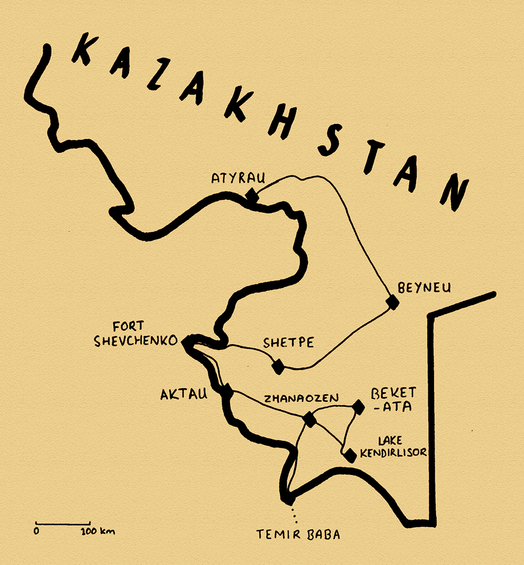
The Caspian Sea is a remnant of the ancient Paratethys Ocean, from which it was isolated around five and a half million years ago. Though not technically a lake, the Caspian is the largest enclosed body of water on Earth, draining a large swathe of European Russia by means of the Volga, Europe’s largest river. On the western shore of the Caspian, the Caucasus Mountains come down to the coast, creating an area of verdant and fertile foothills. On the eastern edge of the Caspian however, lie desolate lowland areas of barren desert, today very sparsely populated. My journey through the Caspian Lowlands would take me firstly through the Kazakhstani region of Mangystau, a starkly beautiful land filled with highly venerated medieval shrines and necropoles of magnificently carved stone, testament to millennia of nomadic civilisations. Across the border to the south, in Turkmenistan, I would traverse the western edges of the Karakum Desert; today a blighted land of sand and takir (dried mud flats), but once the Persian satrapy of Dekhistan with its ancient capital Misrian, a Silk Road staging post, now a hauntingly abandoned ruin in the midst of nothingness.

Kulpytas, Sherkala, Mangystau Region, Kazakhstan
Late in the afternoon of the 11th June 2014 I leave Atyrau after two days spent relaxing, registering myself with the police and stocking up on supplies for the coming weeks of desert travel. I cross the Ural River and enter Asia, where I will remain for the next five months until crossing the Bosphorous in Istanbul. It’s a relaxing drive as the sun’s rays lengthen, colouring the barren plains either side of the road. Not long after leaving the city and sprawl of industry which surrounds it, I’m disturbed when the truck’s charge warning light suddenly comes on. The cause is merely a loose connection which has lead to arcing, burning away a little insulation on the connector. After tightening the connection however, the light is still on and I initially turn around, back towards the city, but stop again and fix the problem after a little thought by replacing the voltage regulator; one of very few spare parts which I am carrying.
Continuing my journey east, I drive blissfully into the cool desert night on a perfect asphalt road, crossing into Mangystau Region, stopping after midnight around twenty-five kilometres short of Beyneu, using my GPS to find the exact same spot near the railway line where I had camped in August 2011. In the morning I pass Beyneu then turn south, climbing almost imperceptibly onto the Ustyurt Plateau, a barren upland which stretches east to the Aral Sea and south into Turkmenistan. The road alternates between perfect new asphalt and sections of horrendously rough, compressed mud where one is forced onto parallel tracks in the steppe which have been milled into very fine dust by passing lorries and which billows in great clouds across the landscape. In the early afternoon I drop off the edge of the plateau through a spectacular escarpment in the cliffs of white and chocolate-brown rock, dropping onto the Mangyshlak Peninsula. In the town of Shetpe I leave the main road and head north on tracks across the semi-desert, stopping at the beautiful, lone mountain known as Sherkala, whose banded flanks of yellow and white limestone have been eroded into deep flutes, picked out in the warm, soft glow of the afternoon sun.

Bactrian Camel, near Shayyr, Mangystau Region, Kazakhstan
After the starkly barren desert around Atyrau, the land of the Mangyshlak Peninsula is subtly greener and lightly covered with fragrant wormwood. The successive generations of nomadic tribes who have grazed these steppes have used the soft native rock to carve elaborate funerary monuments such as highly stylised steles, slab-sided sarcophagi, and large mausolea. These beautiful necropoles can be found stranded in magnificent isolation out on the steppe at places whose significance must be lost to time; the only traces of long departed nobles, warriors and sages from a culture which left no other mark on the land. Here, not far from the foot of Sherkala, I come across my first necropolis, with dozens of graves, some with a carved tombstone known as a koytas and others simply piles of lichen-covered stones. Among these are also several examples of a stele known as a kulpytas; with a rounded upper portion thought to represent a head, or perhaps the cosmos, a beautifully carved middle section, and a rectangular base carved with floral designs still found on contemporary Kazakh felt carpets, these are theorised to be more recent, Islamicised versions of the ancient Turkic balbal, the anthropomorphic stone found all across the steppes of Eurasia.
I drive into the early evening following tracks in the steppe, hugging a gentle ridge dividing two wide valleys dotted with camels and horses, backed by the spectacularly eroded edge of the Ustyurt Plateau, a truly beautiful, calm environment in which I stop to camp for the night. This is exactly the freedom I have been craving throughout the last two and a half years of living in Western Europe.

Shakpak-Ata Underground Mosque, Mangystau Region, Kazakhstan
In the morning the track descends westwards into Torysh, the ‘Valley of Balls’ which is littered with large, spherical and ovoidal concretions of limestone formed in the bed of a shallow ancient sea, now cascading down the hillsides as if used in some giant’s game. As I near the shore of the Caspian, the overcast sky breaks into wet sea squalls which seem rather incongruous in this usually waterless environment, and turn the tracks into mud. Descending onto the coastal plain, I reach a small, sacred valley whose limestone walls have been eroded into honeycomb. The valley is filled with graves, some decorated with ram’s horns and a ritual fire stone known as a shirktas. As I sit in the truck waiting for a particularly strong squall to pass, I see pilgrims filing from a minibus into a modern mosque. Across this region, the age-old steppe traditions of ancestor-worship and paganism fuse with more recently introduced Islam into a culture of shrine worshipping. I walk down into the canyon and enter the centre of veneration here; a cruciform cave-mosque carved out of the native rock, with swirling reliefs of columns, walls etched with pictures of animals and Arabic script and wall-niches for candles. Dating to somewhere between the tenth and thirteenth centuries, the mosque is said to have been the residence of a healer known as Shakpak-Ata, and devoted Kazakh pilgrims come here to be in his presence, and to offer prayers asking for good health or fortune.

Petroglyphs, Beysenbay Necropolis, Mangystau Region, Kazakhstan
The following day, after spending a rainy night out on the steppe I make my way to the coast, passing the beautiful walled necropolis of Beysenbay which is particularly rich in ornately carved kulpytases and etchings of horses, hunters, camels and open hand designs on the walls of a fine, domed stone mausoleum. Then, as I drive on dusty steppe tracks I come across something quite amazing. Here, the vast grassland ecosystem of dry, powdery earth, fragrant with the scent of wormwood and animal musk, dotted with the settlements of herders and nomads, scoured with the time-worn tracks of livestock and occasional monuments of past inhabitants; this steppe which so defines the landscape and culture of Central Asia abruptly, without more than a couple of kilometres warning, drops away into the gleaming azure of the Caspian Sea, which here looks and feels very much like the ocean. I try to imagine the Mongols coming here on horseback in the thirteenth century; smelling the salt air and then seeing the land fall away into oblivion, and wonder if they thought, momentarily, that they had reached the very edge of the world.

Monument to Exile, Fort Shevchenko, Mangystau Region, Kazakhstan
I drop down an escarpment in the steep coastal cliffs to a local beauty spot known as Tamshaly, where water drips gently from within the layers of rock making up the plateau, forming a verdant oasis of hanging greenery and a reed-fringed pool. The beauty is however rather marred by a group of local Kazakh day-trippers who blast out music and distribute litter, so I drive down onto a beach of coarse sand, chat briefly with a local fisherman, then have a refreshing wash at the water’s edge. It’s not far from here to the westernmost tip of the Mangyshlak Peninsula, and I pass through the small port of Bautino, which has a couple of preserved examples of Tsarist-era houses, before stopping for lunch in the adjacent town of Fort Shevchenko. It was here that Russians first established a presence on the peninsula with construction of the naval stronghold of Novopetrovskoye in 1846. This remote outpost naturally became a centre of exile, and was home as such between 1850 and 1857 to Ukrainian poet and political figure Taras Shevchenko, who was imprisoned here after offending Tsar Nicholas I with a poem. His image was rehabilitated in Soviet times as that of an anti-Tsarist activist, leading to the town’s renaming to Fort Shevchenko in 1939. There’s a large bronze statue of the Ukrainian poet in a leafy park in the centre of town, and a striking realist monument to its history of incarceration, but otherwise, Fort Shevchenko still has the air of a far-flung outpost.

Apartment Lighthouse, Aktau, Mangystau Region, Kazakhstan
I drive south-east on a paved road out of Fort Shevchenko, riding roughly parallel to the barren coast towards the regional capital Aktau. As I approach the city, the traffic starts to increase and for the first time since leaving Atyrau I have the impression of entering an urban area. I stop short of the city to visit a final necropolis known as Koshkar-Ata, by far the largest I have seen. In its northern section, I see koytases and kulpytases similar to those I have seen on the steppe, as well as a distinctive tombstone carved into the shape of a ram, known as a koshkaratas, complete with carvings of a sword and axe, indicating that the interred may have been a warrior. In its southern reaches the tightly-packed graves are contrastingly modern, boxy structures which continue to spread ever further south as modern, settled Kazakhs continue the funerary tradition of their nomadic forbears.
Aktau is a modern city, founded in 1958 on this absolutely barren and waterless coastline in order to exploit nearby uranium reserves, supplied with water and electricity by a combined nuclear reactor and desalinator. With the development of Mangystau’s oil reserves, Aktau increasingly became an oil-town, and today shares in Kazakhstan’s post-independence oil boom. Compared with Atyrau, Aktau feels rather less modernised, with fewer glass-fronted oil company offices, but the streets feel friendlier and the warm, blue waters and sandy beaches of the Caspian are far nicer than Atyrau’s desolate surroundings. Indeed, the city’s centre remains very Soviet in layout, divided into micro-districts with each slightly shabby prefabricated apartment building (one of which bears a lighthouse on its roof) numbered individually and accessed by unnamed roads. I spend three full days in Aktau meeting my host Evgenia and a number of her friends, walking among the concrete monuments and mildly cosmopolitan population of a Soviet planned city, and watching Kazakh and Russian families enjoying the beach, swimming in the turquoise waters while tankers and cargo ships manoeuvre around each other a few kilometres offshore.

Kendirli Bay, Mangystau Region, Kazakhstan
The time comes however to leave these urban comforts and head back into the scorching desert. I drive east out of town, through the Karagiye Depression, which reaches 134 metres below sea-level, making it the lowest point in the Former USSR, arriving in the oil town of Zhanaozen in the fearsome afternoon heat. Here I am hosted by Asset, a Kazakh environmental consultant who lives in the city with his wife and two young children. Asset and I immediately seem to bond, despite knowing limited amounts of each other’s languages. With his two sons, Asset and I pick up his friend Ghaziz and head for the coast, to a beautiful secluded bay known as Kendirli. Many families have come here to cool off after the stifling heat of the day, and as the sun slowly sinks behind the long natural headland which protects the bay, filled with young Kazakh families, I feel I am seeing a vision of the future of this prosperous young country which I have enjoyed visiting over the past seven years.
On returning, Asset’s wife has prepared a traditional meal of beshbarmak, consisting of chunks of beef and kazy (horse sausage), with potatoes, onions and hand made pasta squares which is delicious, though I am thankfully not obliged to eat any of the boiled sheep’s head, a traditional Kazakh delicacy reserved for a guest. After dinner, Asset and I head out into the warm evening and round off the evening drinking a few beers with Ghaziz. Despite having known each other only a few hours, I feel as if I’ve come upon an old friend; hospitality experiences such as these are truly one of the great joys of travelling.
I head off into the desert proper the next morning on dusty tracks, joining what is perhaps the most revered pilgrimage route in the country. I first stop at the desert shrine of Shopan-Ata, who was a disciple of the great twelfth century Turkic mystic and scholar Khoja Akhmet Yassawi, and who legend says, founded a mosque here when he came across his masters staff stuck into the desert. The shrine is centred around a simple cave-mosque, behind which lies a ritual desert trail passing various graves, ending at a large stone phallus rubbed smooth by visiting female pilgrims, blackened by the burning of rags soaked in mutton fat which are placed on its tip. Next to this is a curving branch of a long-dead tree under which women stoop, heavily tied with votive scarves. It’s quite a fascinating glimpse of what must be very ancient, and to me very esoteric traditions of the steppe, only very slightly influenced by any Islamic tradition.

Shirktas, Shopan-Ata Shrine, Mangystau Region, Kazakhstan
Beyond the shrine complex, I join a graded track east, deeper into the desert, climbing eventually onto a large, natural ramp which gently brings me once more onto the Ustyurt Plateau, with beautiful views to the south of bright white limestone escarpments carved into the grey-brown desert plain. The track ends at the shrine complex of Beket-Ata, where numerous minibuses are parked outside a modern pilgrim centre. Beket-Ata was an eighteenth century Sufi hermit; educated in Bukhara, a veteran and hero of Kazakh battles with the Kalmyks of southern Russia, later to become a saint, soothsayer and healer. Perhaps because of his fame as a healer, Beket-Ata’s shrine is an especially popular destination of pilgrimage, and I am in the company of dozens of local visitors. The temperature is well above 40º C when I arrive and so I rest for a couple of hours in the air-conditioned pilgrim centre, located on the edge of the plateau, mustering the energy to begin my own walk to the shrine at around 16:30.
From the visitor centre, a path drops down towards the desert floor, passing a brackish holy spring which waters a small grove of saxauls in which a urial ewe is grazing. Groups of red-faced pilgrims pass me on their return journey from the shrine, often asking for water, some of them elderly and overweight women who must be at the very limits of their endurance in the terrific heat. At the cave-mausoleum itself, I join a group of Kazakhs, and together we sit in the whitewashed, almost conical main chamber. Dozens of urial horns are stuffed into an alcove in the ceiling, which has a large hole in to allow light and a little fresh air to enter. A custodian in a taqiyah (white skull-cap) gives an explanation in Kazakh, then recites a prayer in heavily accented Arabic. We then file into a second chamber, which Beket-Ata is said to have used for healing, where a time-worn stick is propped against a wall. We all circulate the chamber three times, ducking under the stick each time, then exit the mausoleum backwards, ending the ritual visit.
Beket-Ata Shrine, Mangystau Region, Kazakhstan
After walking back up to the visitor centre I rest with some of the pilgrims in the male wing of the visitor centre, and at around 19:00 we all sit down to share a communal, celebratory meal. Small plastic tablecloths are spread onto the floor, around which groups of men sit. Huge enamel bowls of broth are brought out and place on the floor between groups. A boy walks around with a ewer of water and a trough like an inverted hexagonal top-hat, and we rinse our hands. Then come enamel bowls full of rice and mutton pieces; for our group of six, a sheep’s head, some ribs, a thigh and a large lump of off-white fat. The meat and rice are fresh and excellent, and after eating we slurp at bowls of salty bullion, most welcome after the sweaty slog down to the shrine and back. When the meal is finished we wipe our greasy fingers on a rather musty rag, then listen to an extended prayer by the custodian. Although the mausoleum itself is rather plain, and the ceremony brief, the reverence of the Kazakh pilgrims, the spectacularly remote location and the ceremonial evening meal make for quite an unforgettable experience. I feel that I have witnessed, and partaken in a very ancient ritual of nomadic spiritualism, laced with paganism, ancestor worship and Islam, which has been passed through the generations within a rich oral history of memory and legends. After watching a spectacular red sunset across the desert, I retire for the night, leaving the cramped visitor centre and spending a warm night sleeping on the back of the truck, though I’m often woken by the near-continuous coming and going of pilgrim-filled minibuses throughout the night.
Sunset, Karyn Zharyk Depression, Mangystau Region, Kazakhstan
I leave early in the morning, backtracking a few kilometres from the shrine, then striking off the well-used pilgrim track southwards, deep into the desert. I spend the day weaving a path on rarely-used tracks which I have studied on satellite maps, orienteering between fixed waypoints, making my way towards the Ustyurt Nature Reserve. It’s a distance of around 165 kilometres to the park entrance through utterly barren terrain, throughout which I see no signs of human life apart from the desert tracks and a single, abandoned shepherd’s hut. By mid-afternoon I reach a track which seems to be regularly used, and plunge into thick, billowing bull-dust and sandy tracks as I climb onto the Ustyurt Plateau near the park entrance. The park is a restricted area, and I take a route as far as possible from the ranger’s hut in order to avoid detection, though manage to take a wrong turn which takes me further from my intended destination on very rough tracks. The outdoor temperature is around 45º C, almost 50º C in the truck, which makes getting lost on these broken-up tracks extremely frustrating. After stopping, cooling my head and back-tracking, I find my mistake at a junction at which I took the wrong fork, and rejoin the correct track, passing what looks to be a recently abandoned lorry. When the track is just a few hundred metres from my destination I take off on a bearing across the rough desert floor, climbing a gentle rise onto a promontory, then descending a steep gradient to come to a stop for the night on a small patch of almost-flat ground, overlooking the Karyn Zharyk Depression.
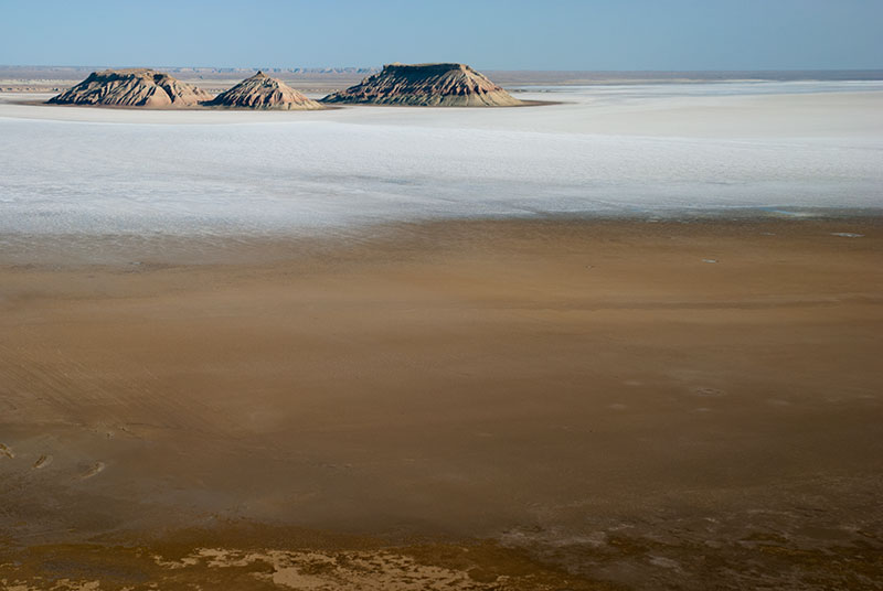
Three Brothers, Lake Kendirlisor, Mangystau Region, Kazakhstan
The view across the depression is simply awesome; one of the most impressive sights I can remember seeing for many years. Perched on the cliff-tops 180 metres above the depression, I have an expansive view of Lake Kendirlisor, which now in mid-summer is a stunning expanse of white salt, grading at its edges into brown silt. On this salt pan are a number of islands looming in the heat haze like floating icebergs but in fact remnant chunks of the Ustyurt Plateau, eroded into beautifully fluted, conical forms of multicoloured banded rock. The heat is fierce, and so I lay my Sindhi ralli (a multicoloured quilt), given to me by a holy man in southern Pakistan six years ago on the shady ground, lying half under the truck, waiting for the sun to lower towards the horizon. The location is utterly remote, and after a tough drive of 216 kilometres from Beket-Ata, during which I have not seen a single person or moving vehicle, it’s both thrilling and slightly terrifying to be here. As the evening cools slightly, there is a spectacular sunset across the depression and I lie in nothing but my underpants on the back of the truck, listening to music under a sky filled with stars, in glorious, perfect solitude. With the experiences of the last few days; staying with Asset and his family, joining the pilgrimage to Beket-Ata, and now having this truly awesome natural wonder at my feet, all to myself, I can say that I’m really living my dreams, living life as I want it to be.

Road to Turkmenistan, near Kendirli, Mangystau Region, Kazkahstan
In the morning, after a perfect night’s sleep, I watch the light change over the depression as the sun rises, though leave before the heat and haze become too much; whilst the evenings and nights here are spectacular, the daytime must be miserably hot and totally shadeless. It’s 161 km of desert tracks to reach Zhanaozen, much of the time in deep bull-dust, where I must either close the windows and watch the temperatures rise above fifty degrees, or allow a constant stream of dust to enter the truck. I’m very relieved to reach civilisation in the afternoon in Zhanaozen, and spend the night with Asset and his family once more.
In the morning I head south, to what feels like the utter end of Kazakhstan. Soon after passing the beach at Kendirli, the asphalt ends and the track becomes an atrocious mess of hard, pounded mud, perhaps the worst road I can remember driving on. After an easy exit from Kazakhstan at the Temir Baba border, I spend the night in no-man’s land waiting for my five-day transit visa for Turkmenistan to begin, parking the truck in the long line of Iranian trucks waiting to enter Kazakhstan. The Kazakhstani border guards here are very kind, bringing me out cold water and a meal of grilled chicken and bread. I’ve often wondered which of the five Central Asian republics of the Former USSR is my favourite, but after this latest visit, I can firmly say it is Kazakhstan.
Stage 33 – Ukraine, Russia & Kazakhstan: To The Edge Of Europe

Two and a half years have elapsed since I returned to the UK on the 1st December 2011, after my initial trip of four and a half years, and my life has changed considerably in this time. My return was rather painful, arriving at the onset of a dismal British winter, and living once again in one place; going from a life filled with adventure and new experiences, to one with seemingly none. By February 2012 however, I had secured a place on a Masters degree programme studying geophysics at Imperial College, including a full industrial scholarship. In April, in between teaching myself basic university-level mathematics, I lead a brief tour to the North Caucasus for a UK-based adventure travel company and by June 2013, returning from a month-long field trip in the mountains of Colorado, I found myself in The Hague, Netherlands making my own research project as an intern at the head office of one of the world’s largest oil companies.
As unexpected and exciting as all this was, nothing could ever really compare to the thrill and deep, spiritual fulfilment of travelling, and I ached to be back in my old lifestyle; to be free, to meet new people in faraway places and explore yet more parts of Eurasia where I had never before set foot. I was offered a job in October 2013 and gladly accepted, but deferred my start date to December 2014. The first seven months of this period were spent completely restoring the truck on a a nut-and-bolt level, emerging in June 2014 in like-new condition. Now was my chance to fill-in a few blanks which had been omitted, usually for lack of time, from the initial four and a half year Odyssey; the eastern shore of the Caspian, the mountains of Iran, the entire countries of Turkey and Armenia, the Azerbaijani exclave of Nakhchivan and the Kurdish administered regions of northern Iraq. Thus I set off on the 2nd June 2014, the very day I finished rebuilding the truck, taking the ferry from Dover, spending a couple of days with friends and family in Germany, and then heading east through Poland towards the Ukrainian border. For the next five and a half months I would be back in my old traveller’s lifestyle, though rather than having an indefinite amount of time and an uncertain future, I now had a fixed time period and a potentially long-term career to follow.

Polesian Forest, near Kovel, Volyn Region, Ukraine
It’s late in the night on the 5th June 2014 as I cross the Bug River, leaving Poland and the EU and re-entering Ukraine at the Yahodyn border crossing where two and a half years earlier I had ended my initial trip on a cold November night. I clear Ukrainian customs in the early hours of the next morning and stop for the night after a few kilometres, glad to be on the road again and back in the Former USSR. Later, I drive east on a good, quiet road running roughly parallel to the Belarussian border, passing through the southern edge of Polesia, which presents a gently beautiful landscape of rolling arable land and patches of undisturbed forest, between villages of quaint and sometimes decorated single-storey houses and telegraph poles crowned by storks nests. The road remains tranquil until it turns south-east towards the Dnieper River and the capital, with traffic building as I approach the satellite city of Irpin’. Once I am within the city limits of Kyiv, I join the recklessly speeding local traffic along the rough but wide avenues heading directly for the centre, amongst high-end late model SUVs; matching my experience seven years ago to the day, when Kyiv was the first city which I would visit in the Former USSR.

Independence Square, Kyiv, Ukraine
My host in Kyiv is Peter, a New Yorker who last year was my mentor whilst working as an intern in The Hague, who has since been transferred to Kyiv where he lives with his Ukrainian wife in a luxurious top-floor apartment in the very heart of the city. Just as my own life has changed in the three years since I was last in Kyiv, so has the world around me. In February of this year Ukraine witnessed a revolution in the heart of the capital, a European-backed revolution against long-standing government corruption, which saw dozens lose their lives and the Ukrainian president flee to Russia. Peter and I walk a few blocks from his apartment to the central Independence Square (Maidan Nezalezhnosti), after which the ‘Euromaidan’ revolution was named. Although now calm and peaceful, the once beautiful square and surrounding streets are filled with tents, piles of tyres, rubble and sandbags, with much of the paving having been ripped up by protestors. Men mill around in fatigues and there is an atmosphere both of protest, celebration and tragedy, with colourful political posters and sombre, candlelit shrines with boards of photos of the deceased and disappeared.
Peter and his wife run a small art gallery in the city centre where we take in a classical music concert, before going for a short walk around town. Away from the recently troubled streets of the very centre, Kyiv is exactly as I remember it from my very first impressions of 2007; a beautiful, exuberant, hedonistic city of wealthy young men recklessly driving expensive vehicles, and of startlingly attractive women. It’s a city which likes to show its beauty and wealth without restraint, though which has just enough sophistication to prevent it feeling outrightly vulgar.
Fields, near Rossosh, Voronezh Region, Russia
Kyiv is merely a stopping point however on my journey to the Caspian Sea, and so I must leave Peter’s good company (and comfortable apartment) and continue east. My initial plan had been to enter Russia from Luhansk, the easternmost region of Ukraine; however the events following Euromaidan have forced me to alter my itinerary. I therefore set off towards the north-east of the country, driving on a road which deteriorates soon after leaving Kyiv to the point of being thoroughly appalling as it passes through occasional, tumbledown villages and fields gone to seed. By mid-afternoon I am close to the city of Sumy, and turn south-east towards the Russian border on more terrible roads, through villages which look to be heavily depopulated. Given the state of the countryside, and the ever-growing conflict between Ukraine and Russia, I begin to wonder whether the border crossing will be open. When I arrive at the redbrick customs building in the fields beyond the village of Velyka Pysarivka, I am the only vehicle, but find the border to be fully operational and cross into Russia without issue.
Houses, near Akhtubinsk, Astrakhan Region, Russia
In addition to a very friendly welcome by the Russian customs officers, I have an immediately positive impression of Russia whose smooth roads, neat villages and large-scale mechanised agriculture seem decades ahead of what I had driven through earlier in the day. I stop in Belgorod just long enough to find an ATM and fill the truck up with fuel, and after a side trip to buy car insurance at a larger nearby border crossing, I leave the city’s busy Saturday-night streets and head east into the night. I drive into the small hours on moonlit provincial roads which cross the gently undulating, softly carved limestone river valleys of southern Russia. After a few hours of rest I continue through the seemingly endless rolling fields of the country’s agricultural heartland, detouring around Donbas in the very east of Ukraine where, following the Russian annexation of Crimea, a nascent civil war has broken out with tacit Russian support, little more than a hundred kilometres south of the tranquil fields and small farming towns through which I am passing. By late morning I reach the M4 Highway, which connects the central cities of Russia with the Black Sea Coast and is busy with holiday traffic, then turn east on the M21 towards Volgograd. Here the landscape slowly changes, becoming drier and scrubbier, and the climate hotter. I cross the wide Don River on a high bridge near the town of Kalach on Don, and before long reach the rough suburbs of Volgograd.

Cows, Ganyushkino, Atyrau Region, Kazakhstan
I choose to pass through Volgograd and cross the Volga Dam, which feeds Europe’s largest hydroelectric station in the north of the city, then drive east and south along the Akhtuba River, a left distributary of the Volga which flows roughly parallel to it, all the way down to the Caspian Sea. Very quickly the landscape becomes the barren, dry steppe of Central Asia, but the proximity of the damp, fruit-growing strip of land between the Volga and Akhtuba gives rise to terrible swarms of biting black-fly, which aim straight for ones ears, eyes and nostrils, and make getting out of the truck a chore, spoiling what would otherwise be a very pleasant night of camping. So bad are the blackfly that I must brush my teeth in the truck, then drive for a period at full speed with the windows slightly open in order to blow them all out, then seal the windows before coming to a halt and spending an uncomfortable night in the airless and sweltering cab of the truck. The road along the Akhtuba passes several points of interest; Kapustin Yar, where the Soviets first tested rocket technology before the construction of Baikonur Cosmodrome, and the proposed sites of both Old and New Sarai, successive capitals of the Golden Horde who subjugated Russia from the thirteenth to fifteenth centuries; both great cities of the medieval world, but both long-destroyed and rather enigmatically vanished, almost without trace.

Bactrian Camels, Atyrau Region, Kazakhstan
After following the Akhtuba for more than four hundred kilometres, I touch the very outskirts of Astrakhan and turn east, crossing a number of minor Volga distributaries, with the very last of these, the Kigach, forming the border with Kazakhstan. The border crossing is straightforward though tedious in the sweltering heat and amid swarms of blackfly, though by early afternoon I’m on the appallingly potholed road east towards the city of Atyrau. Outside the small town of Ganyushkino I stop to watch some cows wading in a pond next to the road, lazily grazing at the thick layer of water lilies on the surface, only to attract the attention of two young Kazakh men lying on the grass nearby. One starts to shout in a way which seems somewhat aggressive, though it is clear he is extremely drunk and, as he fumbles to put on his trousers, collapses into a deep muddy puddle, much to my amusement.
Very soon after Ganyushkino the last traces of greenery disappear and I enter a true wasteland of lifeless, parched, salty plains along which a row of electricity pylons march into infinity. Nothing else breaks the monotony aside from a group of scraggly Bactrian camels, and a weather-beaten nineteenth century pyramidal border marker, but the road steadily improves and by the late afternoon I reach the unlovable city of Atyrau, poised on the Ural River on what is notionally the very edge of Europe. Four days and almost 2900 kilometres after leaving the Poland-Ukraine border, and almost 5400 kilometres from my start point in the UK one week earlier, the truck satisfyingly plastered with the crushed bodies of hundreds of blackfly, I stop with my old friend Akmaral, with whom I stayed twice in 2011.
I’ve reached my entry point into Asia; from here I will slow my pace considerably and begin to explore in detail the western shore of the Caspian, crossing the remote deserts of Mangystau and western Turkmenistan, both areas which I have long-wished to visit.
