
Stage 10 – India & Nepal: Central Himalaya [1/2]
The Himalaya, or the ‘abode of snow’, arcs across the continent marking the collision zone between the Indian Subcontinent and the rest of Eurasia; it is the world’s greatest mountain range. But the Himalaya is far more than just a large accumulation of mountains; it divides the continent, a physical and cultural border between the Indic societies of the fertile lowlands to the south, and the Tibeto-Burman societies of the high deserts and grasslands to the north. The Himalaya has fundamentally shaped life as we now see it in the Indian Subcontinent; all the great rivers of Pakistan, India and Bangladesh – the Indus, the Ganga, and the Brahmaputra to name just the largest – all flow from this vast swathe of highlands. As they do so, they transport not only water, but huge quantities of alluvium, bringing fertility to the Punjab, the Gangetic Plain, and Bengal, which in turn have nurtured the rich societies I’ve recently passed through. But in one way these awe-inspiring peaks have united people, for the cultures of both sides; the Hindus of India and the Buddhists of Tibet, revere the Himalaya as the abode of the gods, of various Himalayan deities, with the holy Mount Kailash (in Tibet) the very navel of the world.
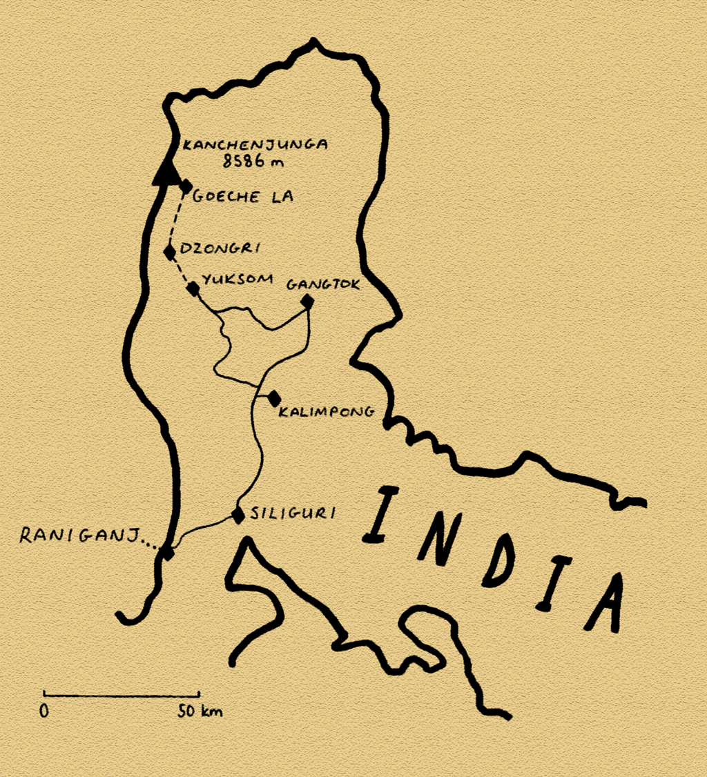
My return journey across the Indian subcontinent will take me across the Himalaya, past the world’s highest mountains, and over the main crestline of the range onto the Tibetan Plateau in the far northern reaches of India. But the Himalaya is not just a collision zone for tectonic plates; here Asia’s greatest powers face each other, the political machinations of which will affect my route. The insular kingdom of Bhutan will be beyond my reach, as will the vast plateaus of Chinese-occupied Tibet. In the western Himalaya, my natural progress west will be impeded by the tense cease-fire line between India and Pakistan in an area which has been disputed since the very formation of the two countries. Regardless, my journey will take me through what is quite possibly the most beautiful region of the world, and will provide a very different physical and cultural background to that of the subcontinent’s lowlands.
Teesta Valley, Sikkim, India
We return to our journey on the 16th May 2008, and I’m moving west in an environment still very different from the great heights of the Himalaya. Having crossed the Brahmaputra, I’m driving west through stifling heat, out of Assam and into the north-eastern reaches of the state of West Bengal. The landscape, intensely green, lays dormant in the torpor of the worst of the pre-monsoon heat. I pause for the night in the unremarkable city of Alipur Duar, a town so little visited by tourists that I’m wholly unmolested by the usual parasitic touts and beggars of India. But in this torrid heat, all my thoughts are focused on escaping to the mountains. My destination is the tiny Indian State of Sikkim, once an independent Himalayan kingdom before being merged into British India, remaining a British protectorate until merging with India in 1975. It’s a small, rocky salient of India wedged between Nepal and Bhutan, and touching Tibet. However, by mid-morning I begin to feel rather drowsy and weak, and must take frequent rests just from the little effort of driving. At one stop, where I leave the car to purchase a bottle of water, I must lean on the car for support like a drunk. I make it in the afternoon to the Gurkha town of Kalimpong, where I collapse into a hotel room and rest for three days of fever and at times mild delirium.
Kalimpong was a Hill Station in British times, a place where colonial administrators would retire from the fierce summer heat of the lowlands, exactly as I have done. It sits in the very southern reaches of the Himalaya, just a few kilometres from the border of Sikkim, but it isn’t until the morning of my departure that the clouds finally part, and I have an inspirational glimpse of a brilliant-white ridge of snowpeaks in the far distance.
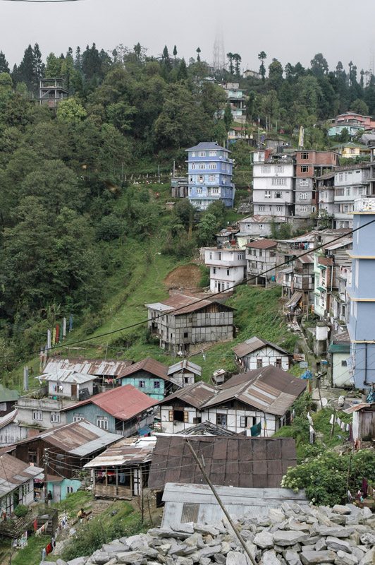
Following my recovery from this mysterious fever, I re-join the busy road which runs high above the frothing grey-white waters of the Tista River, the only road to the state capital. Gangtok is a mildly attractive city, situated in cool, green hills and consisting of multi-storied buildings perched on the steep land astride the main road. Its only really striking aspect is just how much cleaner and more organised it is than the rest of India, and I make the mistake of parking my car on the otherwise empty main road.
Gangtok, Sikkim, India
My reason for visiting Gangtok is to organise a trek high into the restricted mountains of Sikkim, in order to get close the holy mountain Kanchenjunga which at a height of 8,586 metres is the third highest in the world, the easternmost of the fourteen ‘eight thousanders’, and the highest in India. As the area is a restricted border zone, it’s necessary to take a licensed guide, so I approach a few trekking agents in the hope of joining a group which will depart soon. Due to the arrival of the monsoon season, which blocks mountain views with vast daily barrages of cloud and rain, I’m unable to find a group to join, and must contemplate the expense of taking a personal guide and porter. I wander the streets for a short time, until I spot another foreigner and ask straight out if he’d like to join me. His name is Duncan, British, twenty-nine, and we soon agree to leave on a trek as soon as possible. And thus began a deep and lasting friendship.
I return to the car after lunch with Duncan, only to find a crude clamp on one wheel of the car, fastened with a small padlock which looks to have come from a Christmas cracker. My initial temptation to prise it off is tempered by a nearby grinning policeman, and I am shocked to find that there is a rather steep five-hundred rupee fine. I wish to appeal, as there is no sign nearby which states parking is forbidden, but the chief of traffic police, a pompous and unpleasant brute of a man, tells me the notification is at the state border, and upon protest, bellows ‘IF YOU WISH TO TAKE THE CASE ANY FURTHER YOU CAN WAIT TWO YEARS WHILE I IMPOUND YOUR VEHICLE!’ In four and a half years on the road, this would be the only traffic violation I paid for. I would never have predicted this to be in India.
Pemayangtse Monastery, Sikkim, India
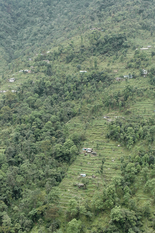
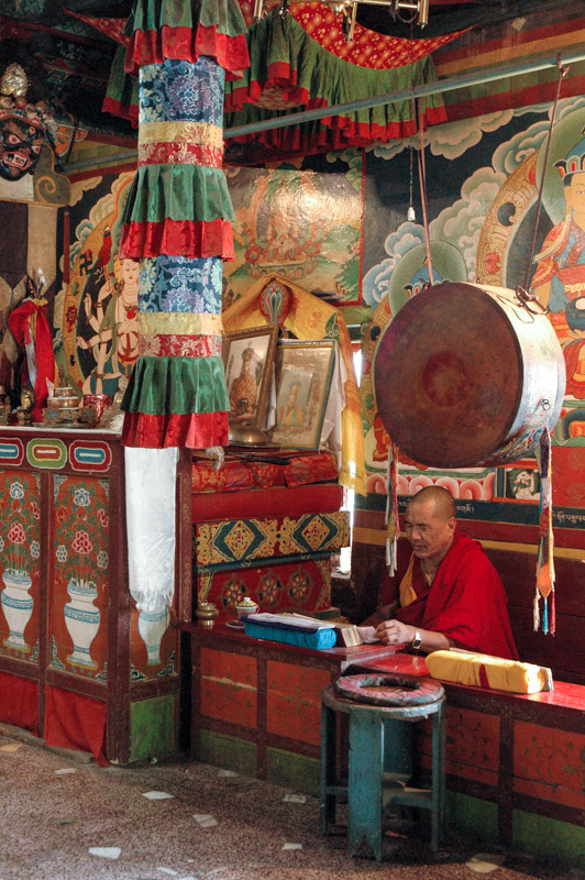
Next day Duncan and I drive across the centre of Sikkim on narrow, winding roads which cross valley after valley of steep, lush, green terraced hillsides, dotted with simple whitewashed homesteads which exist in stark isolation on the roadless slopes. We make a stop at the 18th century monastery in Pemayangtse, one of the most important monasteries in Sikkim. Despite being relatively close to the Bihari plains where the religion was born, the monks of this monastery, like virtually all monks of the Himalaya, practice the Mahayana school of Buddhism. In contrast to the earlier Theravada school, this later and now more popular school of Buddhism made the journey west out of India, through the Khyber Pass into Afghanistan, up across Central Asia and back east into Tibet, where it crossed the Himalaya into Sikkim before spreading further east to China and Japan.
The monastery is a striking building, typical of Himalayan architecture; of square plan, whitewashed with a two-tiered yellow pagoda roof. Around the perimeter fly tall prayer flags of red, green, yellow, blue and white cotton, printed with prayers which the faithful believe will be taken around the world by the action of the wind. The interior of the building, which has the unmistakable smell of butter lamps and burning juniper branches, is decorated with rich frescoes of fantastic Himalayan deities, a beautiful artistic rendition of the great powers which local communities believe inhabit the mountains.
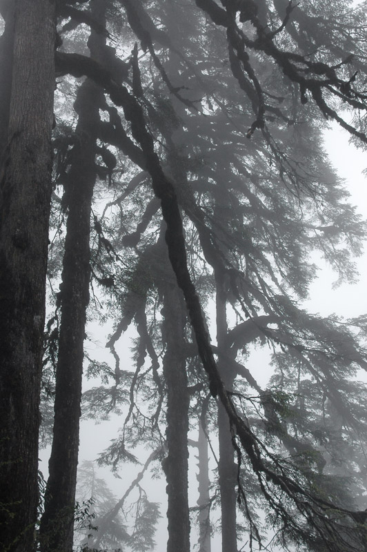
Cloud Forest, near Tshoka, Sikkim, India
So twisted and torturous is the road from Gangtok to our trailhead at Yuksom, that a straight-line distance of less than forty kilometres requires a road trip of almost 150, and takes much of the day. In the evening, we reach the very end of the road, and enjoy our last evening in the comfort of a hotel. We are introduced to the delights of a Himalayan drink known as chhaang. It arrives as a small bamboo barrel known as a dhungro, and a kettle of boiling water. The dhungro is filled with slightly fermented millet, into which one pours the hot water to make an instant alcoholic drink, the taste of which is somewhere between malt beer and fortified red wine. One dhungro of chhaang per person is certainly enough for the whole evening.
The trek starts at a leisurely hour the following morning, under steady rain. Duncan and I have our Gurkha guide, Bob, as well as three Butiya (Tibetan) ‘yak boys’ who are leading two huge yaks which carry our kit. The first two days are a steady climb in the patchy rain; occasionally the clouds will part just sufficiently to reveal the far side of the valley; a verdant, untouched jungle of dark, damp cloud forest. We pass tiny, isolated settlements of simple, subsistence farms which lie in small clearings in the tall-tree forest. The blocky whitewashed stupas which mark high-points of the trail, surrounded with damp prayer pennants seem almost organic in this Himalayan landscape. On the second day, as we climb to four thousand metres, the trees become shorter and the forest thins and blends into rolling dark green hillsides of wild rhododendron as we approach the mountain hut at Dzongri.
Prek Chu Valley, near Thansing, Sikkim, India
I am not a fan of needless physical exertion. My motivation for trekking lies purely in the prospect of seeing scenery which is not accessible by other means. The actual exertion, the physical challenge of walking up mountains, in itself holds no appeal for me. The first two days therefore, are rather dull and unrewarding. Bob, our guide, at times looks rather worried at our progress, and expresses doubts that we will make it to the ultimate destination of the trek, the Goecha La, a 4,920 metre pass at the foot of mighty Kanchenjunga. Whilst I am in no doubt as to my physical ability to reach the mountain, I have nagging worries that on the entire nine-day trek we will be walking through this endless, miserable cloud, and not catch a single glimpse of the world’s third-highest mountain which lurks just beyond. My morale is therefore boosted somewhat when, at sunset on the second day, from a low peak just next to Dzongri, the clouds finally part to reveal distant, snow-flecked mountains. Not the big one, but inspiring nonetheless.
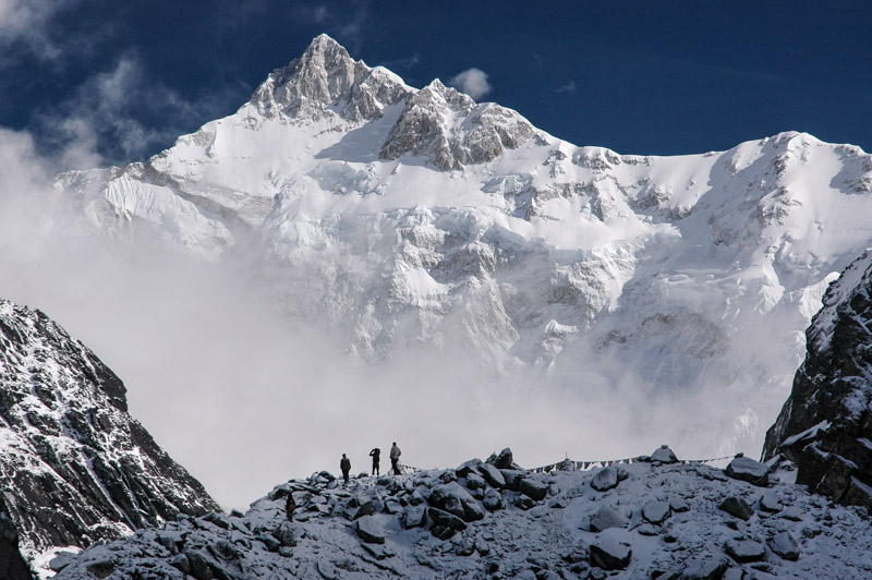
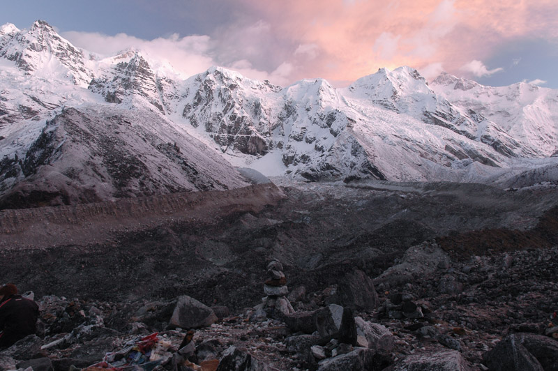
Kanchenjunga (8586 m), Goeche La, Sikkim, India
The third day is an acclimitisation day, trekking in thick, low cloud to a murky grey lake and back in order to give our bodies an extra day at this slightly rarefied altitude of four thousand metres. Our destination on the fourth day is Thangsing, a wide meadow upon which the yaks are let loose to graze. It is from here that we will make our attempt at 01:00 the following morning on the Goeche La. Bob complains unconvincingly of being ill – unless laziness is an illness – and tells us he’s sitting out the final leg. Nevertheless, as we stumble out of our four-thousand metre hut into the freezing night, our spirits soar when we see a clear night full of stars, and we make good progress up the valley and onto a moraine. The sky is illuminated in vivid pinks at dawn, and we soon see that we are surrounded by a vast amphitheatre of sublime mountain scenery. But the pink clouds are a warning of impending cloud cover, and it’s a race against the power of the monsoon to reach the Goeche La before all views are obscured. It’s a tough march in the thin air, but we reach the final pass at around 07:00, just as the first clouds begin to rise. The view is utterly magnificent; despite standing at very nearly five thousand metres above sea level, Kanchenjunga soars more than three-and-a-half kilometres above us, a solid wall of snow-covered glaciers and rock, occasionally showing its real light grey colour where the face is too steep for snow to settle upon.
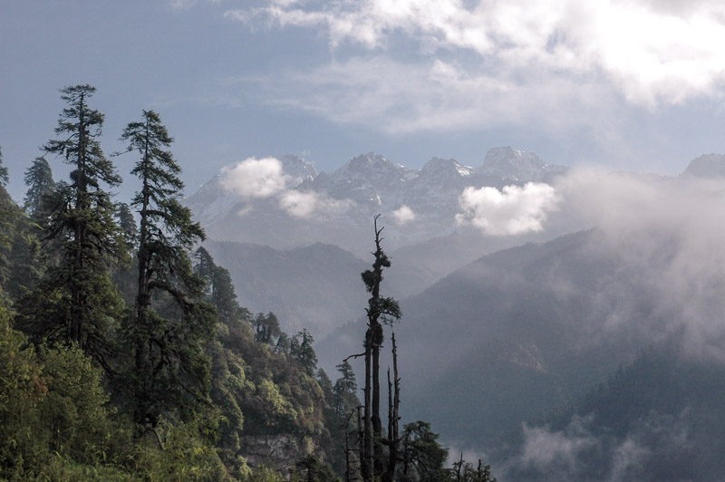
Kanchenjunga Himal, near Tshoka, Sikkim, India
We make a side trip to beautiful Lam Pokhari Lake on our return from Thangsing to Yuksom, which lies on the edge of a mountain, beyond which to the south the land falls away and is covered in a soup of monsoonal cloud. While the lake is not especially spectacular, its setting on the edge of an unseen abyss echoes of the edge of the world. The reality is slightly less spectacular, though it’s amazing to think that from this ledge, the whole of India unfolds, stretching out in front of me all the way down to the Indian Ocean. Clouds and rain accompany us on our descent back to Yuksom, though our bland diet is enriched when we come across a dead yak, whose solid meat sustains us for two days of yak for breakfast, lunch and dinner. We spend three days relaxing and drinking chhaang in Yuksom in an orgy of laziness before heading south once again.
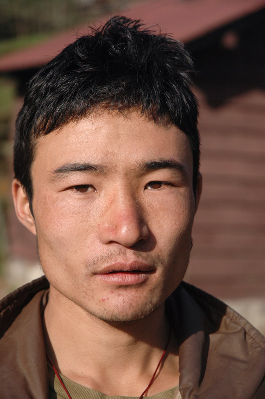
Butiya Man, Tshoka, Sikkim, India
Extracting ourselves from our post-trek lassitude, Duncan and I, with our fifteen-day ‘Restricted Area Permits’ about to expire, drive out of Sikkim and back onto the torrid plains of India, where the monsoon has arrived in earnest. Here, we’ll stay with Marcus, a German whom I had met in Romania on the outward leg of the trip. Marcus lives with his partner and two small children in the West Bengal town of Siliguri, where he works as a consultant for sustainable tourism. Siliguri is a busy transit bottleneck located in the ‘chicken’s neck’ of India, a narrow strip of the country which squeezes between Nepal and Bangladesh to connect the seven outer north-eastern states to the rest of India. It’s not a town of any specific appeal, though we enjoy good food and company, smoking bidis (small natural Indian cigarettes) on the veranda while the monsoon rains pour down. Duncan soon departs by train for Kolkata, from where he will head to Mumbai and then back to England (I will meet him again in Tashkent in November 2009), but I, enjoying the unusual European company (and cooking) of Marcus and his family, stay in Siliguri for a week of further relaxation.
On my first attempt to leave Siliguri and enter Nepal, I fail even to reach the border crossing as there’s a bandh (strike-cum-demonstration) over rising fuel prices. In South Asia, one had better not attempt to drive through such a bandh, unless one wishes to have one’s car set on fire, and so it’s not until the following day that I cross into the far south-eastern corner of Nepal, and drive in one long day to the capital, Kathmandu.
Stage 9 – Bangladesh & India: The Hill States [2/2]

On the 6th May 2008, exactly one year into my trip, I leave Bangladesh and enter India for the second time, into the north-eastern state of Tripura. I hand my passport to the immigration officer, open at the page of my new Indian visa, only to watch him for three minutes carefully write down the details of a long-expired Kazakhstani visa, which sits opposite the Indian visa in my passport. After he has written a number of details into his ledger, including that fact my Kazakhstani visa had expired ten months ago, I tell him we are in India, not Kazakhstan. This is definitely India.

Tripuri Man, near Agartala, Tripura, India
But this India, in the town of Agartala, capital of the tiny state of Tripura, is quite different from that which I left one month earlier. Though most people here are Bengali, the atmosphere is slightly different from West Bengal; policewomen are directing the traffic from elevated platforms, and women are digging the roads at the edge of town. Men move around town on motorcycles, wearing dark blue hard-hats. I stay a night in this otherwise nondescript town, and leave the following morning. Annoyingly, due to perceived security hazards from the tribal communities who inhabit the jungle either side of the north-bound road, it is necessary to travel in convoy, one which crawls up and down the narrow road in clouds of dust and diesel smoke, and makes only 150 kilometres of progress all day. The terrain here is similar to that in the Chittagong Hill Tracts, though the ridges are far less steep and pronounced. In the afternoon, thoroughly sick of the convoy, I break off in the town of Kumarghat, and find a hotel to rest in. Like Agartala, the town is mostly Bengali, and of no specific interest, but while having dinner in a small restaurant, I am approached by a man of non-Indian appearance. His name is Biakthanga, of the Darlong tribe, he lives in the nearby village of Darchawi, and he invites me to visit him in his village the following day. I of course, accept.
Darchawi, Tripura, India
I arrive in Darchawi late next morning, and am welcomed by Biakthanga, and introduced to his wife and three children, Joseph, Ismael and Job. Like all Darlong, a Tibeto-Burman tribe closely related to the Mizo, they are Christians. The Darlong were reached by Welsh Protestant missionaries in the 19th century, and by 1911 were all converted. It strikes me here that, despite having travelled through very traditional areas, of Muslims, Sikhs, Hindus and Buddhists, it is only Christians in my experience who feel a pressing urge to impose their faith upon others. Biakthanga tells me there are still Catholic missionaries in the region, though he doesn’t approve of them: ‘I don’t consider them real Christians; if I do wrong, I pray only to God, I don’t confess to a priest who is also a human being. It is my belief, not my actions which will take me to God. Catholics do a lot of good things, no doubt – schools, hospitals, aid – but ultimately they are to buy people. This you cannot do. Faith is in your heart; if I tell you something, you must consider it. If you believe it, that’s your choice. There should be no compulsion by money; this is Earthly redemption, not spiritual redemption.’
Like many Asian Christians, Biakthanga and his wife find it surprising, and clearly disappointing, that I am not a Christian. ‘You must let Jesus into your life!’ she tells me, though with a smile.

Reang Woman, Darchawi, Tripura, India
Darchawi is a large village, almost entirely Darlong, but is less traditional than settlements of a similar size in the hills of Bangladesh. Judging by the lack of lowland people, it seems that there are stricter limitations on prospective settlers here. All around the village are fields of fruit; lychees, pineapple, betel nuts, coconuts and jackfruits. Biakthanga takes me for a walk through these fields, where his wife is at work clearing a field (he works in the village as a schoolteacher), and down into some clearings in the jungle, where there are familiar looking elevated wooden houses of the Reang tribe, whose women wear elaborate jewellery. It’s a great pleasure to walk here and meet people, but the small villages feel far less ‘untouched’ than those in the Bangladesh forests near Thanchi.
One morning, a bell rings out, and I’m told that this signifies a death in the village of an old Darlong man. In this hot, humid environment, and without the possibility of refrigeration, funerary arrangements are dealt with quickly, and in the mid afternoon, the village shops are closed, and mourners, mostly female, come to observe the body of the deceased one final time. They hold prayers, and sing traditional Darlong songs. A grave is dug at the edge of the village, in the rich, red-brown earth of the deceased’s family’s land where tea, pineapple and rubber are growing. The coffin is brought from the village to the burial site, accompanied by howls of anguish which turn into uncontrolled shrieks of grief as the bereaved catch one final glimpse of their departed relative, while the nails of the coffin lid are driven home. There will be a formal wake; a dinner cooked tomorrow, to which the entire village is invited.

Darlong Woman, Darchawi, Tripura, India
In an attempt to escape the stifling heat and mosquitos indoors, I’m sleeping in the fly-net of my tent on the flat roof of Biakthanga’s house. I’m woken at around 05:00 by a very excited Job (Biakthanga’s youngest son), who tells me ‘They’re going to cut a pig!’, and in the otherwise quiet dawn, I can suddenly hear the unmistakable screams of a pig. We make our way over to the deceased’s compound, where the poor beast that is going to form the basis of today’s lunch, a huge pig, is being rather slowly dispatched. Instead of making a clean, swift cut across the animal’s throat, here, the pig’s blood is prized, and so the animal is killed by a sharpened bamboo stick being gouged into the heart. Three men must stand on the poor animal at times in order to hold it down in its throes of agony, but after perhaps ten minutes, it expires, and is swiftly butchered. I’m not a squeamish person, but when the butchers pull out the pig’s football-sized bladder and throw it out into the street, disgorging it contents only to immediately be carried off by a waiting dog, I decide it’s time to retire back to my tent. Little Job is transfixed by the bloody scenes.
I feel far sturdier by lunchtime, and the whole village is coming to the town hall where a squad of cooks are watching over six large pots of bubbling pig stew. It’s a nice chance to see the entire village, but the highlight is the food. Despite having witnessed the poor animal’s demise, the food is a great treat, especially for a pork-lover who has been so long in pig-hating Muslim and vegetarian Hindu countries.

Tea Plantation, near Silchar, Assam, India
From Darchawi, I move north out of Tripura, across a small corner of Assam, and into another of India’s tribal states, Meghalaya, whose name aptly means ‘the abode of clouds’. The state occupies a knot of highlands which branch off the easternmost ridges of the Himalaya, and lie immediately to the north of the sweltering lowlands of Bangladesh. As huge, moist bodies of air coming off the Bay of Bengal move north and hit these uplands, vast quantities of rain are released. Officially the wettest place in the world, it can rain almost continuously during the impending monsoon season, from June until September.
As would be expected, the hills of Meghalaya are lush, emerald-green, and the road winds across deeply incised valleys and over rocky passes. As there is so little flat land, the settlements are few, but towards evening I stop in the village of Chiehruphi which is located in the damp, cloudy Jaintia Hills of eastern Meghalaya. As I settle down for the night in a clearing near the church, where the air is alive with the sound of insects, lizards and frogs and dotted with dancing fireflies, two young men appear, surprised to see a European striking a tent on the back of a truck. They are of the Khasi tribe, the majority group in Meghalaya, a modern, matriarchal tribe. They invite me to their home for a cup of tea. The house is typical of the region, a squat, single storey dwelling with a heavy, sloping roof. What takes me aback though is that I’m greeted by the woman of the house, who asks me all the normal questions; where I am from, if I have a family, what the purpose of my trip is, and so on. Her husband, in a complete role reversal to virtually all other homes I’ve visited so far in Asia, sits meekly in the corner, twiddling his thumbs. It’s a strange, though memorable experience.
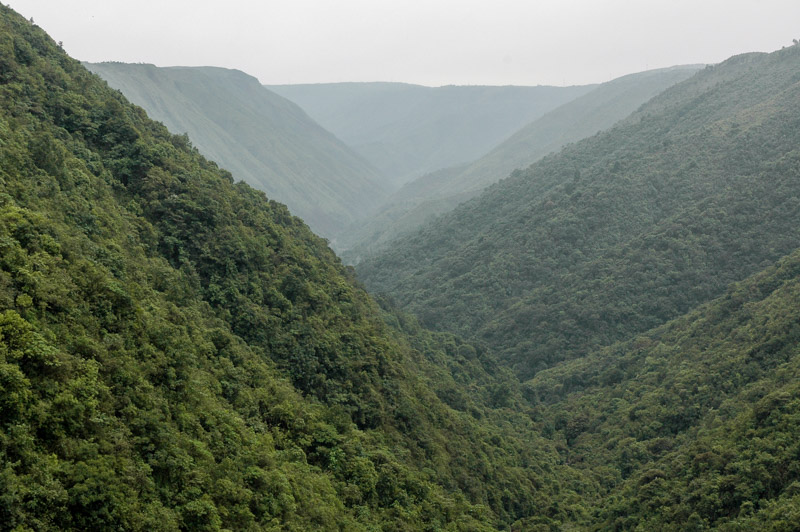
Khasi Hills, Meghalaya, India
Next day, I drive west over a wide plateau of rich green grass, dotted with stands of fir trees, which at times looks almost like a golf course. During British times, the state was nicknamed the ‘Scotland of India’. Passing the state capital, Shillong, I turn south, crossing a 1,800 metre pass through pine-clad hills, before gently descending along the side of a wide, gaping canyon filled with lush vegetation and small swirls of cloud. A steady drizzle descends, and the forest gives way to a damp, undulating grassy plateau, occasionally dotted by megaliths, the gravestones of long-forgotten dead. My destination is the town of Sohra, better known as Cherrapunji. Once officially the wettest settlement on the planet, the town has since relinquished its title to Mawsynram in the next valley, but for a long time retained the world record for the highest rainfall in one year, a staggering 22,897 mm in 1861. The town has a distinct end-of-the-world feel to it, perched on the edge of this sodden plateau, overlooking the plains of Bangladesh which one may glimpse through the haze, more than a kilometre below.
Sitting in a small café in Cherrapunji, above the hotchpotch bazaar where traders are permanently installed in polythene covered sheds against the perpetual rain, I look out on a landscape which looks more like Scotland or Mongolia than any part of India I’ve ever seen. I get chatting to the café owner, about, naturally, the rain. ‘Once, in 1987, I remember it rained for seven days and nights, without even a minute’s break. In the rainy season, all your clothes are wet, we try to dry them over a small burner, but they never really dry, and they stink. You can’t see anything, there’s fog everywhere!’ I like Cherrapunji; it’s uncrowded, quiet, hassle free and friendly, and I feel sufficiently unharassed to camp in the middle of town.

Nohkalikai Falls, Cherrapunji, Meghalaya, India
Early in the next morning, I drive a little way into the nearby Nohkalikai Falls, which with a single drop of 335 metres is one of the highest in India. The waterfall can be seen from a plateau, overlooking a vast green canyon surrounded by a number of plunging waterfalls, a landscape intensely cut and scarred by the action of huge volumes of water. I leave the car on this plateau, and descend into the jungle on a steep, rocky path cut through the intense undergrowth of the jungle. I’m looking for a very unusual piece of engineering down in the jungle, though I’m not too sure of how to find it. As I descend, the temperature, cool and fresh on the plateau, starts to revert to the close, steaminess of the lowland jungles of Bangladesh. I cross a few rivers, of clear, blue-tinged water cascading over large, timeworn pink granite boulders. Under the tree canopy, rocks are covered in shimmering mosses, and occasional orchids grow amongst creepers.
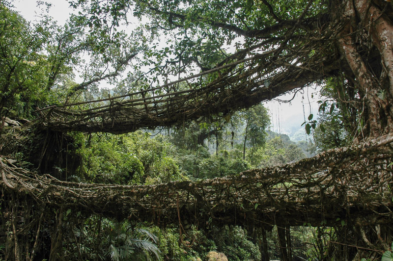
Root Bridge, Nongirat, Meghalaya, India
After a few hours, I find what has drawn me down into this damp, shady world of greenery, near the bottom of a small jungle waterfall just before the tiny Khasi settlement of Laitkynsew; a two-tiered footbridge made from living tree roots, stretching sixteen metres across a rocky riverbed. It’s an astounding piece of bio-engineering; the roots of one huge banyan tree, which naturally emerge above ground and hang down into the river channel, have been stretched in two sections right across to the far bank, where they have naturally anchored into the soil for over a hundred years. The bridges are amazingly stable, far more so than equivalent rope bridges, though every part of the bridge, with the exception of some walking boards, is natural, living tree; there are no cables, posts or struts.
Exhilarated by having found this bridge, deep in the Meghalayan jungles, I make my way back slowly to the car, jumping into clear, blue pools of cool, fresh water on my way. I camp up on the plateau that evening, a wonderfully cool, tranquil night.
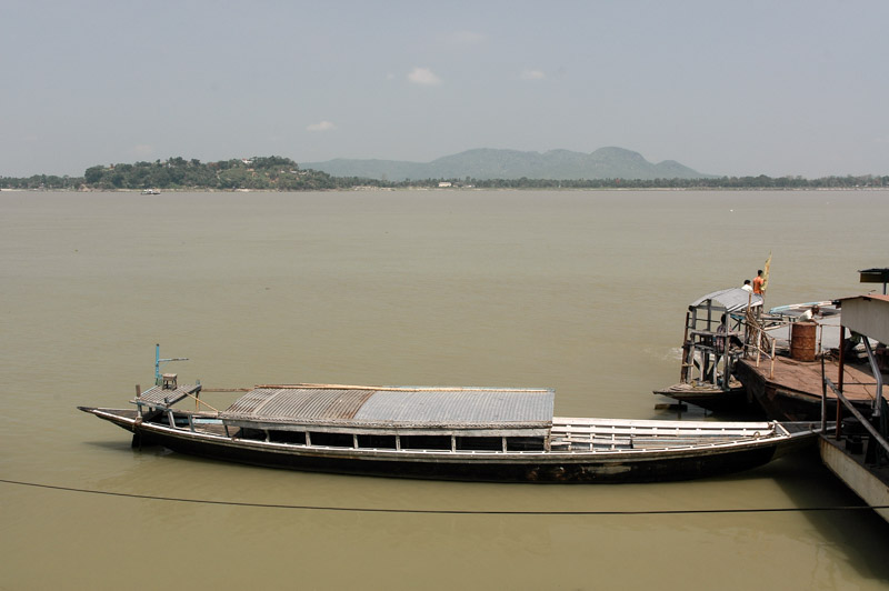
Brahmaputra River, near Guwahati, Assam, India
Next morning, I begin my journey back down to the sweltering lowlands; though I pause in the capital Shillong once more. The Khasi youth of Shillong, all wearing western clothes and listening to western music, certainly seem to look to the west, rather than to their lowland countrymen, as a cultural influence. The bruised, dark sky of low clouds threatens rain, and I enter a roadside restaurant for lunch. There’s a printed menu, wood-panelled walls, and a smell of faint cigarette smoke and spilled beer. The whole place feels eerily like Britain.
It’s a long, slow descent into Assam, where the roads become terrible, the air hot and muggy, and full of voracious mosquitoes. The Assamese seem an exotic blend of Indo-European and Tibeto-Burman people – the girls are especially attractive – but the crowds, noise, filth, stares and beggars leave me in no doubt that one has returned to India; rather a shock after the cool, tranquil and uncrowded hills of Meghalaya. I leave Guwahati, crossing the greyish waters of the Brahmaputra and head west on broken roads through the impoverished Assamese farmland, towards the Himalaya proper.
Stage 9 – Bangladesh & India: The Hill States [1/2]
 On the 25th April 2008, I leave my slice of paradise, the tropical island of St Martins, return to the mainland, and begin the long return journey back across the Indian Subcontinent. As I drive north, the hills which rise to my right represent the beginning of what is geographically, culturally and ethnically Southeast Asia, an area I’ve never had much interest in visiting. However, a tiny sliver of the hills are politically part of Bangladesh and India, and their indigenous tribal inhabitants are known as Adivasis (non-Indo Aryan tribes). In India, there are six entire states which cover this buffer-zone, but here in Bangladesh they occupy a narrow belt of north-south ridges in the east of Chittagong Division, which are known as the Chittagong Hill Tracts. I was drawn to these hills by the thought of jungle walks to remote tribal villages, and by their reputation as being dangerous, one which deters many foreigners from ever visiting them.

Rakhine Woman, Lama, Chittagong Division, Bangladesh
The Chittagong Hill Tracts are inhabited by indigenous Tibeto-Burman tribes, who have moved into these far-western reaches of Southeast Asia over the past centuries. At the time of partition, the area was roundly expected to be ceded to India, along with all other hill states, but the Radcliffe Line left them in Pakistan. This marked the beginning of a long period of tension between the native tribes and Bengali settlers who move up from their traditional lowland environment to farm the slopes of the jungle. Following the King of the Chakma tribe siding with Pakistan during the country’s independence struggle, tensions escalated to an outright insurgency which lasted from 1973, until a peace accord was reached in 1997. The Hill Tracts remain officially, and temptingly ‘dangerous’.
My destination for the night is the small market town of Lama, which sits on a low ridge, around twenty kilometres into the hills. The majority of the town’s inhabitants are previously landless Bengali settlers, who often clear the forest to cultivate tobacco, or engage in illegal commercial logging. There are also plenty of Southeast Asian faces here; principally members of the Marma (or Rakhine), Chakma and Mro tribes. The police, who naturally are Bengali, let me park the truck and sleep in the garden of their thana (police station). I’m not sure if it’s out of kindness or suspicion. They are certainly keen to know what I’m doing, and one of their numbers accompanies me into town in the evening.
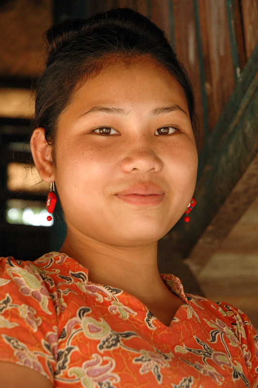
Rakhine Girl, Lama, Chittagong Division, Bangladesh
I express an interest in seeing some of the town’s tribal people, but we rush through the area of Lama in which they live (the ‘village’, as my Bengali escort calls it), whilst he leers at the beautiful, uncovered Marma women. Soon we are at a Bengali cinema where my police host seems perplexed that I don’t wish to watch the two hours of over-amplified screeching and gratuitous violence that constitute most Bengali films. The evening is rounded-off when he orders himself dinner and cigarettes at a nearby restaurant, where I am to foot the bill.
The next morning starts off far better, as I’m given permission to move freely within the town. I go straight back to ‘the village’ and have a look round. The area is filled with very distinctive wooden houses with thick hardwood frames, elevated on stilts above the ground. The walls are usually bamboo mats, a little like Japanese tatami, but are sometimes made from hardwood planks. In larger houses, there may be a first floor balcony, and all have large sloping roofs to deal with often torrential rain. The area directly under the living quarters is often used to keep livestock in, generally pigs, or they may be used as an open, shady daytime seating area. Women play an obvious role in public here, and dress freely, wearing elegant flowery dresses and showing long, beautiful glossy-black hair. Many of the younger women are extremely attractive, and the older women, who often sit around smoking home-made cheroots or large pipes, are openly chatty.
My presence here causes some interest, though not the vacant, bovine stares which are so common, and so trying of one’s patience, here in the Indian Subcontinent. Instead, I’m introduced to a young Marma man, Maung-Maung, a Cox’s Bazaar University student who is visiting family in the village, and speaks good English. Maung-Maung and a friend of his invite me into one of these elegant houses, for a delicious lunch of fresh, crisp greens, wild potatoes and rice, and tell me a little about their people. The Marma are a branch of the greater Rakhine tribe, who hail from the state in Myanmar of the same name, having first settled in the area in the sixteenth century when the area was part of the Arakan Kingdom. They make up the second-largest tribal group in the Hill Tracts, and are almost all Buddhist.
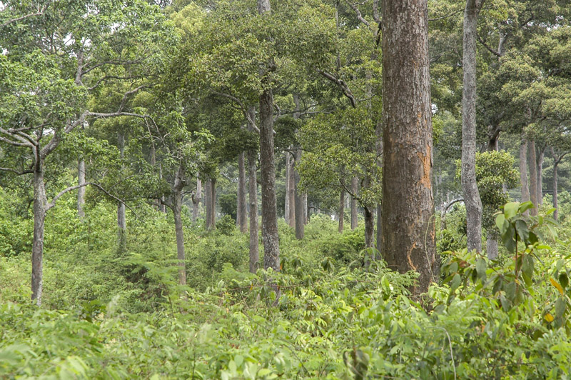
Forest, near Cox’s Bazar, Chittagong Division, Bangladesh
After lunch, Maung-Maung accompanies me to the nearby town of Ali Kadam, which after initial concerns the police agree to, though I am met by four (Bengali) police officers when I arrive, three of whom are armed with sub-machine guns. It seems faintly ludicrous to walk around the peaceful villages of such warm and gentle people with a group of gunmen, but I don’t wish to push my luck at this stage, and the officers are relaxed and keep their distance. At the far end of the village, at a Buddhist monastery where children are being given a free (secular) education, I am introduced to a middle-aged man named Sawraza. He’s a Burmese ex-freedom fighter, who having seen his mother and father killed in Rakhine State in 1988, fled into Bangladesh. Although things are far from perfect here, it’s preferable to open persecution by the military junta government of Myanmar. He tells me he is a Burmese language correspondent for the BBC, and with the money he earns, he has built this school and temple for local Marma children who would otherwise not receive an education.

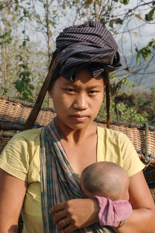
Chak Woman, Idgarh, Chittagong Division, Bangladesh
Maung-Maung, seeing my interest in his home region, invited me back to his family house in the village of Idgarh, a little further north from Lama towards Chittagong, and a few kilometres off the main road. Maung-Maung’s family welcome me in their large, elevated wooden house, which is made entirely from high-quality hardwood. There are three rooms inside, a long first-floor balcony, and a large shady veranda underneath. His mother cooks some local delicacies; wild pig which had been caught by hunters in the jungle, and is absolutely delicious, tortoise, which is a little like beef, and pigeon, which tastes like gamey chicken, with banana shoots and rice. In the evenings, I drink powerful locally made rice-wine with Maung-Maung’s uncle on the balcony. I can’t believe my luck.
Away from the police, I’m free to wander the village and its surroundings with Maung-Maung, and visit some nearby settlements of both Marma and Chakma tribes; kind, friendly and inquisitive tribal people. Some of the tribes in the region are matriarchal, and for the first time since leaving Russia, I’m in a society where men and women enjoy equal (though different) roles. Many of the women I meet, often smoking huge pipes filled with rough home-grown tobacco, are confident and engaging, and show none of the timidity or terror normally found in South Asian women. Despite my great affection for Asia and great respect of Asian social mores, strict gender segregation is something I have never been able to see as anything other than negative and regressive.

Mro Priest, Chimbuk, Chittagong Division, Bangladesh
Local Bengalis traditionally look down upon these tribal societies, and admittedly, the Bengalis have a far longer and richer historical legacy. But I soon observe that the tribal villages I’m staying in, despite sometimes being even poorer, are more pleasant than nearby Bengali villages, or indeed any villages I’ve yet seen in the subcontinent. They are cleaner, with very little litter and no festering pools of rubbish and human excrement. There are no beggars, and no feral children rooting through garbage piles and sewers. The villagers don’t stand rigidly and stare blankly at me, and are dignified and industrious. The houses may be spartan, but they are clean and tidy. This doesn’t seem to be related to economics; people here just seem to be able to lead dignified lives within their means; real beacons in the squalid sea of the subcontinent’s tens of millions of poor. Perhaps for being comparatively simple, or not having a long contact with religion, these tribal societies have far less prejudice than their lowland neighbours; there is equality between genders, between rich and poor, educated and ignorant, disabled and able-bodied. Women can wear garments practical for work which show off their femininity, and men can go about their lives bare-chested, and may wear shorts.
Maung-Maung is a great example of this difference in mindset. As a child, he contracted polio, and was left without the use of his left arm. Traditionally, in subcontinental society, this would most likely relegate him to a life of begging. But his father, who was neither a rich nor educated man, saw that Maung-Maung was the brightest of the children and together with extended family, collected enough money to send him to university. After all the squalor and socio-religious prejudice of the last few months, being in this gentle society, communicating with both halves of the human race, eating pork, wearing shorts, I feel it’s the kind of place I could stay for a few months.

Road to Thanchi, Chittagong Division, Bangladesh
I wish, however, to make a journey deeper into the Hill Tracts, far from the main road and Bengali settlers. I don’t know how far I’ll need to go to do this, but I select Thanchi, the last town on the map, less than twenty kilometres from the Myanmar frontier, and Maung-Maung asks to accompany me as a guide. We set off in the morning, climbing steadily, through Mro villages perched on high, exposed hillsides from where they practice their traditional slash-and-burn shifting cultivation. We reach a pass at about 750 metres above sea level; quite an elevation for a country which is otherwise very nearly flat. The view from the crest is magnificent; to the west, the sky meets the Bay of Bengal somewhere in the hazy distance, while to the east is a breathtaking view of endless emerald-green ridges unfolding to a distant mountain range marking the Myanmar border.
Chakma Woman, near Thanchi, Chittagong Division, Bangladesh
We descend into the jungle, negotiate through the army checkpoint at Balipura, soon after which I catch a glimpse of topless Mro women walking in the jungle. A few kilometres further we reach the Sangu River, on the banks of which lies the town of Thanchi. I make my presence known to the local police, who after initial surprise are friendly and accommodating, though they clearly intend to keep a close eye on me. I’ve not felt a hint of tension in the Hill Tracts, let alone anything remotely close to danger, and I’m becoming more suspicious and resentful of the police attention. Nevertheless, I’m allowed to wander in Thanchi during daytime.
This distant jungle outpost is a hub for the surrounding villages, and boats buzz up and down the slow, muddy waters of the Sangu River, which connects the isolated hill communities. Though there is a (currently) small Bengali minority, much of the town is of local tribes, who live in traditional wooden houses. What really interests me however, are all the trails which lead out of town into the hills, to distant and isolated hill villages.
To that end, the following morning, Maung-Maung and I slip out of the thana on the pretences of going for breakfast, then sneak off into the jungle, climbing in the growing heat up the steep, dry hillsides. The traditional slash-and-burn agriculture which the tribes practice leaves patches of the jungle burnt and naked, but never over-exploits a particular area beyond regeneration; a truly sustainable way of life. We climb up and down ridges on well-worn paths for around two hours, until we reach a Mro village. The first reaction of the children, who are playing in the cleared area between the houses, is to flee, screaming. I feel like a real Victorian explorer; for all I know, I might be the first European they’ve ever set eyes upon.

Mro Woman, near Thanchi, Chittagong Division, Bangladesh
The Mro are perhaps the oldest of the tribes inhabiting these hills, but they are, for want of a better word, often quite primitive. We approach one of the village houses, into which many of the children fled, and meet the woman of the house, Tsiumrho. She is also timid at first, but Maung-Maung soon reassures her that we are just curious visitors. The house is made from bamboo canes around a simple wooden frame, with walls of woven bamboo-leaf. Inside the house is nothing modern, with the exception of a gas lamp and a few bars of soap. On a shelf are two dry, blackened cow heads. The family use hollowed-out gourds to store water, and banana leaves for fans. She complains that there are large numbers of rats this year, which will eat the rice and vegetable crops, particularly when the rainy season begins, during which the crops cannot be harvested. In the house are no instruments of timekeeping; no clocks or calendars. Some Mro tribes, such as this family perhaps, have no concept of time, other than the passing of the seasons.
Although a few Mro have adopted aspects of Buddhism or Christianity, they are overwhelmingly Animist, worshiping three deities; Turai, the creator, Sangtung, the spirit of the hill, and Oreng, the river deity. Their mythology, the Mro say, goes some way to explain why they are culturally quite simple, in a story as follows: God sent the Mro ancestors their scriptures, written on banana leaves, along with clothes for their women to wear. The messenger however, paused to bathe in a river on his journey, only to find on his return to the riverbank that his divine luggage had been consumed by a cow. The sacrifice of a cow, in the annual Kumulong, or ‘cow stabbing festival’ is an act of revenge upon the hapless beast which caused them to be without a formal religion, and their women traditionally half-naked. The cow heads in this family’s house are, I imagine, something akin to a souvenir from past Kumulongs. Interestingly, a new religion seems to be emerging among the Mro, known as Cranna, though with its emphasis on a single god, and weekly prayers on Sundays, many see this as an insidious type of proto-Christianity planted by missionaries who have traditionally had little success with the Mro.
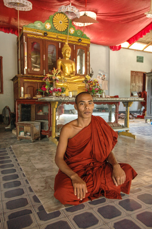
Rakhine Monk, Thanchi, Chittagong Division, Bangladesh
After this interesting break, we trek further into the jungle, looping round towards the river, and encounter a small Marma village of houses made entirely from bamboo canes. A number of male voices can be heard from one of the elevated bamboo dwellings, and after making some enquiries Maung-Maung signals that we’ve been invited in. In the single-roomed, elevated bamboo hut are half a dozen Marma men, who invite us to join their dinner of bamboo shoots, prawns, banana plant, wild potatoes and rice. One of the men is another former freedom fighter from Myanmar, who fled across the border in 1979, leaving behind a family with whom he no longer has contact. They are extremely surprised to see me here, and tell me that it was just three kilometres from here that a Bengali NGO worker was kidnapped (though later released unhurt) last year by ‘hill men’. In response, the Bangladeshi Army arrested the entire male population of a nearby Mro village, four of whom have never been released. I later heard from Joyanta (my host in Dhaka) that the entire incident was staged by the Army. It seems clear that the country’s authorities are keen to maintain the dangerous reputation of the Hill Tracts in order to keep outsiders away. It’s a convenient cloak for the continuing encroachment of lowland settlers and their destructive agricultural practices into these tribal lands, which the government seems to do little to stop. I ask the men their opinion of their neighbours. They tell me that they live with, and respect the Mro, though they admit, with little prejudice, that the Mro are uneducated and backward. On their Bengali neighbours however, they are clear: ‘They are taking our land’.
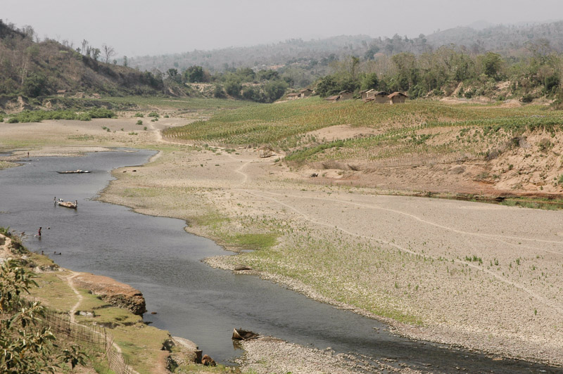
Sangu River, Thanchi, Chittagong Division, Bangladesh
Returning to Thanchi in the late afternoon, we’re in a spot of trouble with the police, and I’m assigned a guard who watches over me all evening as I strike my tent and prepare to retire for the night, saying hotly ‘You no reporting to thana!’ every time I catch his gaze. A huge, distant cumulonimbus rises above the hills of Myanmar to the east, its towering head illuminated in flashes of pink, silent lightning. I lie back and cherish the day’s experiences; my forbidden view of what may be a fast-vanishing way of life.
In the morning I’m woken by the azan (Muslim call to prayer), normally a beautiful sound echoing at dawn through the great cities of the Islamic world, it sounds out of place in this remote jungle town. Maung-Maung and I leave in the morning, heading towards the district capital of Bandarban. On the way, we stop in a Bawm village to eat a jackfruit, a huge, spiky, green-yellow fruit, the interior of which consists of a delicious, slightly slimy flesh which tastes like something between a mango and a pineapple, one of the best tasting fruits I have ever eaten. Bandarban is a hectic, uninteresting place filled with Bengali settlers, but just beyond the northern outskirts of the town lies a striking piece of Buddhist architecture, the Burmese style Buddha Dhatu Jadi, or Golden Pagoda. I’m welcomed here by an English-speaking Chakma monk, who, after my expressing an interest in his beliefs, tells me a little about Buddhism.
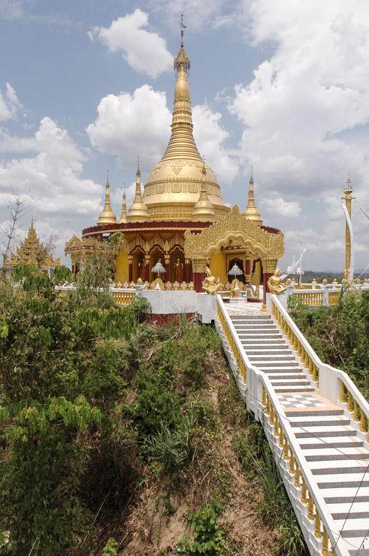
Buddha Dhatu Jadi, Bandarban, Chittagong Division, Bangladesh
For the first time, I hear someone talking about their religion (if Buddhism may be called such) without any hint of zeal. Buddhism, he tells me, is not theo-centric, but homo-centric. It does not concern itself with speculation as to the nature of any god, but concentrates on the individual. Though many Buddhists worship the Buddha, this is not the main aim of their faith, not a path to enlightenment. The monk shows me a quote, said to come from the Buddha himself, which is perhaps the only piece of religious scripture which has really caught my eye:
‘Do not believe in anything simply because you have read it. Do not believe in traditions because they have been handed down for many generations. Do not believe in anything because it is spoken of and rumoured by many. Do not believe in anything simply because it is found written in your religious books. Do not believe in anything merely on the authority of your teachers and elders. But, after observation and analysis, when you find that anything agrees with reason and is conducive to the good and benefit of one and all, then accept it and live up to it’ – The Buddha
I come away from my whole experience; meeting Maung-Maung and staying with his family, trekking out to remote jungle villages, and finally sharing thoughts with this Buddhist monk, deeply spiritually enriched. These gentle jungle communities seem to be the antithesis of all the stresses and prejudices of the subcontinent as a whole. I feel deeply privileged to have met Maung-Maung, and finally bid him farewell on the main road. He will return to his village, while I will begin my trip north, and then west across the Himalaya.
