
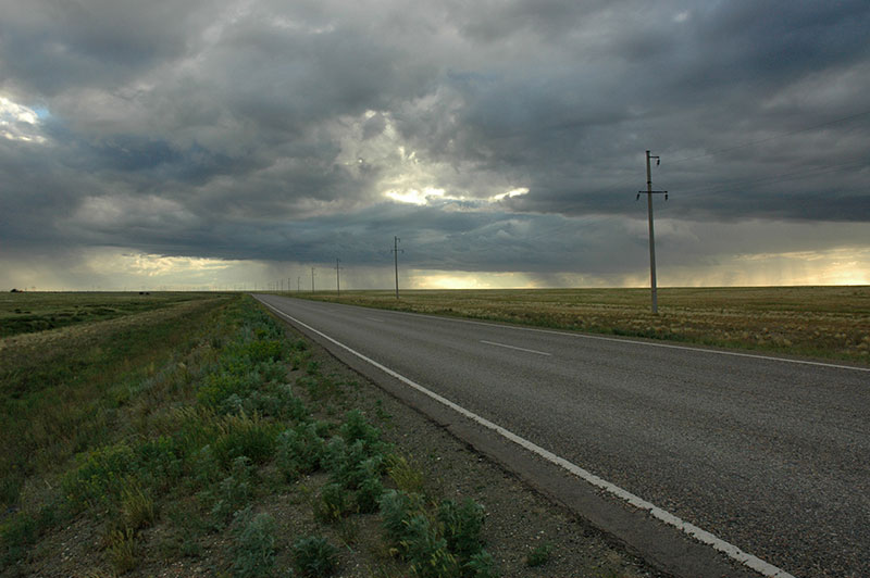
Stage 22 – Russia & Mongolia: Altai To The Gobi Desert [2/3]

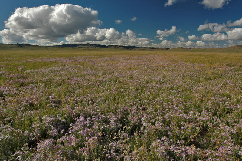
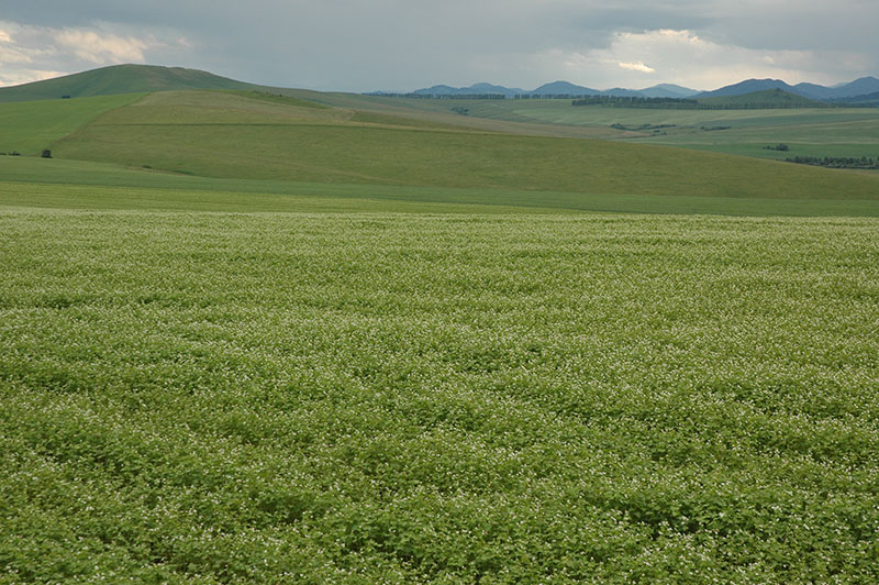
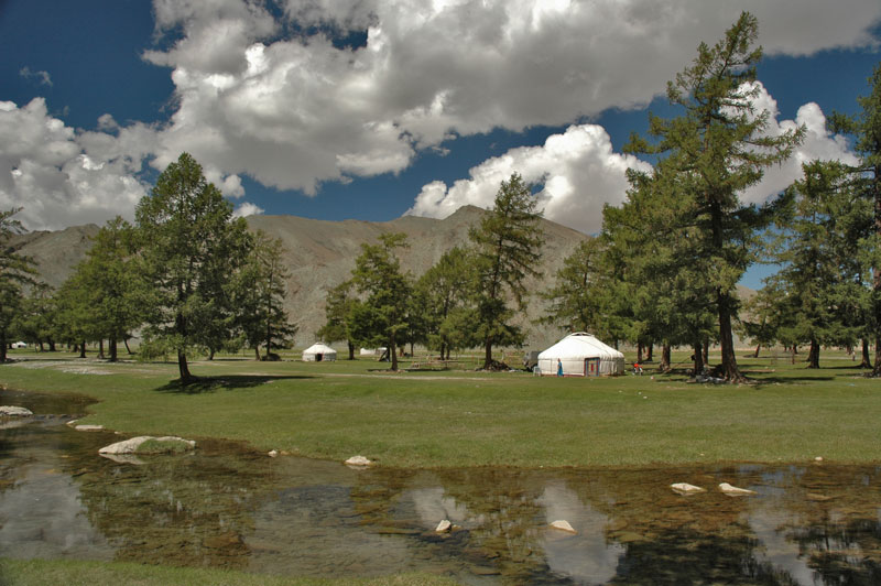
It’s the 28th July 2010 and alongside my new-found travel partner Jacob, I drive south out of Ölgii on what is known simply as the ‘Southern Route’, a mostly unpaved road (often just sets of parallel vehicle tracks) which loops through southern Mongolia, fringing the Gobi Desert on its way to the capital. Climbing steadily out of town, we reach a high, dry plateau from which the mountains start to recede to the west, leaving us on a raked red-orange gravel plain. To the south is the turquoise and saline Tolbo Lake, and in the background the twin peaks of holy Mt. Tsambagarav with their sensual saddle-like glaciers, marking the border with Khovd Province. I am again deeply impressed by the diversity of breathtaking landscapes which one finds in the Altai region.

Tolbo Lake, Bayan-Ölgii Province, Mongolia
In the tiny sum (district village or ‘town’) of Tolbo, which consists of a few dozen mud-brick houses and yurt-compounds arranged loosely on the gravel plain, Jacob and I are introduced to the provincial guanz, a small no-frills eating house serving the very sparse passing traffic. It’s a rather unsavoury room in a hut, reeking of years of mutton fat. There is only one dish on the menu: tsuivan, consisting of a greasy bowl of grey-brown chunks of fatty, gristly mutton and simple hand-cut noodles. It’s a truly un-appetising dish to which our palates never became accustomed, though the locals seem to relish it. Often the only alternative we could rely upon would be dry, bland biscuits (which we soon name sheep-shit biscuits), or a mixture of instant noodles and Russian tyushonka (tinned meat) which is little improvement on the local cuisine. For much of the time that we camped in the Mongolian wilderness, eating would become a matter of survival rather than pleasure. Finding a decent meal would be a joy that we might talk about for days after.
With hunger staved off, we leave the Southern Route as it turns east towards Khovd, and proceed due south, aiming for the south-western corner of the country. Here the land becomes slightly watered once more, which means we loose the smooth gravel plain and must proceed slowly over very lumpy and sometimes muddy tracks. Like eating, driving in Mongolia often also goes from being a pleasure to an endurance test. In the late afternoon we arrive in the rather scruffy sum of Delüün where we brave another bowl of tsuivan, before camping near a river just south of town. At 2150 m elevation, it’s a rather damp and cold evening, but it’s nice to meet the curious though unintrusive local Kazakhs who come over from their nearby yurts to check us out and give us onward directions.
Next day we set off early, crossing a wooden bridge and then climbing up into a bleak wilderness of craggy hills. We’re heading south down a narrow corridor in the extreme west of the country, with the mountains on our right forming the Chinese border. It’s far less attractive than the parts of Altai which I have recently passed through, and is almost unpopulated. We do see however our first yaks, with their long grey, brown or black woollen coats somehow confirming the harshness of the environment. We also see the winter homes of the Kazakhs (who are generally only semi-nomadic); small wood and mud homes at the base of towering mountains. It’s hard to imagine how harsh life must be in these windswept valleys, where winter temperatures may hit -40ºC. We climb a 3100 m pass, and as we would often do, begin to wonder if the track is really going to the destination we have in mind. We reason that the track must be going somewhere, and the bearing is good, so we press on.
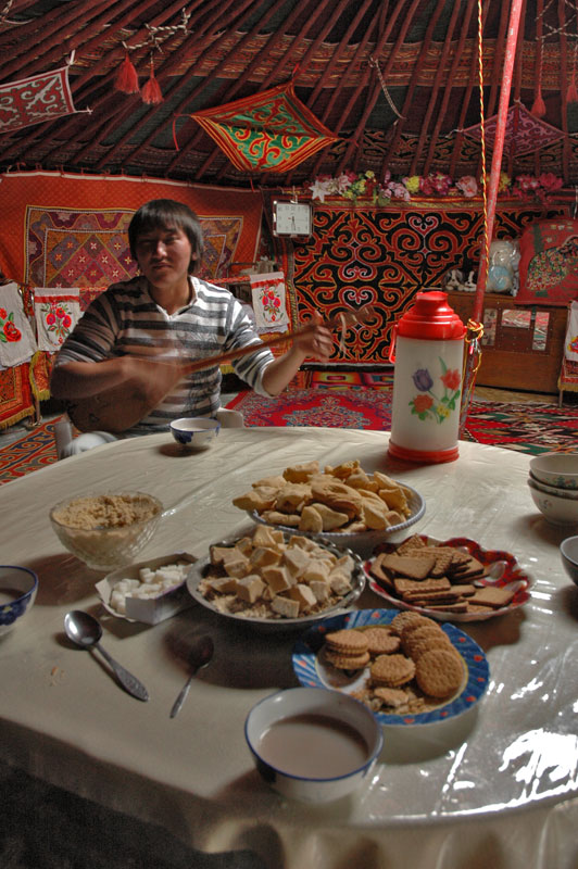
Kazakh Dombra-Player, Bulgan, Bayan-Ölgii Province, Mongolia
We are very happy then, after spending the entire day driving just 130 kilometres, to reach the pleasant sum of Bulgan, located on the green banks of the meandering Bulgan River. After having a late lunch, we meet a Russian-speaking Kazakh from Astana in Kazakhstan who invites us into his family’s yurt (which is located in a yard outside their house). Here for the first time I get a real glimpse of Kazakh culture, as it would have been in what is now Kazakhstan prior to the ruthless Soviet collectivisation of the early twentieth century.
The Kazakhs of Western Mongolia have maintained a traditional existence, moving into this harsh, mountainous region from their homelands to the west and south in order to escape waves of persecution and forcible settlement over the last 200 years, from both the Chinese and Russian (later Soviet) authorities. With the fall of the Soviet Union, many Mongolian Kazakhs chose to move to Kazakhstan, enticed by President Nazarbayev’s oralman (returnee) policy which offers them incentives to settle. Of these however, many chose to return to Mongolia, perhaps missing the traditional way of life, disillusioned with the urbanised and often Russian-speaking society of modern Kazakhstan. We are invited to sit at the dastarkhan, a table spread with several types of biscuits and hard cakes, as well as traditional Kazakh bauirsak, (deep-fried pockets of dough) and Chinese flasks of tea. We drink the milky tea from wide bowls, while out host plays a short number on a dombra, a traditional Kazakh lute. After two days of nothing but hard driving, it’s a wonderful cultural experience.
We camp that night at the riverside but draw the attention of a pleasant, though drunk and slightly deranged Mongol who unceasingly mimes his intention to join us on a motorcycle the next day, twisting his clenched right hand and making loud revving engine noises until we drive off and camp a few hundred metres downstream. We leave in the morning, heading south to another Bulgan, this one in Khovd Province and in the far south of the country. The track is rough, but the scenery beautiful, following the Bulgan River along wide bends lined with tall elms and poplars. At one point the track simply ends, and we enter the river – not a conventional river crossing – but must simply drive in the river, through knee deep water, until we are faced by a glistening wet, muddy and extremely steep bank up which it seems we must drive. I have serious doubts that it is possible, but in low-range first-gear and 4WD, the truck admirably clambers up without the slightest hesitation. For a few kilometres the track consists of a narrow ledge cut from the rock, which is almost impassable in places, even with the truck’s formidable clearance. At times Jacob has to marshal me along at a crawl; sometimes we simply have to build a section of the track by re-arranging the rocks. Eventually however, the land drops and opens into a wide floodplain, a sea of swaying reeds and tall grasses. After so many days in the cold mountains, the air is balmy and I am almost overwhelmed when we reach a brand new, smooth asphalt road which leads the final few kilometres to Bulgan.
Bulgan is more like a town than anything we have seen since leaving Ölgii, with brisk trade from the nearby Chinese border. We get very excited when we spot (and smell) a guanz with Chinese lettering on the front and receive a delicious meal of Chinese-style lamian, hand-made noodles with meat and vegetable broth, with real, fresh chillies. Jacob and I gorge ourselves like half-starved animals while the ebullient cook and proprietor somehow, despite us not having a word of language in common, tells us that he is a Chinese-Mongol, who has left his native Xinjiang Province of China in face of persecution from the authorities. He also gives us a lecture in Kalmyk history and becomes almost tearful when I produce some pictures of my recent visit to Elista. True to Chinese form, he attempts to overcharge us for the meal, though it hardly detracts from the experience and we camp outside town in the pleasantly warm evening, rounding off a nice day with some Korean beer.
Mongol Girls, Altai, Khovd Province, Mongolia
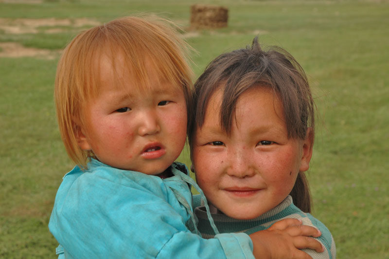
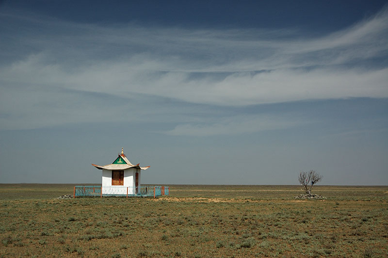
We are on the fringes of the Gobi Desert, and in the morning we set off (after noticing we have been sleeping right next to a rubbish dump) east on the new asphalt road. We stop for lunch in Uyench, continuing on alternating stretches of perfect asphalt and dusty desert track, until the asphalt road starts bearing off-course. While Jacob snoozes, I head off road, towards a distant track which I can see to the south. Passing the tiny and almost abandoned-looking sum of Altai, we reach a grassy riverbank where a clear river cuts across the desert from its source in the mountains to the north. After days on the road without a bath, we both strip-off and jump in, lavishly washing ourselves in the cold water and braving wretched horse-flies with large, iridescent compound-eyes. On the far side of the meadow is a Mongol ger (yurt), where a family has been watching our strange antics. We go over to ask directions and meet our first Mongol family; husband and wife with four young children. The smell inside is a rather strong mixture or human and animal odours, but the family are immediately hospitable and generous, and we are offered tea, sweets and yoghurt. A television, powered by a solar panel and car battery, and receiving a signal from a rather incongruous satellite dish beside the ger is playing, showing not violent Chinese films or Bollywood drivel, but images of cattle and horses being ridden on the steppe… pretty much what could be seen by just peering out of the door. The man gives us directions to continue on the asphalt road which I had earlier left, miming that one can drive along it at great speed, and we say goodbye after our accidental encounter with the almost intrinsic hospitality of the Mongolian steppe.
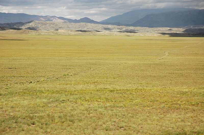
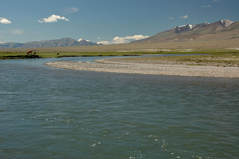
Great Gobi ‘B’ Strictly Protected Area, Govi-Altai Province, Mongolia
We follow the asphalt until the road turns decisively north and then find a track leading off to the east, towards the national park we are aiming for. Near the junction is a lone ger, advertising itself as a guanz. We step inside and mime to the rather perplexed family inside that we want food. They set about preparing pasta and cooking meat; the eldest daughter squatting above a board rolling out the dough whilst farting with impressive force and regularity. The family pay no attention, but Jacob and I have to walk outside to laugh. The father of the family shows us to an outhouse behind the ger offering it to us as a place to stay, though it turns out to be a reeking room full of half-decayed animal parts. We decline and I pitch the tent on the back of the truck. After more than an hour we indicate once more that we want food, and suddenly two small cups of tsuivan are handed over; not the food which was being prepared, but food which had been ready all along. We eat the small portions and then decide to leave rather than wait for anything more. We ask how much we should pay, which seems to confuse the woman who initially waves us off. We ask again, and then (more through confusion than avarice I imagine), quotes an outrageously high sum. We baulk, upon which the husband clenches his fist angrily. We leave a standard amount for the meal, and depart, driving a couple of kilometres down the road to camp at the roadside where we crack open a small bottle of ’emergency vodka’ and erupt in uncontrollable laughter at the utter strangeness of our encounter. This would be the first of numerous incidences where it seemed there was far more than just a language barrier between ourselves and Mongolians.

Przewalski’s Horses, Great Gobi ‘B’ Strictly Protected Area, Govi-Altai Province, Mongolia
It rains in the night and we set off early the next day, heading south-east on tracks of black gravel through a landscape of desert greened by lush, tall grass from the unseasonable rain. It’s very remote, almost trackless country and we have to ask some miners for directions, but in the early afternoon we drop out of the mountains and reach the headquarters of Great Gobi ‘B’ Strictly Protected Area. I had not imaged that the Gobi would be a damp plain of endless green grass, backed by jagged black mountains but it’s a stunningly wild and remote location. We have the luck to meet Werner, a German retiree who lives in the capital and is accompanying a guest to the national park. He not only arranges us a free place to stay in a comfortable ger, but also sends his guide to take Jacob and I out to see the star attraction of the park: some extremely rare specimens of Equus ferus przewalskii, or Przewalski’s Horse, the only extant sub-species of the true wild horse, ancestor of all modern domesticated horses (including feral horses often mistakenly called ‘wild’). Extinct in the wild, a breeding program of captive animals led to their being re-introduced into the wild here in one of their native habitats. With the population of around 300 animals decimated by the zud (extremely harsh and snowy Mongolian winter) of 2009/10, less than 100 survive. As we race across desert tracks, myself and the guide in the truck, Jacob on the back, I can’t imagine that we’ll see any, but to my amazement we soon come upon three specimens. Sturdy, squat and short-maned, with small heads and slightly drooping mouths, the wild horses look like pale-brown stripeless zebras and are a stunningly beautiful site in this newly-greened desert. It’s doubly rewarding to see them here in Mongolia, where the horse is so elemental to the survival and development of human life and culture.

Altai, Govi-Altai Province, Mongolia
We leave the National Park the following day, heading further east across the plain of swaying fresh grass, then turning north towards the mountains once again. We climb up through bright orange and dark grey mountains, crossing a pass with a tremendous tail-wind and dropping down to the desolate sum of Bugat where we find no facilities at all. We continue north through dry, craggy hills until reaching the larger sum of Tögrög where, finding the guanz to be closed, the owner instead invites us into his home where he serves us a genuinely tasty tsuivan. It’s also interesting to see inside a Mongol urban home – a very simple two-storey communist-era apartment building with electricity but no running water – which is nevertheless warm and filled with similar trinkets and furniture to the traditional ger.
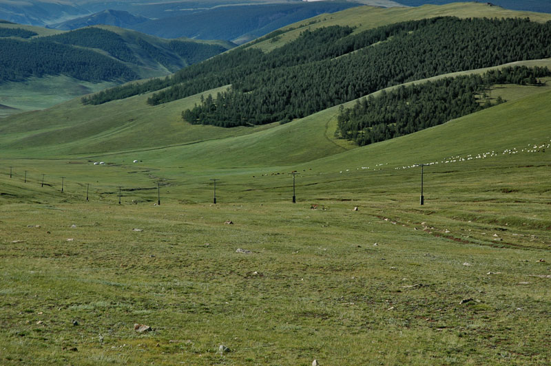
Forested Hills, near Uliastai, Zavkhan Province, Mongolia
Next day we cross the large floodplain north of Tögrög and re-join the Southern Route for a few kilometres, stopping in the small city of Altai, capital of Govi-Altai Province. Here we have a good meal, resupply and have a shower in the town’s simple bath-house. Mongolia is pleasingly well set-up to cater to the basic needs of travellers such as ourselves, as well as more conventional nomads. There is nothing more to detain us in Altai and so we head north out of town, camping on plains of tiny white wildflowers. A cold night follows and we are not surprised in the morning – of the 4th of August – to find fresh snow on the low ridges of the Khasagt Mountains off to our west. Continuing north, we pass an outcrop of basalt columns near the sum of Taishir, then soon enter Zavkhan Province. The land slowly greens as we cross high, undulating grassy plains dotted with white gers and grazed by sheep, horses and yaks, then climbing the following day into hills which start to support stands of beautiful pine forest, crossing a pass and dropping down to the provincial capital, Uliastai.

Mongol Man, near Yaruu, Zavkhan Province, Mongolia
Uliastai is a little more congenial than Altai, and we visit its hilltop monastery with eight whitewashed stupas (Buddhist reliquaries), a reconstruction of one of the hundreds of monasteries destroyed during Stalin’s religious purges of the 1930s, during which tens of thousands of Mongolian monks were killed. From the hill, the suburbs of Uliastai are very attractive with neat rows of colourful houses, each on a square of land ringed by picket fences, often including a ger. Though one would never guess, Uliastai, one of the most remote provincial capitals in the country is also one of its oldest cities; during the Manchu (Qing) Period from the late seventeenth century until 1911, it was one of the most important cities of the Province of Outer Mongolia, and a staging post on the caravan routes into China proper.
We have lunch and then head north again, turning west off the track up a side-valley towards Yaruu. As we climb the landscape becomes very pleasantly green, with numerous gers. Ancient balbals in various states of verticality line the road, attesting to generations of nomads having lived in these beautiful rolling hills. We camp high on this attractive grassland, and are joined in the evening by some local men who take a great interest in Jacob’s binoculars; a small but good quality pair which is evidently far superior to the halves of old Russian field glasses which the local squint into to spot their herds and look for wolves. During our travels in Mongolia we would always be the object of interest for locals, who are naturally curious to investigate any stranger who arrives near their home, but we would often be surprised by the length of time for which they would happily just sit and watch us.

Khar Lake, Zavkhan Province, Mongolia
Beyond our campsite we descend the following morning, leaving the lush green hills and dropping abruptly into a large sandy area. These dunes, the Mongol Sands, are spread across north-western Mongolia by strong winds, and are some of the most northerly in the world. Amongst the sands is the gleaming blue expanse of Khar (black) Lake, where we stop to have a dip in the water, and set up camp for the night. As we relax by the lakeside we are met by a group of Mongol fishermen who are camped in the nearby dunes, and they take Jacob out on an inflatable Chinese dinghy. I stay on land, walking in the dunes and marvelling at how, whilst I am standing on an accumulation of pure sand, on the far side of the lake the land is green and fertile and dotted with gers. Upon returning Jacob describes how the fishermen have a superstitious fear of the water – miming that it contains evil spirits – and deduced that none of them could swim. In the evening we are treated to a dinner of fried fish, a very welcome break from mutton, and the good company of the fishermen, though I decline their suggestions of driving back in the dark to Yaruu to buy some vodka.
Wildflowers, near Tudevtei, Zavkhan Province, Mongolia
The next two days are spent driving through remote country, over steep, sandy slopes down to Tsetsen-Uul, then through beautiful green valleys filled in places with purple wildflowers near Tudevtei, past deep-blue Telmen Lake to join the ‘Central Route’, another of the three east-west routes across the country. In the gorgeously located sum of Tosontsengel, set in a wide, emerald-green valley surrounded by patches of dark green forest, we have a wash, eat dinner and then camp out by the Ider River just east of town. Once again we are spotted by some locals who have set up camp nearby, and are filling a pressure cooker which resembles a piece of space-junk with meat, rocks, vegetables and water. Up until this point in Mongolia, I have managed to avoid drinking with Mongolians who tend to be wild, uncontrollable drinkers once they start, but after the inevitable invite to join them we are plied with vast quantities of vodka, to the extent that I have no recollection of the evening at all. I awake in my tent in the morning feeling hideous, with vomit smeared on my trousers. Jacob is asleep across the two seats of the truck, his head just above a pile of vomit in the driver’s footwell which we agree is most likely mine.

Chuluut River Canyon, near Tariat, Arkhangai Province, Mongolia
The day that follows is wretched; after cleaning up we set off (there is no sign of our hosts from the previous evening, or their car) and we make slow progress on rough roads through indifferent countryside, turning south at the eastern edge of the province and leaving the Ider River. By late afternoon I brave a bowl of tsuivan, despite the revolting smell and rubbery meat making me feel slightly nauseous. Jacob chooses to stay hungry and we spend a cold, damp evening camping near the roadside. We wake up feeling far better and continue south, crossing into Arkhangai Province and dropping into the valley of the Chuluut River, which braids across an expansive grassland dotted with yaks. The skies clear and the road improves, passing the dramatically cracked ancient black lava-flows of Tariat as we follow the river downstream, climbing onto a plateau where the river leaves the road and descends into a beautiful, steep-walled gorge. As we head towards the provincial capital Tsetserleg, we start to encounter stretches of asphalt where a paved road is finally being built from the capital. We stop just short of Tsetserleg to have a surprisingly good meal in a guanz, though as we are finishing a fight between two large Mongol men (no doubt fuelled by alcohol) breaks out and we drive a few kilometres down the road before making camp.

Deer Stone, Near Tsetserleg, Arkhangai Province, Mongolia
Tsetserleg is actually one of the most pleasant towns which we visit in Mongolia, with the same neat rows of colourful houses, fences and gers as Uliastai. Behind the few concrete apartment blocks and derelict square which make-up the centre of town, on the side of a hill, is the small Guden Monastery, consisting of three temples with crimson walls, carved wooden beams and beautifully tiled, curving pagoda roofs. Dating from the late seventeenth century, the buildings were declared a museum at the time of the purges, and thus the monastery is one of a very small number which escaped destruction at the hands of the communists. More intriguing still is the carved stele which we find on the eastern edge of town in a grassy area criss-crossed by vehicle tracks. This 2.5 metre high carved piece of basalt is covered in elaborate, stylised reindeer, with long, highly ornate antlers, and who appear to be in flight. Found almost exclusively in Mongolia, these deer-stones seem to depict an ancient form of Siberian shamanism, and although their purpose is a mystery, evidence suggests they are not graves, but may be religious objects, or even spiritualised humans representing a greatly revered person.
By late afternoon we cross into Övörkhangai Province and reach the banks of the Orkhon River, where we set up camp. The temperature is pleasant, there are no insects and no intrusive locals. Just as I think we are about to have our first genuinely pleasant night of camping in Mongolia, a storm appears on the horizon, and sudden winds flatten the tent. There is then a brief storm and a few claps of thunder. We retreat to the cab of the truck, cursing the capriciousness of the Mongolian weather.
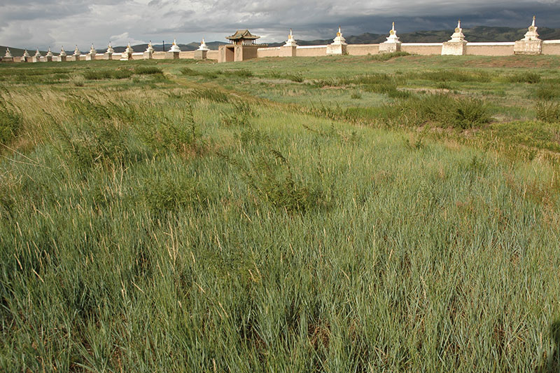
Erdene Zuu Monastery, Kharkhorin, Övörkhangai Province, Mongolia
The Orkhon Valley is historically perhaps the most important region of Mongolia. It was here, in the very centre of the modern Mongolia state that successive empires such as the Xiongnu (possibly the Chinese name for the Huns), Göktürks and Uyghurs (both early Turkic empires) established their power base. The most notable of course was that of the Mongols, with the immediate successors of Chinggis Khan establishing the capital of their enormous empire here, founding the city of Karakorum. Foreign visitors to Karakorum such as Marco Polo, William of Rubruck and Ibn Battuta describe a huge city of both settled houses and nomadic tents, a cosmopolitan, polyglot and religiously tolerant capital of an empire covering much of the known world outside of Western Europe. The city’s fortunes soon began to wane however, with Kublai Khan, grandson of Chinggis Khan establishing his imperial capital in Dadu (now Beijing), greatly eclipsing the old capital roughly fifty years after it was established. Later, when the Ming Dynasty replaced the Yuan in the late fourteenth century, troops were sent to destroy Karakorum.
It’s just ten kilometres from our campsite to the modern town of Kharkhorin, which lies very close to the site of old Karakorum. Today the area is dominated by the Erdene Zuu Monastery, a late sixteenth century Buddhist complex surrounded by a very impressive whitewashed wall of 108 stupas. In the huge monastery grounds lie only a few beautiful though melancholic temples, lonely survivors of Stalin’s purge, sitting picturesquely with their iconic pagoda roofs overlooked by grassy hills and a brooding grey sky.
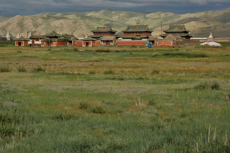
Erdene Zuu Monastery, Kharkhorin, Övörkhangai Province, Mongolia
Adjacent to the monastery we walk around the long grass where once apparently the imperial palace stood with its famous silver tree fountain, which would dispense great quantities of alcoholic drinks for the khan’s parties. Save for a very few stone monuments, notably a great stone tortoise or bixi, a creature from Chinese mythology which the Ming troops must have spared, there is simply nothing left. It is in fact rather hard to believe that this was once one of the world’s most important cities. Thinking about it, it’s also rather hard to believe that the simple herders we’ve met in the countryside, who know little of the world beyond their immediate environment, once forged an empire which connected the medieval world, fostering global trade, inventing the postal service, and transporting the knowledge of the Islamic world, then in the height of its glory, west to medieval Europe, sewing the seeds of the Enlightenment. But such perhaps is the way of the Mongols, who live their lives moving ceaselessly, leaving no trace of the presence behind (save for stacks of empty vodka bottles). It’s also fair to say that their greatest material achievements lie in Persia, Central Asia and India through their descendants. In a relative flash the Mongols transformed the world, then retreated to their beautiful but harsh homeland, never to be heard from again.
Contenting ourselves with what Kharkhorin has to offer, we head east on the last leg of our long journey to the capital, driving on an unbroken ribbon of asphalt through uninteresting scenery to Ulaanbaatar.
Stage 22 – Russia & Mongolia: Altai To The Gobi Desert [1/3]

Mongolia sits squeezed between Asia’s two largest countries, Russia and China, which have in turn dominated this rugged, high and remote land for most of the last 350 years. Looking further back into history however, Mongolia’s high steppes and mountains nurtured generations of vigorous pastoral nomads whose tribal confederacies came to dominate the region, most famously the Mongols who under under Chinggis Khan seeded the largest contiguous land empire in history. Today, physical remains of this past are extremely scant, and Mongolia remains largely pre-industrial and (at present) of little importance to world politics. Herein lies its allure however, for Mongolia is unlike any other country; virtually roadless, very sparsely populated with no large cities outside the capital, a wilderness of true nomads living a traditional, pre-modern lifestyle in a stunningly beautiful and endlessly varied landscape. My two wilderness months driving more than seven thousand kilometres in this landscape, almost all of it off-road, wild-camping and touching settlements only to take on provisions, are some of my fondest memories from all of Eurasia.

Pine Forest, Novoyegoryevskoye, Altai Territory, Russia
It’s the 3rd July 2010 and after a very easy border crossing, I am in Russia’s Altai Territory; a patch of fertile farmland between the steppe of Kazakhstan, the wilderness of Siberia, and the Altai Mountains. Despite the border being an arbitrary, straight line drawn across the Earth, there is a very subtle change in the scenery with increasingly frequent stands of pine forest. The Altai Territory is a veritable breadbasket of Siberia and the small farming towns and villages through which I drive, surrounded by vast arable fields, have typically Russian names; Nikolayevsk, Mikhailovskoye, Volchikha. Turning east in Volchikha I enter some very appealing pine forest, bathed in the late after noon light from a low, golden sun. Colourful Soviet signs line the road, reminding picnickers and day-trippers to respect the flora and fauna of the forest, and avoid starting fires. It’s all deeply comforting; a cosy paradise amongst the inhospitable wilderness which surrounds it for thousands of kilometres.
My destination is Rubtsovsk, a provincial town which I had passed through on a rainy night back in 2007 on my very first trip to Russia. I had back then imagined Rubtsovsk to be a dingy, decaying town full of drunks, and I am pleasantly surprised to find it a pleasant and likeable place, with only touches of decay and alcoholism. The town is in fact a good example of provincial Russia; hit hard by perestroika and the collapse of the USSR, when the collectives were closed and the machinery sold off by the directors, the economy stagnated and became controlled by a gangster underworld, and the streets became dangerous, filled with drunks and violent gangs. Although lagging far behind the revival seen in many of Russia’s larger cities, Rubtsovsk has come back from the dead, with a large factory re-opening, and small businesses flourishing following a major economic clean-up.
Tsarist Building, Zmeinogorsk, Altai Territory, Russia
Nicer still are my host family; Alexander, Olga and 4-year old daughter Sofia. Alexander and Olga are a lovely couple; warm Siberians (renowned throughout Russia for being especially friendly and kind) who don’t drink or smoke, don’t watch TV (to my delight), and of course have nothing to do with politics. The following day we go for a picnic at a lake in the forest I had driven through on my way from the border, a long, shallow lake occupying an imperceptible fold in the land, the outermost ripple of the Altai Mountains. On another day, Alexander drives me to meet his friend Sasha in the nearby town of Zmeinogorsk, an eighteenth century mining town sitting on a once lucrative poly-metallic mineral vein. After a short tour of the mining museum and some charmingly down-at-heel red-brick Tsarist-era buildings, around which cows graze in knee-high grass, we retire to Sasha’s house, which he has built himself. Surrounding the house is a carefully planted cottage garden, in which lies Sasha’s newly created wooden banya (sauna). I’m very impressed by Sasha’s handiwork; on a very modest teacher’s salary he has created a small but idyllic countryside home.
While we eat dinner cooked by his wife, much of it consisting of home-grown vegetables and home-made preserves, Sasha heats up the banya and in the evening Alexander, Sasha and I enter for this most quintessentially Russian experience. The three of us sit naked in the steam-room, wearing traditional felt hats to protect our heads from the 80ºC+ heat. Water is poured over the hot rocks which sit above the banya’s wood-burner creating a dense, sweltering atmosphere which brings out a healthy sweat. I am given a light thrashing by Sahsa, brandishing a birch-branch venik to produce a gentle reddening of the skin; an unexpectedly pleasant and invigorating experience. After a couple of trips in and out of the steam room, we wash from buckets of hot water and then sit out in the cool of the night wearing only towels. The banya experience brings on a kind of deep, bodily relaxation well beyond that of a simple bath.
Crop Fields, near Belokurikha, Altai Territory, Russia
After five relaxing nights in Rubtsovsk, I resume my trip, driving first north to Aleysk and then cutting east on backroads towards the Karun River and the road to the Mongolian border. These small, potholed roads pass through what was once productive farmland, but today the land stands idle, and the villages around are yet to emerge from the economic collapse of the 1980s and 90s. Here lie tumbledown wooden houses, fields of rusting old farm equipment, broken-down cars and wandering drunks drinking themselves to oblivion on home-made samogon (moonshine), too poor to buy vodka. With these come all the deeper social problems; poverty, despair, broken families, ragged children and a hopeless fondness for the good old days of the USSR. There is little money in the Russian economy to be made from farming, with profits taken by intermediaries between the farmer and the shops, and with no money to invest in farming, and seemingly little initiative to raise it, it’s hard to imagine how these villages will ever survive.
As I approach the Karun River, the border with the Altai Republic, the land starts to buckle and the gorgeous green outliers of the Altai Mountains come into sight. Crops start to appear in the fields, and I reach the resort-town of Aya, thronging with jolly Russian tourists, mostly from nearby Novosibirsk. I cross a toll bridge and drive a few kilometres south to the capital of the Republic, Gorno-Altaysk. Here I have the great pleasure to meet Pasha, who hosted me in Novosibirsk in June 2007. It’s a very fond reunion, and after a day in the rather seedy and unlovely city, we leave together for the mountains.

Kuray Steppe, Altai Republic, Russia
The M52, or Chuya Highway runs initially south along the Karun River, passing tourist cafés and restaurants, trinket stalls and other overpriced tourist paraphernalia before it swings west and then south again, climbing onto the ridges of the Altai Mountains then re-joining the Karun near Onguday. Here the Russian influence soon weakens, and the villages start to be populated by the native Altai people; often rather distant and unwelcoming, and with an evident weakness for alcoholism. Along the road are faint traces of ancient shamanism; ovoos (piles of votive stones) and menhirs, and the scenery becomes increasingly impressive as we climb. The road turns to the south-east, leaving the Karun and following the Chuya, one of the most distant tributaries of the Ob, which eventually floes into the Arctic Ocean. Near the scruffy village of Kuray, we camp for one night in front of the glorious, jagged and snow-capped massif of Ak-Tru, in a tranquil spot amongst solitary pine trees.
Chuya River, Kosh Agach, Altai Republic, Russia
Leaving our campsite and rejoining the road, we cross the beautiful Kuray Steppe where the magnificent mountain scenery continues to improve. Climbing a little further, the scenery suddenly changes from mountain valley to the deserted expanse of the Chuya Steppe, grazed by roaming, moulting packs of pungent Bactrian camels. Upon this bleak and windswept but starkly beautiful plateau, the district town of Kosh Agach sits amidst a few small villages and patches of green land along the river, surrounded on all sides by distant saw-tooth mountains dappled with patches of bright snow in their crags and lees. The town has a stark, end-of-the-world feel to it, a staging post between one wilderness and another, though the people are friendly, mostly smiling Kazakhs rather than the cold Altai folk who live to the north. It is a harsh place however; storms race in from the surrounding mountains whipping up great clouds of dust, and the weather changes very quickly. The locals tell us that it reached -50ºC last winter.
After asking around in the bazaar we find lodging in the house of a saleswoman named Dinara, a melancholic but kind Kazakh lady who trades in Chinese clothes brought across the Mongolian border. We also secure vital border permits from the police, and then head west out of town, leaving the asphalt and driving 30 km across the featureless gravel plain to a large prominent rock with ancient petroglyphs. Then another sudden change of landscape occurs and we are amongst green, grassy valleys with rushing rivers of glacial melt. Heading for the magnificently remote point where Russia, Mongolia and China meet, we stop for the night at a friendly Molybdenum mine (and make use of their banya) near some curative radon-springs at a point known simply as Tyopliy Klyuch (warm spring).

Ukok Plateau, Altai Republic, Russia
The following day, the track beyond the mine soon deteriorates to a rocky quagmire, and I decide not to take the truck any further for fear of damaging it out here, just before finally entering Mongolia. Thus I continue on foot, climbing a nearby 3000 m high ridge and am rewarded with a truly magnificent view. Thirty kilometres to the south is the gleaming white massif of Tavan Bogd, a massif of five peaks on the tri-border point, with Khüiten Peak (4373 m) being the highest in Mongolia. Slightly to the west is the dark green and almost mythical Ukok Plateau, speckled with lakes and kurgans (burial mounds) of the Pazyryk Culture. Beyond the plateau is a forty kilometre chain of ice-peaks marking the narrow strip of China which separates Mongolia form Kazakhstan. Far in the distance to the west, amongst the dark clouds of a gathering storm is the smooth, prominent peak of Belukha, the ice-giant of Siberia. It is quite some time before I can tear myself away from this inspiring view of true wilderness, and make the long trudge back to the truck (shortened somewhat by hitching a very uncomfortable ride on the back of a Russia tourist’s quad bike).
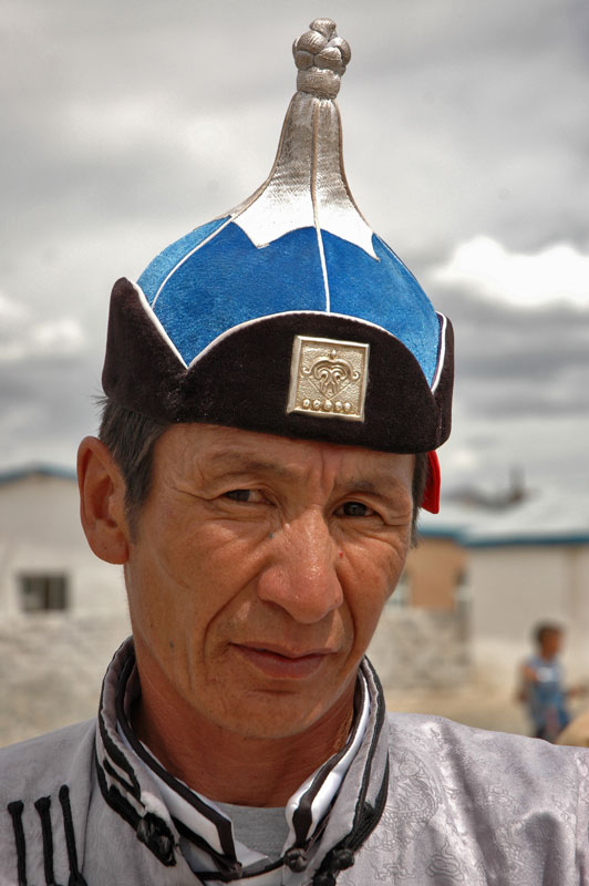
Kazakh Man, Ölgii, Bayan-Ölgii Province, Mongolia
Pasha and I spend another evening with the miners, who are a rough-cut but very warm bunch, with scars and missing teeth, before retracing our steps to Kosh Agach where we part. Pasha heads back down towards home, while I head south. After camping for a night on the beautiful (but mosquito-infested) steppe, I am the first in the morning at the border in the village of Tashanta. After clearing Russian customs, I drive the final twenty-odd kilometres of neutral territory to the Mongolian border.
Crossing into Mongolia, the land opens abruptly; gone are the rolling green hills, replaced by a huge landscape of high gravel plains and distant grey-brown mountains dissected by desolate valleys. The border settlement is a tiny collection of half-collapsing mud-brick hovels, but within minutes I’m totally alone in a bleak and dusty semi-desert, with nothing but vehicle tracks to point the way to the next town. I cross a steep and rocky pass, pausing at the top next to a large ovoo to look out across a forbidding landscape. Far to the south-west are mountains high enough to have small glaciers lining their upper ridges and folds; in places distant rain-storms obscure the horizon like grey curtains, their clouds dappling the ridges of mountains in black shadow. It’s hard to believe that I will find a sizeable town in this utter wilderness.
Yet soon after descending the pass, I find myself on a smooth, recently constructed asphalt road, heading straight to the town of Ölgii, capital of Bayan-Ölgii, the westernmost and highest province of Mongolia, and the most remote from the capital. With almost 90% of the population consisting of Kazakhs, it is also the country’s only Muslim province. The whole of western Mongolia has long been a remote and highly isolated place, cut off from the outside world by deserts and great mountain ranges. After the collapse of the USSR (and economic subsidies) in 1991, the whole region found itself without electricity for several years. However, with the growth of the nascent Mongolian economy, and the recent opening of the border crossing with Russia, this small frontier town seems finally to be opening up.
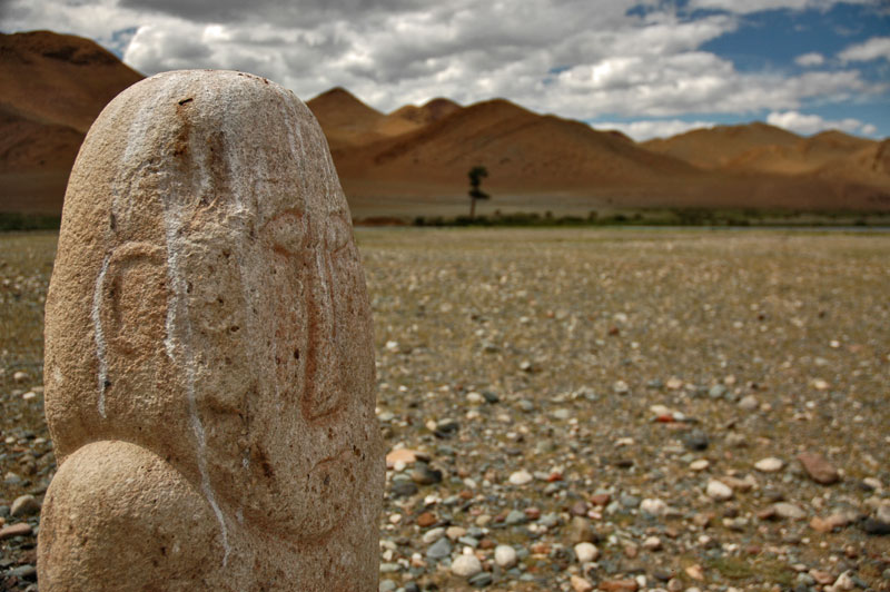
Balbal, Sagsai, Bayan-Ölgii Province, Mongolia
I spend my first afternoon walking around Ölgii, a tiny town of simple, low whitewashed huts, with the odd Communist-era two- or four-storey apartment block. I camp on a city street, sleeping in the tent on the back of the truck. In the morning, I set out to obtain the necessary permit to enter Altai Tavan Bogd National Park, which covers most of the extreme west of the province where the Russian and Chinese borders meet. It is here that I meet two young Germans, Tilo and Katrin, professionals who have driven their Land Rover all the way from Australia. After sorting out our paperwork, we happen upon a sports-field where men in traditional costume are shooting arrows from longbows, part of the midsummer festival of horse-riding, wrestling and archery known as Naadam. Here in this western backwater of Mongolia, the local Kazakhs seem to have a very low-key Naadam, but in the rest of the country it constitutes the cultural highlight of the year.
Tsengel, Bayan-Ölgii Province, Mongolia
I’m delighted when Tilo and Katrin agree to my idea of travelling into the national park together, and the three of us drive out of town to camp next to a nearby river. The location is beautiful; a grassy riverbank dotted with small trees, but the mosquitoes are voracious and we all don our insects headnets; something I am very glad indeed to have bought prior to departure.
After stopping in Ölgii once more to buy provisions (mostly cans of Korean beer) we drive west, immediately entering the vast wilderness of Bayan-Ölgii and climbing another rocky pass, stopping in the village of Sagsai to admire the balbals (anthropomorphic megaliths) and mud-walled Kazakh mausolea before camping in a gloriously empty valley amongst the barren mountains. We pass Tsengel the following morning; a beautiful village of yurts pitched among tall larch trees and the gentle meanders and grassy fluvial islands of the Khovd River. We track the river south-west for much of the day, crossing a very rustic wooden bridge and climbing up onto a large plateau, to the ethereally beautiful Khurgan Lake. A large expanse of crystal sapphire-blue water, Khurgan Lake is backed by the snowcapped ridges of the Altai, where they form the border with China. Sun-bleached, half-submerged rocks are arranged in an almost Zen-like formation just off the shore; it’s a stupendously relaxing and soothing vista. We spend all of the next day at the lake; with Tilo kitesurfing at great speed across it, and the two of us later floating out on inner tubes dangling bated hooks on fishing line in an ultimately unsuccessful attempt to catch fish.
Khurgan Lake, Bayan-Ölgii Province, Mongolia
Leaving the lake, our next intended destination is the furthest western extremity of Mongolia, our aim to climb part-way up the Tavan Bogd massif, and we take a back route over a high pass and rough, seldom-used track in order to reach the Tsagaangol Valley, which gives access to Mongolia’s highest peaks. The Tsagaan (white) river is in full spate however, living up to its name and after driving the truck in to the point where the current begins to rock it, I quickly back out and we decide to camp and wait until morning, hoping that the glacial torrent will be less fierce then. In the morning the river is no less vigorous, and we reluctantly decide to abandon our attempts to cross it. As something of a consolation however, we continue up the right bank of the river to another deep and rocky crossing, where Tilo and I set out on foot to the small dark ridges of Mt Sheveet, which are decorated with magnificent panes of ancient petroglyphs depicting elaborate hunting scenes and a stunning, metre-high hunter on horseback.

Petroglyphs, Mt Sheveet, Bayan-Ölgii Province, Mongolia
It takes a day and a half to make our way back via Tsengel and Sagsai to Ölgii, where we return to a spot close to our riverside campsite, but high enough to avoid many of the insects. The following day we have a final meal together in a small guanz (canteen) in a disused railway carriage. Tilo and Katrin leave towards Russia, while I have the good fortune to meet Jacob, an itinerant Californian wildlife biologist who has just entered Mongolia. I ask Jacob if he’d like to join me on my journey across Mongolia, and such was the beginning of a deep friendship which we would develop over the next seven weeks of driving and camping, right across the country.
Stage 21 – Russia & Kazakhstan: The Eurasian Steppe
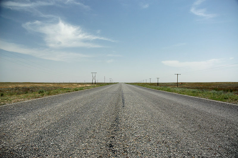
My main goal for 2010 was to spend a long summer in Mongolia and Siberia, several thousand kilometres from my starting position in the North Caucasus. My journey to the Altai Mountains, the entry point to Mongolia, would take me right across the vast Eurasian Steppe, from the torrid lowlands of the Caspian Sea, up the Volga, lazily meandering through the very heart of Russia, and across the huge, near-emptiness of northern Kazakhstan to the southern edge of Siberia. While the destinations were rarely spectacular, the endless, gentle undulations of the steppe and the soothing lack of visual stimulation were a very memorable attraction in themselves.
Road R281, Kalmyk Republic, Russia
It’s the 3rd June 2010, and I have just left the town of Khasavyurt, putting behind me the Caucasus mountains and heading for the plains of northern Dagestan. Gone are the lush green surroundings of the mountainous south, replaced with a flatter, drier environment which becomes increasingly arid and scrubby as I head north. Passing the town of Kizlyar, famed for its ‘cognac’, I start to leave civilisation; rivers dry out, the canals disappear, and the distances between settlements greatly increases until it becomes true steppe; flat, hot, featureless scrubby grassland dotted with occasional isolated collective farms; long, low buildings with roofs stained orange with lichen. In this desolate, harsh environment the wonderful smell of wormwood – the quintessential fragrance of the Eurasian Steppe – fills the air, the hardy plants managing to grow in the poor, hard-baked steppe soil. Crickets somehow teem in this marginal rangeland, and in places the roads are painted red with their crushed bodies.
I cross the tiny Kuma River, the border into the Republic of Kalmykia in an utter void of a landscape. After a few kilometres, in the forlorn village of Artezian, the highway to Astrakhan simply ends, having been deliberately destroyed, and a sign marks a very spurious ‘Border Zone’ with warnings not to enter without the correct permits. This leaves just a small provincial road which cuts across the steppe towards the Kalmyk capital, Elista. As I progress north-west, further from the Caspian Sea, the steppe becomes subtly beautiful; painted in shades of khaki and yellow with occasional purples from short-lived wildflowers. The road, smooth, quiet and arrow-straight pierces the steppe under a huge, open sky streaked with thin high-altitude clouds; this is a big change from the rough, winding mountain roads on which I have been for the last few months. My hay fever stops, and I’m thrilled to be back in the serenity of the steppe, though I do have to remind myself that I am still in Europe.
Temple, near Komsomolskiy, Kalmyk Republic, Russia
Just past the isolated town of Komsomolskiy, I come across something yet more un-European; a tiny, white, cubic Buddhist temple topped with a simple Mongolian-style pagoda roof. Next to the temple stands a small, dead-looking tree, kept in place by a pile of votive stones like a Mongolian ovoo (shamanistic cairn), and tied with a few colourful prayer rags. Approaching the temple, a rather parched-looking shepherd emerges, asks for some water, and after taking a brief slug from my flask returns to his position of repose in the temple’s meagre shade. I am rather taken with this highly premature introduction to Mongolian culture, or rather, to the Republic of Kalmykia: Europe’s only Buddhist republic.
The Kalmyks are indeed of Mongolian ancestry, descended from the Oirats, the westernmost of the Mongol tribes, coming from the Altai Mountain region of western Mongolia. The westernmost sub-tribe of the Oirats, the Kalmyks migrated west in the early seventeenth century from eastern Kazakhstan, and settled in this Lower Volga area. The Kalmyks became allies of Russia, guarding Russian territory from the raiding Turkic tribes (principally Nogais and Kazakhs) to the south and east. The Kalmyks eventually became full subjects of Russia, but had a tumultuous relationship with the imperial power. Like the nearby Ingush (and many other groups), the Kalmyks were viewed as fifth columnists by Stalin and were systematically exiled to Siberia and Central Asia in 1943. With perhaps 50% of Kalmyks surviving to return to Russia in 1957, an autonomous Kalmyk Republic was established in 1958. Today Kalmykia is yet another interesting republic within Russia, all but unknown to the outside world. Running the republic is multi-millionaire businessman come politician Kirsan Ilyumzhinov, also president of the world chess federation, who is famed for his devotion to the game and for announcing that he had been abducted by extraterrestrials in 1997.
Lenin Square, Elista, Kalmyk Republic, Russia
In the town of Yashkul, I turn east and travel through slightly lusher, greener country to the capital, Elista which rises suddenly from the steppe. Elista seems to be a lovely place; a tidy, provincial Soviet city of Mongolian faces and oriental pagodas and gates in the distinctive crimson and yellow shades of Mongolian architecture. There is none of the tension of the North Caucasus here, I am not harassed by the police, and despite the steamy, suffocating heat, the streets are filled with beautiful girls; tall, thin oriental beauties.
At the centre of Elista is the quirky and manicured Lenin Square, a mix of preserved old Soviet architecture, pagoda-style gates and a large fountain with giant metallic lotus flowers as a nod to the official Buddhist religion of the republic. Out on the edge of town is the highly unusual ‘Chess City’, something of an Olympic Village dedicated to the game, built somewhat controversially by the idiosyncratic president. Chess City even houses a Mongolian Consulate, but after several visits the pleasant though timid secretary, who seems not even to know what a visa is, admits that the consul has left, and that his whereabouts and date of return are unknown.

Golden Temple, Elista, Kalmyk Republic, Russia
Kalmykia’s most impressive edifice is the 2005 Burkhan Bakshin Altan Sume (‘The Golden Abode of the Buddha Shakyamuni’), known colloquially as the Golden Temple. Huge and rather gaudy in the interior, it is Europe’s largest Buddhist temple, and reminds me of the temples built to house the monks sent by various buddhist countries to Bodh Gaya in India.
My host in Elista is Tseren, an amply-sized Kalmyk doctor who is a heavy drinker and smoker, and welcomes me to his apartment by cooking a meal: drowning four eggs and a considerable quantity of pork steak in hot oil with a tin of peas, and serving with a small loaf of white bread and a bottle of cognac, a present from one of his patients. We spend evenings hitting-up gambling establishments with his brother, or drinking heavily into the small hours. On my third evening, Tseren convinces me to accompany him to a banya (Russian bath), despite my insistence that I am not interested in making use of the ‘girls’ for which he graciously offers to pay. As we sit, pickled equally by alcohol and the fierce steamy heat of the hot-room, I momentarily wonder, half-seriously, if I would really refuse the advances of one of the Kalmyk beauties I had seen out on the streets in town. However, as a rather unattractive Russian woman of middle years enters the room, I assure Tseren that he is free to enjoy himself as he pleases; and that is indeed what I can faintly hear as I recover in the cold plunge-pool for the next few minutes.

Assumption Cathedral, Astrakhan, Astrakhan Region, Russia
Luckily, to relieve me from these debaucheries, I am joined the next day by Karolina, the Polish volunteer whom I had met and stayed with for two days in Georgia, two months earlier. Enduring a long railway journey from Warsaw across Ukraine to Volgograd, then a minibus down to Elista which is essentially the middle of nowhere, Karolina has chosen to join me for the quite spectacularly unspectacular crossing of the vast emptiness between here and the eastern borders of Kazakhstan. On my way to the bus station to meet her, I make a discovery which rather sours my time in Kalmykia; that someone has broken into the back of the truck and stolen my tool kit.
We leave Elista, heading due east into the brackish and fly-infested delta region of the Volga, Europe’s longest and largest river, to the city of Astrakhan. A fertile area in a vast region of forbidding steppe, the Volga Delta has been the capital of the Khazars and Golden Horde, and the city of Astrakhan emerged as the capital of the Astrakhan Khanate in the mid fifteenth century. The Russians first conquered Astrakhan in the mid sixteenth century, and for a long time it was the southern outpost of Russia, at the end of the Volga, a trade and staging post for expansion into Central Asia in the nineteenth century. Walking around the city centre, this history is evident in being visibly one of the most cosmopolitan cities in the Former USSR. The early eighteenth century buildings of its central Kremlin, built and preserved in the style of those in the Russian ‘Golden Ring’ east of Moscow, is sufficient however to very much give it the impression of being ‘real’ Russia.
Wooden House, Astrakhan, Astrakhan Region, Russia
Astrakhan is situated astride the mighty Volga, which here is almost 900 metres wide in places. River docks still pulse with activity in the centre, lying at the far end of the river which directly connects a great number of Russia’s most important cities and, via canals, Moscow and both the Black and Baltic Seas. Around the port is the historical centre Astrakhan, an area of brackish air and lumpy streets of often very beautiful old Russian houses; single storey brick homes, whitewashed and slowly being eaten away by damp, or two-storey wood-panel houses in wonderfully textured, damp-stained wood, occasionally subsiding dramatically in the boggy earth. The area is run-down and raffish and unusually extensive in modern Russia, where all too often such neighbourhoods are charmlessly architecturally gentrified. Piercing this rabble of old houses are brightly painted orthodox churches, and an early twentieth century mosque of teal-painted wooden panels with a simple minaret resembling a church steeple, giving a slightly Asian air to the area’s otherwise quintessential Russian-ness.
For the next 800 kilometres we will follow the right bank of the Volga, winding through the heart of what I consider one of Russia’s most endearing regions; Povolzhye, literally meaning ‘along the Volga’. Leaving the northern outskirts of Astrakhan, we enter the stretch of farmland which runs along the river, dotted regularly by timeless Russian villages. Set a few hundred metres from the road, these traditional villages, their peasants out tending fields, are a string of pitched-roofed brick houses set along an old cart track, dotted by tall green willow trees and water towers, and occasionally by beautiful and recently restored cathedrals whose onion domes stand out like sentinels on the steppe. They are the sort of villages one imagines when reading Gogol or Chekhov, and life there, despite the tribulations of the Soviet period, has in all likelihood changed little since the lives of the great authors.

Kalmyk Monks, Tsagan Aman, Kalmyk Republic, Russia
As a break to this Slavic quaintness, a finger of Kalmykian territory surrounds a ten-kilometre stretch of the Volga, incorporating the historical (but restored) temple in Tsagan Aman. Karolina and I stop for lunch in the town and after eating at a simple canteen, brave the pestilent swarms of black-fly to visit the monastery. Here we are welcomed by two kind monks, whose crimson robes of the Mahayana rite of Buddhism, common in northern and eastern Asia, seem rather acutely out of place here: more of the hidden charm of deepest Russia.
After several hours of driving through the sweltering heat, we arrive in the city of Volgograd, better know by its previous name of Stalingrad; the city at the heart of the battle which reversed the fortunes of the Nazis and, according to virtually any citizen of the Former USSR, won the war. Unlike Astrakhan, Volgograd is a sprawling linear settlement occupying only the right bank of the Volga, at the point where the river dog-legs to the north-east. From the point at which we enter the city, in its flooded southern industrial suburbs, a sea of cooling towers, electricity pylons and pipelines, it is more than sixty kilometres by road to the city’s northern limits.

‘The Motherland Calls’, Mamayev Kurgan, Volgograd, Volgograd Region, Russia
Volgograd is a pleasant Soviet city with some elegant boulevards, but it is dominated by the memorial complex of Mamayev Kurgan, marking a hill which was bitterly fought over, and which changed hands several times during one of the very bloodiest battles of human history. Completed in 1967, the complex is in terms of the hallowed sanctity of its territory, the reverence with which people come to visit and pay their respects, and the scale and cultish style of its monuments, the most sacred temple in the fanatical remembrance and worship of the Second World War, or rather the Great Patriotic War; the closest thing the Soviet Union had to a state religion.
One enters the complex from the city’s main street, walking up flights of stairs onto a paved, tree-lined walkway which crosses the railway lines, then climbs to the sculpture ‘Fight to the Death’; which portrays in concrete the herculean torso of an infantryman who has become one with the ground beneath him. Then up more steps, flanked by the ‘Walls of Ruin’, to a long rectangular pool of murky water, around which are statues of heroic soldiers and a weeping mother cradling her dead child. At the far end is a vast martial mural with valiant defenders of the Motherland overlooked by Lenin. Below this lie steps which lead south and up onto the hill itself, on which stands the centrepiece of the complex; the towering ‘The Motherland Calls’ sculpture; an eastward-facing statue of Mother Russia, holding aloft a giant stainless-steel sword, face determinedly turned north towards the capital. In 1967 this was the largest free standing statue in the world, and it is quite staggeringly large, even in the vast openness of the steppe. Though its grace is very slightly detracted from by a cartoonish face and rather oddly-set breasts, the statue is a masterpiece of Soviet art, representing the unimaginable scale of the battle, and the unthinkable sacrifice and suffering which the Soviet people endured.

Remembrance Hall, Mamayev Kurgan, Volgograd, Volgograd Region, Russia
After circumambulating the statue, paths lead down to a very unprepossessing memorial hall, which once entered has a cathedral-like atmosphere. Gentle, funereal music is piped continuously as pilgrims descend a perimeter walkway. Around the circular walls are crimson plaques displaying what must be just a tiny fraction of the Soviet casualties, set against a background of golden mosaic tiles. Two guards stand facing each other on the black marble-tiled floor, in front of a central pedestal supporting a giant hand which grasps an eternal flame. Families take photos of themselves, perhaps lay flowers for a relative, before departing into the blinding summer light outside. I emerge suitably moved by my unexpected Soviet religious experience.
In the afternoon, we continue our journey north up the ‘Mother’ Volga, deeper into the heart of Russia. The Volga Dam at the northern end of Volgograd transforms the river beyond into a deep blue reservoir, at times almost nine kilometres wide. The land becomes dryer and even more sparsely populated, supporting vast praries of yellowing grass. We arrive in Saratov in the early evening, though our host Mikhail actually lives on the left bank of the river, in the separate town of Engels.

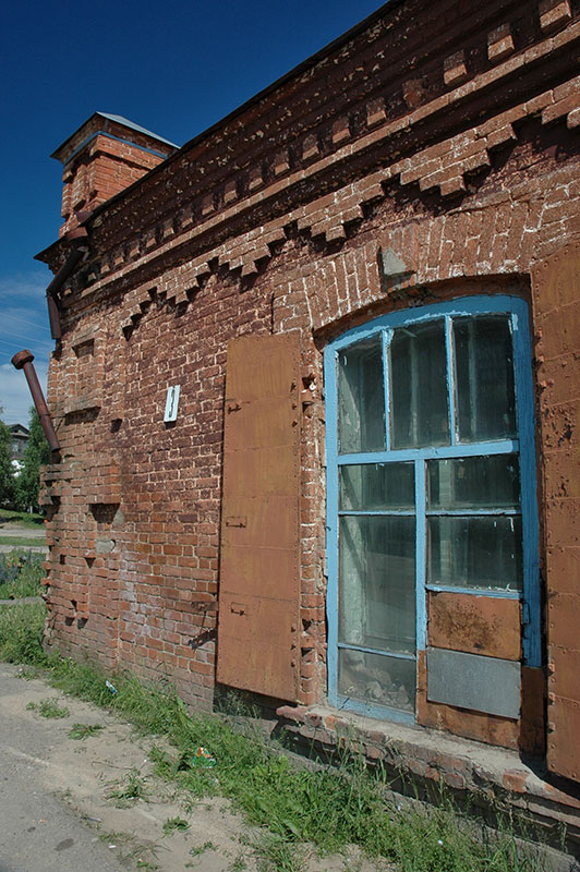
Apartment Building, Saratov, Saratov Region, Russia
Saratov is an unremarkable city on the Middle Volga, typically Russian except perhaps for a slight Teutonic orderliness to the place, which may or may not be evidence of the large community of Volga Germans who used to reside here. Indeed, the city of Pokrovsk – known as Engels today, and where we are staying – was the capital of the long-dissolved Volga German Republic. Deported en masse to Kazakhstan and Siberia by Stalin, few Volga Germans ever returned to the region, with survivors mostly finding their way back to Germany. Aside however from the remarkably Germanic-looking conservatory there seems very little trace of them.
Nevertheless, Saratov retains a lot of its Soviet neatness and charm, and as we walk back in the late afternoon across the three-kilometre long Saratov Bridge, passing the beautiful sandy beaches of a riverine island on which hundreds of locals are sunning themselves, I feel that Saratov is amongst the nicest of Russia’s cities, lacking both the ugly, runaway commercialisation which has spoilt many of Russia’s cities further west, and the corrupt and over-policed atmosphere of the cities of the North Caucasus. We retire back to Mikhail’s flat, and together with his girlfriend, the four of us lie back on our beds and listen to Pink Floyd whilst smoking together; a very pleasant end this particular visit to Russia.

Volga River, Saratov, Saratov Region, Russia
The following day we leave Engels, the Volga, and the Russian heartland, and almost immediately enter country which is visibly neglected. The farmland lies idle, much like the very occasional village out on the steppe which sits inactive through the heat of the day. Physically, this would be the landscape for much of the more than three thousand empty kilometres ahead, to the far side of Kazakhstan. We cross the border with little fuss near the forgotten village of Ozinki, and arrive in the afternoon in the provincial capital of Oral, a city which sites astride the Ural River, and thus occupies both Europe and Asia. As with most Siberian cities, Oral was originally founded by Cossacks, and is today a sleepy and rather dull, though not unpleasant place. Around half of the city’s inhabitants are Russian, and almost all still refer to Oral by it’s Soviet name, Uralsk.

Wooden House, Oral, West Kazakhstan Region, Kazakhstan
Our stay in Oral is however made memorable by out host, Ash. Half Kazakh, half Jewish and openly gay, Ash is endlessly generous, giving us our own apartment free of charge, and even inviting us to celebrate his birthday with two Russian friends at a small resort out of town, located on a muddy tributary of the Ural River. After five days of relaxation however, we are ready to leave Oral, and get back onto the highway for another monotonous and featureless drive of almost 500 kilometres to the next city, Aktobe.
To describe Aktobe as an interesting city would be an exaggeration, but with Kazakhs here making a clear majority, it does at least feel more Asian than Russian. Our Kazakh host Rysta and her cousin Marat live in a modern apartment, but still offer us a traditional Kazakh welcome, preparing a huge beshparmak; a delicious and filling dish consisting of chunks of boiled beef and horsemeat served on square sheets of pasta, with potatoes and raw onions.

First President’s Park, Aktobe, Aktobe Region, Kazakhstan
We explore the city the following day, starting with the bazaar which has the atmosphere of Central Asia: stalls of colourful dried fruit, Korean ladies selling pickled salads, and open air stands cooking shashlik, filling the air with greasy smoke. Amongst the jostling women out on shopping trips are the usual rogues and loiterers, and even a traditional stone healer. We visit the local museum, and are guided around its modest exhibits by an English-speaking guide, free of charge, though I am slightly surprised to hear her refer to the Russian colonists as ‘invaders’. There is little else of interest in the city, but as the sun sets, we find ourselves in the newly-opened ‘First President’s Park’, which has a large shanyrak (the traditional roof-piece of a yurt) held aloft on pillars resembling a yurt’s wooden outer struts, as tribute to the (now almost vanished) nomadic lifestyle of the Kazakhs. Across the road is the glitzy new Nur Hasir Mosque, not far from a newly built Orthodox church; a demonstration of inter-ethnic harmony and religious tolerance. The park is full of young Kazakh couples and families, most of whom have children; evidence of the recent baby boom across the country. It’s all a rather endearing and convincing demonstration of a confident and progressive country which as a sovereign state is less than twenty years old.
Leaving Aktobe, we are back on the long, featureless highway. The road is in pleasingly excellent condition however, in stark contrast to the appalling broken asphalt I had encountered in the north-east of the country three years earlier. Not far from the city limits, a road sign reminds us of the vast scale of the country: ‘Almaty 2304 km’. We drive through a massive, empty landscape past Khromtau (‘Chrome City’) with its piles of grey-green mine tailings, the only thing to catch the eye for scores of kilometres around. We fill up with fuel in the junction town of Qarabutaq, then turn north towards Kostanai. The land flattens further and we enter an absolute nowhere.
Lisakovsk, Kostanai Region, Kazakhstan
Telegraph lines recede into the distance where the land ends and there is only the glare of the sun through the accumulated kilometres of air. Tracking the Russian border, the road slowly deteriorates and we pass crumbling Slavic villages of once pretty white-washed homes with light blue window frames, now often abandoned and raided for building material. Some have Ukrainian names such as Kievskoye or Don, reminders perhaps of Kazakhstan’s painful Soviet history as a place of exile. There can’t be many countries whose ethnic make-up – with descendant populations of Russian, Ukrainians, Poles, Germans, Koreans, Tatars, Chechens, Ingush, Kalmyks, Turks and many more – has been so influenced by the paranoiac machinations of one man.
Our destination, which we reach in the late afternoon after 678 mind-numbing kilometres, is Lisakovsk, a small mining city of some 36,000 people on the Tobyl River; an accumulation of Soviet microrayons (microdistricts) out on the steppe amidst endless golden field of swaying grass. Despite owing its existence to extensive iron ore deposits, Lisakovsk is not a grim, industrial disaster-scape of belching chimneys and slag piles, but rather one of those delightfully isolated oases of Soviet apartment buildings, parks, and little else. Our Russian host Tatyana barely meets us before giving us the keys to our own fully-furnished apartment – free of charge again – and departing, leaving us to enjoy a full day walking around the town and the pleasant, silent surrounding countryside.
Steppe Road, near Atbasar, Akmola Region, Kazakhstan
Our onward journey continues past the similar mining town of Rudny and then Kostanai, the provincial capital, from where the road heads south-east across yet more hundreds of kilometres of nothingness. A modest patch of pine forest near Esil provides a few minutes of genuine excitement for us, and then later an impressive storm breaks over the steppe near Atbasar, but otherwise the journey is simply hundreds of kilometres of soothing monotony. The land here in this sub-Siberian belt of northern Kazakhstan is very slightly damper than that to the south, and the area was the focus of Khrushchev’s 1953 ‘Virgin Lands Campaign’, a plan to dramatically increase the wheat harvest of the USSR. Though early years were sporadically successful, the marginal soil was soon depleted of nutrients, yields dwindled and Kazakhstan lost millions of tons of topsoil as a result of wind erosion. Today the area is largely fallow, subtly changed from the wild, virgin steppe to the south.
Our destination is the national capital Astana, but as night falls we are still far away and the road suddenly deteriorates to a rough track until we are close to the city limits. Here, in the early hours we come against crooked police who deliberately delay us in the hopes of extracting a bribe, but fail of course to succeed. Finally, at around 03:00 we arrive at the luxury housing complex in the ‘Triumph of Astana’ building, and are graciously received by our Ukrainian host Marta, who works here as a corporate lawyer.
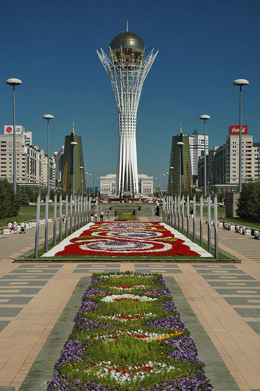
Bayterek Tower, Astana, Kazakhstan
Astana is the impressive show-piece of Kazakhstan’s post-independence economic boom, almost entirely constructed since the mid-1990s out in the middle of the steppe, in a windy and fiercely cold location. Originally named Akmolinsk, the city was re-named in 1961 to Tselinograd, acting as capital of the Virgin Lands Campaign. Renamed Akmola at independence in 1991, this sleepy, nondescript provincial town became the capital of Kazakhstan in 1997, taking the title from Almaty and changing its name yet again to Astana. While Almaty was fairly reasoned to be too congested and unsuitable for major urban expansion, at risk of seismic activity, and tucked away in a far corner of the country rather close to the Chinese border, many also saw the desire of President Nazarbayev to construct his own city largely from scratch, and for it to be his lasting, tangible legacy to the country.

Skyline, Astana, Kazakhstan
The Triumph of Astana, the 39-storey skyscraper in which we are hosted, is itself one of the more impressive and recognisable buildings in Astana’s rapidly-evolving skyline. Built in the Socio-Classical style of the USSR’s earliest, Stalinist-era skyscrapers such as Moscow’s State University, Kyiv’s ‘Hotel Ukraina’, and Warsaw’s Palace of Culture, it’s an elegant, if rather odd throwback to a period of time in which Kazakhstan’s population was ruthlessly collectivised, and the country viewed by the leadership as a vast penal colony. Astana’s centrepiece is a large, perfectly manicured park surrounding the striking Bayterek Tower, a tapering, vase-like white mesh structure supporting a giant golden sphere, representing an ancient Turkic legend in which a bird of happiness lays a golden egg in a poplar tree. Around the tower are various ministries, the opulent presidential palace, plush governmental residential blocks and a collection of skyscrapers including the Northern Lights Towers which look like slightly irregular stacks of books, and the tubular Kazakhstan Railways building.
Across the small, brown flow of the Ishim River, Astana has expanded and includes a number of more original structures such as the pyramidal Palace of Peace and Reconciliation and the building of the Kazakhstan National University of Arts, a glass-panel structure with the form of an sloping volcanic cinder cone. Although there is still plenty of nasty gold-tinted glass and cheap siding panels on old apartments, the overall impression of Astana is not of Ashgabat’s monstrous, megalomanical monuments, nor Tashkent’s rather tacky post-independence structures, but of more genuine, confident nation building. It’s slightly less ostentatious than I had imagined, though like any new city it lacks somewhat in atmosphere. But with an ever-expanding urban area and population, Astana might one day conceivably eclipse its southern rival in terms of cultural and economic importance.
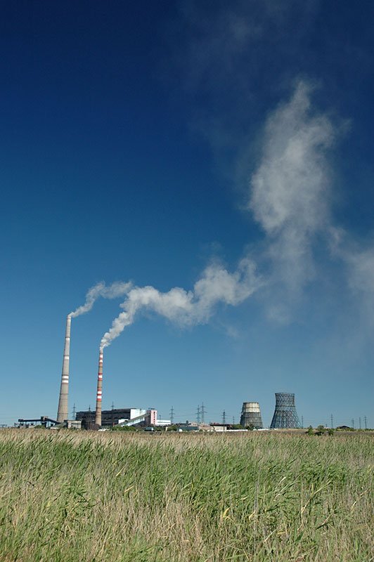
Thermal Power Station, Karaganda, Karaganda Region, Kazakhstan
However, thanks to the useless absentee consul in Elista, I must leave this sea of modernist architecture, green grass and perfectly maintained flowerbeds in order to pursue once more a Mongolian visa. Having not yet bothered to move their diplomatic representation to the new capital, this involves a journey all the way to Almaty. I foolishly decide to undertake the journey by bus; seventeen mind-numbing, tedious and uncomfortable hours each way, on which Karolina very bravely accompanies me, but we return within 48 hours with a visa in my passport, ready to complete this summer’s plan.
Following two more nights in the luxury of Marta’s apartment, we head south to the much older, and altogether less glamorous city of Karaganda, synonymous with coal mining and the large KarLag labour camp which operated from the 1930s to 1950s. The steppe south of Astana soon reverts to a wild, uncultivated state, though approaching Karaganda we pass the heavy industry in Temirtau (‘Iron City’), a blighted landscape of smokestacks and blackened earth where President Nazarbayev began his career as a steelworker. Karaganda is again a pleasant though featureless place, with its large red-granite statue of Lenin and pastel-coloured ‘House of Culture of Miners’ giving it a clear Soviet pedigree and less of an air of economic dynamism. We stop for a night, then head east once more onto an unpaved road which leads across a green, marshy area of steppe towards the first trace of topographical relief I have encountered since leaving the Caucasus: the forested granite outcrops of Bayanaul, a hilly ‘island’ in this sea of steppe.
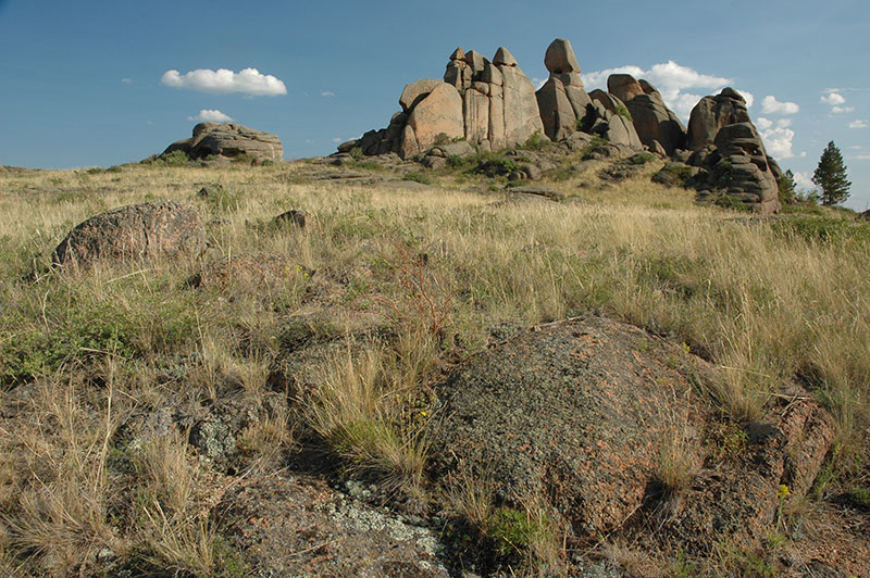
Volcanic Rocks, Bayanaul, Pavlodar Region, Kazakhstan
After thousands of kilometres of flat grassland, Bayanaul is a welcome change of scenery with its gently forested hills backing a warm turquoise lake whose sandy beach understandably attracts tourists in this vastly inland environment. After a very Soviet canteen lunch at the lakeside sanatorium, we head off in the truck into the hills to explore the bizarre volcanic formations whose rounded and wrinkled contours lend them a form something like giant sheep droppings. With us are our American host Mary, a Peace Corps Volunteer from New Orleans, and her rather eccentric Kazakh landlord who acts as our guide. Away from the central ridges around the lake, the surrounding prominent, oddly-sculpted hills are dotted with small fir and birch trees, and their obvious attraction in such an otherwise featureless environment is marked by pre-Soviet Kazakh graves, and far more ancient Scythian-type burial complexes consisting of a recessed central crypt surrounded by large, standing megalithic slabs partly submerged in the soil. The like of these may be found across the grasslands of Eurasia, from eastern Siberia to eastern Europe, attesting to very expansive nomadic empires of old.
Our trip finishes in Toraigir (which marks the 100,000 kilometres mark on my journey), a small, ramshackle village of whitewashed farmhouses behind leaning picket fences, surrounded by rusting Soviet agricultural equipment and battered cars in various states of decay. We are invited in here for tea with home-made bread, smetana (sour cream) and varenya (fruit conserve) by a lovely Russian family who still farm this area in deepest Kazakhstan, perhaps a century since their ancestors settled here, in spite of many of their kin leaving and heading for the cities of modern Russia. In these people one sees the old pioneer spirit of the Russians, which allowed them to colonise such a vast and truly inhospitable swathe of Eurasia, and we experience also their genuine warmth and hospitality.

Mashkhur Zhusup Mosque, Pavlodar, Pavlodar Region, Kazakhstan
Karolina and I make our last drive together, leaving Bayanaul and heading north towards Ekibastuz, then east to the city of Pavlodar on the Irtysh River. We stroll around yet another of Kazakhstan’s provincial cities, this one reminding me of Semey with its air of recent resuscitation from deep economic slumber. The otherwise featureless streets of the city are enlivened by the newly built Makhshur Zhusup Mosque, an unprecedented, modernist mosque with heavily fluted, tapering circular walls arriving at a smooth upper dome, all covered in gleaming turquoise tiles, and surrounded by a courtyard with four needle-like minarets in soft yellow brick. It’s a pleasing final example of Kazakhstan’s newly independent identity.
In the morning, I drop Karolina off at the station, from where she will return to Astana, then fly on to Poland. At once I’m sad to leave her smart and charming company, but on the other, I’m looking forward to crossing the Altai Mountains and finally reaching Mongolia. I leave Pavlodar, heading north-east on a road which crosses fallow grassland towards the Russian border at Sharbakty, more than five thousand kilometres after leaving the North Caucasus, and from where I will enter Siberia proper.
